
 | ||
Similar Lavezzi Islands, Maddalena archipelago, Cavallo, Budelli, Arcipelago di La Maddale | ||
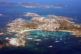
Oyster 53 sailing yacht big waves high winds strait of bonifacio
The Strait of Bonifacio (French: Bouches de Bonifacio, Italian: Bocche di Bonifacio, Corsican: Bucchi di Bunifaziu, Gallurese: Bocchi di Bunifaciu, Sardinian: Buccas de Bonifatziu, Ligurian: Bocche de Bunifazziu) is the strait between Corsica and Sardinia, named after the Corsican town Bonifacio. It is 11 km (6.8 mi) wide and divides the Tyrrhenian Sea from the western Mediterranean Sea. The strait is notorious among sailors for its weather, currents, shoals, and other obstacles.
Contents
- Oyster 53 sailing yacht big waves high winds strait of bonifacio
- Map of Strait of Bonifacio
- References
Map of Strait of Bonifacio
The most famous disaster in the Strait of Bonifacio was that of the French frigate Sémillante on February 15, 1855. Sémillante had left the port of Toulon the day before on its way into the Black Sea to supply the Crimean War with troops. A storm caused it to hit a reef; the ship sank and none of the 750 soldiers on board survived.
After a tanker disaster in 1993, the passage through the Strait of Bonifacio has been prohibited for French and Italian flag ships with dangerous goods. Passage for ships with dangerous goods sailing under other flags is strongly discouraged and subject to mandatory piloting.
Its maximum depth is 100 metres (330 ft).