
Average depth 2,000 m (6,562 ft) Area 275,000 km² | Type Sea Max. depth 3,785 m (12,418 ft) | |
 | ||
Surface area 275,000 km (106,200 sq mi) | ||
Sunset on the tyrrhenian sea at campora san giovanni
The Tyrrhenian Sea (/tᵻˈriːniən ˈsiː/; Corsican: Mari Tirrenu, French: Mer Tyrrhénienne [mɛʁ tiʁenjɛn], Italian: Mar Tirreno [mar tirˈrɛːno], Neapolitan: Mar Tirreno, Sardinian: Mare Tirrenu, Sicilian: Mari Tirrenu) is part of the Mediterranean Sea off the western coast of Italy. It is named for the Tyrrhenian people, identified since the 6th century BCE with the Etruscans of Italy.
Contents
- Sunset on the tyrrhenian sea at campora san giovanni
- Map of Tyrrhenian Sea
- Geography
- Extent
- Exits
- Basins
- Name
- Ports
- Winds
- References
Map of Tyrrhenian Sea
Geography
The sea is bounded by the islands of Corsica and Sardinia (to the west), the Italian peninsula (regions of Tuscany, Lazio, Campania, Basilicata, and Calabria) to the east, and the island of Sicily (to the south).
The maximum depth of the sea is 3,785 metres (12,418 ft).
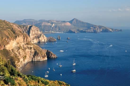
The Tyrrhenian Sea is situated near where the African and Eurasian Plates meet; therefore mountain chains and active volcanoes such as Mount Marsili are found in its depths. The eight Aeolian Islands and Ustica are located in the southern part of the sea, north of Sicily.
Extent
The International Hydrographic Organization defines the limits of the Tyrrhenian Sea as follows:
Exits
There are four exits from the Tyrrhenian Sea (north to south):
Basins
The Tyrrhenian Basin is divided into two basins (or plains), the Vavilov plain and the Marsili plain. They are separated by the undersea ridge known as the Issel Bridge, after Arturo Issel.
Name
Its name derives from the Greek name for the Etruscans, who were said to be emigrants from Lydia and led by the prince Tyrrhenus. The Etruscans settled along the coast of modern Tuscany and referred to the water as the "Sea of the Etruscans".
Ports
The main ports of the Tyrrhenian Sea in Italy are: Naples, Palermo, Civitavecchia (Rome), Salerno, Trapani and Gioia Tauro. In France the most important port is Bastia.
Note that even though the phrase "port of Rome" is frequently used, there is in fact no port in Rome. Instead, the "port of Rome" refers to the maritime facilities at Civitavecchia, some 68 km (42 miles) to the northwest of Rome, not too far from its airport.
Giglio Porto is a small island port in this area. It rose to prominence, when the Costa Concordia ran aground a few metres off the coast of Giglio and sank. The ship was recently removed and towed to Genoa.
Winds
In Greek mythology, it is believed that the cliffs above the Tyrrhenian Sea housed the four winds kept by Aeolus. The winds are the Mistral from the Rhône valley, the Libeccio from the southwest, and the Sirocco and Ostro from the south.