
Country United States Time zone Eastern (EST) (UTC-5) GNIS feature ID 1621477 Population 2,437 (2013) | County Mackinac FIPS code 26-70840 Elevation 179 m Local time Friday 2:08 PM | |
 | ||
Weather 6°C, Wind E at 16 km/h, 64% Humidity Area 6.967 km² (6.941 km² Land / 3 ha Water) Points of interest Castle Rock, Straits State Park, Mackinac Island State Park, Richard and Jane Manoogi, Fort de Buade | ||
Places to eat in st ignace michigan clyde s delicious colossal hamburgers
Saint Ignace, usually written as St. Ignace, is a city at the southern tip of the Upper Peninsula of the U.S. state of Michigan, bordering the Straits of Mackinac. The population was 2,452 at the 2010 census. It is the county seat of Mackinac County. For travelers coming from the Lower Peninsula, St. Ignace is the gateway to the northern part of the state.
Contents
- Places to eat in st ignace michigan clyde s delicious colossal hamburgers
- Map of St Ignace MI 49781 USA
- St ignace michigan
- History
- Geography
- 2010 census
- 2000 census
- Transportation
- Local sights and events
- Notable people
- References
Map of St Ignace, MI 49781, USA
St. Ignace Township is located just to the north of the city, but is politically independent.
Located in Michigan's Upper Peninsula, St. Ignace is at the northern end of the Mackinac Bridge and Mackinaw City is the southern end. The bridge connects the Lower and the Upper peninsulas of Michigan.
As of the 2010 census, nearly one-third of the population of the city identified as Native American. The Mackinac Bands of Chippewa and Ottawa Indians, a state recognized tribe, is headquartered at St. Ignace, and has bands in several other counties in the region. In addition, the large federally recognized Sault Ste. Marie Tribe of Chippewa Indians owns and operates a casino on its land in St. Ignace, as well as in four other cities in northern Michigan.
St ignace michigan
History
St. Ignace is the second-oldest city founded by Europeans in Michigan. Before French contact, various cultures of Native Americans had inhabited the area for thousands of years. Early historic peoples here were predominantly the Iroquoian-speaking Wendat, whom the French called the Huron.
By the early 18th century, the Anishinaabe Ojibwe, who spoke one of the Algonquian languages, became prominent in the region. Another related Anishinaabe people were the Ottawa. The third member of the Council of Three Fires, a loose confederacy of these tribes, was the Potowatomi people. All three peoples are members of various federally recognized tribes in northern Michigan.
French explorer and priest Jacques Marquette founded the St. Ignace Mission on this site in 1671 and was buried there after his death. He named it for St. Ignatius of Loyola, founder of the Jesuit religious order, whose priests were active as missionaries across North America. (Ignace is the French version of Ignatius.) Jesuits served at missions to convert First Nations/Native Americans to Catholicism and to share French culture. In 1673, Marquette joined the expedition of Louis Jolliet, a French-Canadian explorer, and departed from St. Ignace on May 17, with two canoes and five voyageurs of French-Indian ancestry (Métis) on a voyage to find the Mississippi River
While exploring the region on the ship Le Griffon with Louis Hennepin, Sieur de La Salle reached St. Ignace on August 27, 1679. Louis de La Porte, Sieur de Louvigny founded Fort de Buade here in 1681 as a fur trading post. It was later directed by Antoine Cadillac. It was closed by the French in 1697. The Jesuits abandoned their mission in 1705.
The Ojibwe, who came to dominate most of the territory of present-day Michigan in the 18th century among Native Americans, were allies of the French in the Seven Years' War against the British. After the British victory in the Seven Years' War, in 1763 they took over the territory of France in North America, including this part of the former New France. After the victory of rebellious colonists in the American Revolutionary War, in 1783 the village was included within the new United States, as part of what became called its Northwest Territory.
Originally an important fur trading site in early years of French colonization, St. Ignace declined in importance by the early 19th century. The United States prohibited British Canadian traders from operating across the border after conclusion of the War of 1812. European demand declined for North American furs, and other parts of the economy grew.
Both British-Canadians and later Americans operated a larger trading center at Sault Ste. Marie, on both sides of the Canadian-US border, until the decline of the fur trade in the 1830s. The fur trade also suffered before, during and after the hostilities of the War of 1812, as the United States prohibited British traders from operating across the border, as had been their earlier practice. The Ojibwe had allied with the British, their longtime trading partners, during the War of 1812, hoping to reduce encroachment on their lands by the numerous American pioneers in the region.
In 1882, St. Ignace was given economic impetus by the construction of the Detroit, Mackinac and Marquette Railroad, which connected the straits area to the major city of Detroit. It was incorporated as a village on February 23, 1882, and as a city in 1883. In the late 19th century, it began to attract tourists as a popular summer resort and for its connection to Mackinac Island.
Since the late 20th century, the city has become a rural destination for heritage tourism and is part of a regional area popular for summer tourism. The Mackinac Bands of Chippewa and Ottawa Indians, a state recognized tribe, is based in St. Ignace. It has bands in several other counties in the region. With an enrolled membership of 4,000 in this area and state recognition, it has been seeking federal recognition since 1998. The larger federally recognized Sault Ste. Marie Tribe of Chippewa Indians, based in the city of that name and the region of northern Michigan, owns and operates a gaming casino on land it controls in St. Ignace, in addition to four other cities in the state.
Geography
According to the United States Census Bureau, the city has a total area of 2.69 square miles (6.97 km2), of which 2.68 square miles (6.94 km2) is land and 0.01 square miles (0.03 km2) is water.
2010 census
As of the census of 2010, there were 2,452 people, 1,064 households, and 633 families residing in the city. The population density was 914.9 inhabitants per square mile (353.2/km2). There were 1,299 housing units at an average density of 484.7 per square mile (187.1/km2). The racial makeup of the city was 63.4% White, 1.0% African American, 27.8% Native American, 0.3% Asian, 0.2% from other races, and 7.3% from two or more races. Hispanic or Latino of any race were 1.1% of the population.
There were 1,064 households of which 27.0% had children under the age of 18 living with them, 43.3% were married couples living together, 11.1% had a female householder with no husband present, 5.1% had a male householder with no wife present, and 40.5% were non-families. 33.8% of all households were made up of individuals and 13.6% had someone living alone who was 65 years of age or older. The average household size was 2.24 and the average family size was 2.84.
The median age in the city was 44.5 years. 21.3% of residents were under the age of 18; 7.7% were between the ages of 18 and 24; 21.6% were from 25 to 44; 31.6% were from 45 to 64; and 17.7% were 65 years of age or older. The gender makeup of the city was 48.2% male and 51.8% female.
2000 census
As of the census of 2000, there were 2,678 people, 1,085 households, and 675 families residing in the city. The population density was 990.7 per square mile (383.0/km²). There were 1,232 housing units at an average density of 455.8 per square mile (176.2/km²). The racial makeup of the city was 71.81% White, 19.42% Native American, 0.56% Asian, 0.30% African American, 0.04% Pacific Islander, 0.19% from other races, and 7.69% from two or more races. Hispanic or Latino of any race were 0.90% of the population.
There were 1,085 households out of which 29.2% had children under the age of 18 living with them, 46.7% were married couples living together, 11.5% had a female householder with no husband present, and 37.7% were non-families. 31.6% of all households were made up of individuals and 15.0% had someone living alone who was 65 years of age or older. The average household size was 2.35 and the average family size was 2.96.
In the city, the population was spread out with 23.2% under the age of 18, 8.6% from 18 to 24, 27.4% from 25 to 44, 22.7% from 45 to 64, and 18.1% who were 65 years of age or older. The median age was 39 years. For every 100 females there were 93.4 males. For every 100 females age 18 and over, there were 88.2 males.
The median income for a household in the city was $34,447, and the median income for a family was $45,893. Males had a median income of $29,813 versus $23,017 for females. The per capita income for the city was $17,340. About 6.0% of families and 9.0% of the population were below the poverty line, including 10.3% of those under age 18 and 9.5% of those age 65 or over.
Transportation
Local sights and events
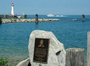
St. Ignace contains many locations from where one can get a good look at the Mackinac Bridge. Castle Rock, a geological limestone stack, is located three miles (5 km) north overlooking Lake Huron. Rabbit's Back, a prominent promontory that also overlooks Lake Huron, is 4 miles (6.4 km) north. Chain Lake, 1 mile (1.6 km) inland, features inland fishing opportunities.
Also featuring Kewadin Casinos - St. Ignace.
There are numerous civic events in St. Ignace.