
Country United States Settled 1847 Elevation 856 ft (261 m) Local time Friday 2:02 AM | Counties Ingham, Clinton Incorporation 1907 Time zone EST (UTC-5) Population 48,554 (2013) | |
 | ||
Weather -1°C, Wind NW at 16 km/h, 45% Humidity Colleges and Universities Michigan State University, Michigan State University, Douglas J Aveda Institute, Michigan State University | ||
East Lansing is a city in the U.S. state of Michigan directly east of Lansing, the state capital. Most of the city is within Ingham County, with the rest in Clinton County. The population was 48,579 at the 2010 census, an increase from 46,420 in 2000. It is best known as the home of Michigan State University.
Contents
- Map of East Lansing MI USA
- History
- Geography
- Description
- Neighborhoods
- 2010 census
- 2000 census
- Government
- Higher education
- Public primary and secondary schools
- Private schools
- Local transportation
- Intercity transportation
- Major highways
- Culture
- Sports
- Centennial
- On campus
- Off campus
- Outside East Lansing
- Newspapers
- Local events
- Notable people
- References
Map of East Lansing, MI, USA
History
East Lansing was an important junction of two major Native American groups: the Potawatomi and Fox. By 1850, the Lansing and Howell Plank Road Company was established to connect a toll road to the Detroit and Howell Plank Road, improving travel between Detroit and Lansing, which cut right through what is now East Lansing. The toll road was finished in 1853, and included seven tollhouses between Lansing and Howell.
Michigan State University was founded in 1855 and established in what is now East Lansing in 1857. For the first four decades, the students and faculty lived almost entirely on the college campus. A few commuted from Lansing, and that number increased when a streetcar line was built in the 1890s, but there were few places to live in the then-rural area immediately around the campus.
That started to change in 1887, when professors William J. Beal and Rolla C. Carpenter created Collegeville, along what is now Harrison Road and Center and Beal Streets, north of Michigan Avenue. Few faculty were attracted to the location, and the first residents were "teamsters and laborers". In 1898, the College Delta subdivision (including what is now Delta Street) had the support of the college itself, which provided utilities, and several professors built homes there (one of which survives today at 243 W. Grand River Ave.). Other subdivisions followed.
At that time, the post office address was "Agricultural College, Michigan." A school district encompassing the nascent community was created in 1900. In 1907, incorporation as a city was proposed under the name "College Park"; the legislature approved the charter but changed the name to "East Lansing." The first seven mayors, starting with Clinton D. Smith in 1907 and Warren Babcock in 1908, were professors or employees of the college.
The city charter in 1907 prohibited the possession, sale, or consumption of alcoholic beverages, and East Lansing was a "dry" city until voters modified the charter provision in 1968.
Geography
According to the United States Census Bureau, the city has a total area of 13.67 square miles (35.41 km2), of which 13.59 square miles (35.20 km2) is land and 0.08 square miles (0.21 km2) is water.
Since 1998, East Lansing has expanded its borders through the use of 425 Agreements. The city is currently in three 425 Agreements with Bath Township, DeWitt Township, and Meridian Township, and has effectively added thousands of acres of land to its border.
The city has also made use of annexation of surrounding township lands in recent years. It annexed the 66.5 acres (269,000 m2) of the Four Winds Golf Course in Meridian Township in 2001, and another 6 acres (24,000 m2) of the township in 2006. The city also annexed from DeWitt Township the land that is currently the East Lansing Soccer Complex.
Description
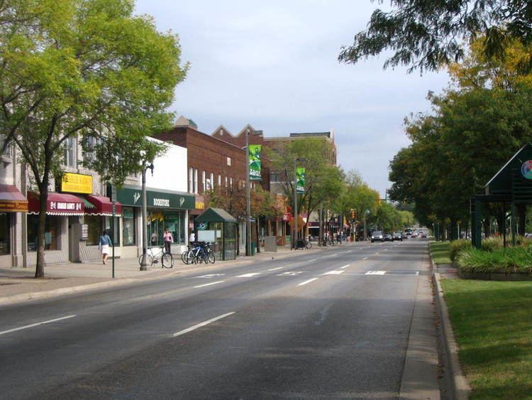
The city's downtown area is centered around Grand River Avenue, a wide, tree-lined boulevard that evolved out of the 19th-century plank road that connected Lansing to Detroit. Grand River Avenue and Michigan Avenue serves as a dividing line between the Michigan State University campus and the rest of the city. The street is lined with many college-oriented businesses, such as bars, tanning salons, coffee shops, head shops, restaurants (many dine al fresco) and bookstores. Immediately north of downtown are predominantly student neighborhoods. Further north is the residential part of the city. In the northernmost tier of the city are several new housing subdivisions and student-oriented apartment complexes. These new developments are far from the university, but their lower property tax rates allow them to offer students more amenities.
Neighborhoods
East Lansing has more than 25 neighborhoods, many of which have neighborhood associations that sponsor social events, attend to neighborhood issues, and often advocate for neighborhood interests in meetings of the City Council and city commissions.
A section of the city has been designated a Historic District, and a Historic District Commission has been established by the City Council. In addition, many landmark structures in the older neighborhoods have been identified within a Landmark Structures Historic District of the Historic Preservation Code.
Neighborhoods with Wikipedia pages include Tamarisk.
2010 census
As of the census of 2010, there were 48,579 people, 14,774 households, and 4,811 families residing in the city. The population density was 3,574.6 inhabitants per square mile (1,380.2/km2). There were 15,787 housing units at an average density of 1,161.7 per square mile (448.5/km2). The racial makeup of the city was 78.4% White, 6.8% African American, 0.3% Native American, 10.6% Asian, 1.0% from other races, and 2.9% from two or more races. Hispanic or Latino of any race were 3.4% of the population.
There were 14,774 households of which 13.8% had children under the age of 18 living with them, 24.7% were married couples living together, 5.6% had a female householder with no husband present, 2.2% had a male householder with no wife present, and 67.4% were non-families. 33.3% of all households were made up of individuals and 7.6% had someone living alone who was 65 years of age or older. The average household size was 2.23 and the average family size was 2.80.
The median age in the city was 21.6 years. 7.5% of residents were under the age of 18; 62.4% were between the ages of 18 and 24; 14.6% were from 25 to 44; 9.2% were from 45 to 64; and 6.4% were 65 years of age or older. The gender makeup of the city was 48.5% male and 51.5% female.
2000 census
As of the census of 2000, there were 46,525 people, 14,390 households, and 5,094 families residing in the city. The population density was 4,136.6 per square mile (1,596.7/km²). There were 15,321 housing units at an average density of 1,362.2 per square mile (525.8/km²). The racial makeup of the city was 80.91% White, 7.40% African American, 0.33% Native American, 8.21% Asian, 0.08% Pacific Islander, 0.95% from other races, and 2.12% from two or more races. Hispanic or Latino of any race were 2.69% of the population.
There were 14,390 households out of which 16.1% had children under the age of 18 living with them, 27.6% were married couples living together, 5.7% had a female householder with no husband present, and 64.6% were non-families. 36.2% of all households were made up of individuals and 7.2% had someone living alone who was 65 years of age or older. The average household size was 2.22 and the average family size was 2.82.
In the city, the population was spread out with 9.0% under the age of 18, 58.6% from 18 to 24, 16.4% from 25 to 44, 9.9% from 45 to 64, and 6.0% who were 65 years of age or older. The median age was 22 years. For every 100 females there were 92.7 males. For every 100 females age 18 and over, there were 91.7 males.
The median income for a household in the city was $28,217, and the median income for a family was $61,985 (these figures had risen to $29,885 and $81,941 respectively as of a 2007 estimate). Males had a median income of $43,767 versus $30,556 for females. The per capita income for the city was $16,333. About 11.0% of families and 34.8% of the population were below the poverty line, including 13.8% of those under age 18 and 3.7% of those age 65 or over.
Government
East Lansing has a council-manager government, in which the city council appoints one of its members as mayor and another as mayor pro tem — a city council member with extra ceremonial duties who chairs council meetings in the mayor's absence. The city council consists of 5 at-large council members who are elected in non-partisan elections to 4-year terms in November of odd-numbered years. The city council chooses the city manager, the city's chief administrative officer. The manager is appointed by and answers to the council.
An important aspect of East Lansing's government is its system of commissions. The commission members are ordinary East Lansing citizens appointed by the city council and advised by members of the city staff. Commissions may propose or review policies in their bailiwicks and make recommendations to the council. Major East Lansing commissions and boards include those for Planning, Zoning, Housing, Transportation, and Parks and Recreation. Other commissions and boards that also involve active engagement of ordinary citizens play a role in East Lansing's governance.
East Lansing Government founded the Technology Innovation Center, an incubator for technology start-ups.
Higher education
Michigan State University, a member of the Big Ten Conference, is the largest education institution in the State of Michigan (7th largest in the United States), reflecting East Lansing's history as a college town. MSU has more than 200 programs of study including two in human medicine (M.D. and D.O.) and one veterinary medicine school (D.V.M.), a law school (J.D., L.L.M., and M.J.), and numerous Ph.D. programs. There is also a Master of Arts in Technology (MAET) program.
Nearby Lansing is home to several other colleges, including Thomas M. Cooley Law School which is the largest law school in the United States (by attendees), Davenport University, and Lansing Community College.
Public primary and secondary schools
This city is covered by the East Lansing Public Schools district, which has an enrollment of just over 3,400 students in grades K-12. The district also includes small portions of neighboring Lansing, Lansing Township, and Meridian Township. The district consists of six elementary schools, one middle school (MacDonald Middle School), and East Lansing High School. One fifth of the district's students come from outside of East Lansing through Michigan's Schools of Choice program.
Private schools
Local transportation
Capital Area Transportation Authority (CATA) provides public bus transit throughout East Lansing, Lansing, and surrounding areas.
The Northern Tier Trail is a shared-use pedestrian and bicycle path system connecting some parts of the northern half of the city; the Lansing River Trail begins on the campus of Michigan State University and extends west into downtown Lansing and then north towards the airport.
Intercity transportation
Amtrak, Indian Trails, and Greyhound all provide intercity rail and bus services at the East Lansing Amtrak depot, which is located at 1240 South Harrison Road, within walking distance of the Michigan State University main campus, although public transportation also serves the depot.
Amtrak offers daily service to East Lansing on its Port Huron to Union Station, Chicago train, the Blue Water. Two class one freight railroads serve the city including Canadian National Railway (CN) and CSX Transportation (CSXT).
Bus transportation is offered between East Lansing and Detroit Metro Airport twelve times daily by Michigan Flyer. Megabus offers three daily trips between Chicago, Grand Rapids, East Lansing, and Detroit.
The Capital Region International Airport in nearby Lansing offers a number of non-stop domestic and international flights as far as Cancún, Las Vegas, and Orlando; connections between East Lansing and the airport are offered by CATA (with a transfer in downtown Lansing); rental cars are also available at the airport.
Three major interstates and one U.S. Highway serve the East Lansing area including: Interstate 96 (I-96), I-69, I-496, and U.S. Highway 127 (US 127).
Major highways
Culture
The city has several neighborhoods of detached, single-family houses within a mile of the Michigan State University campus. Under a 2004 city zoning ordinance, several of those neighborhoods have used a petition process to establish zones that prohibit or severely restrict renting. The net size of the area where renting is prohibited has increased since 2004.
East Lansing has a very large student population; in 2006 the city's population was about 45,931, while the university's 2006-07 enrollment was 45,520. Granted, not all students enrolled live in East Lansing or on campus.
Sports
From March 29 to April 2, 2006, East Lansing hosted the USA Hockey National Tournament. The age group that competed contained players from the U-14 Tier 2 division. States were represented with teams from Massachusetts, Michigan, Alaska, Nebraska, Florida, California, Connecticut, Indiana, New York, and Pennsylvania. In the end, The LA Hockey Club representing California won.
Centennial
In 2007, the City of East Lansing celebrated its Centennial. The celebration began in January 2007 with a kick-off press conference at the Marriott Hotel in downtown East Lansing. Events throughout the year included an old fashion concert, a birthday party, and a historic homes tour. A fireworks show took place in August, along with many more events throughout the year. With Michigan State University's Sesquicentennial ice cream flavor such a huge success, the City of East Lansing contracted Melting Moments ice cream shop to develop a Centennial ice cream flavor. All downtown businesses were encouraged to take part in Centennial festivities. The Peoples Church on West Grand River Avenue also celebrated its 100th birthday in 2007.