
Country United States County Burlington Royal charter January 13, 1713 Founded 21 February 1798 Population 3,227 (2000) | Formed November 6, 1688 Incorporated February 21, 1798 Area 77.7 km² Local time Thursday 8:15 AM | |
 | ||
Weather 3°C, Wind NW at 5 km/h, 66% Humidity | ||
Springfield Township is a township in Burlington County, New Jersey, United States. As of the 2010 United States Census, the township's population was 3,414 reflecting an increase of 187 (+5.8%) from the 3,227 counted in the 2000 Census, which had in turn increased by 199 (+6.6%) from the 3,028 counted in the 1990 Census.
Contents
- Map of Springfield NJ USA
- History
- Geography
- Census 2010
- Census 2000
- Parks and recreation
- Local government
- Federal state and county representation
- Politics
- Education
- Transportation
- Points of interest
- Notable people
- References
Map of Springfield, NJ, USA
History
Springfield was originally formed on November 6, 1688, and reformed by Royal charter on January 13, 1713. Springfield Township was incorporated by the Township Act of 1798 of the New Jersey Legislature on February 21, 1798, as one of New Jersey's initial group of 104 townships. Portions of the township were taken on December 2, 1723, to form New Hanover Township. The township's name derives from springs and brooks in the area.
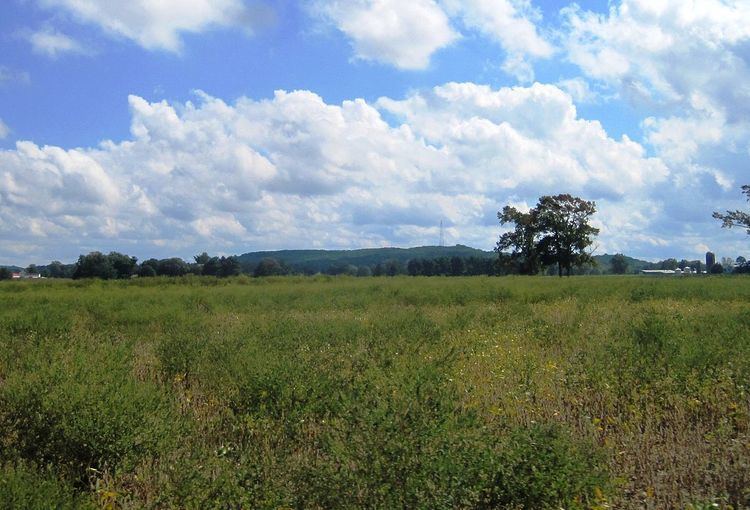
Geography
According to the United States Census Bureau, the township had a total area of 30.001 square miles (77.701 km2), including 29.940 square miles (77.544 km2) of land and 0.061 square miles (0.157 km2) of water (0.20%).
Juliustown (2010 Census population of 429) is an unincorporated community and census-designated place (CDP) located entirely within Springfield Township, while Fort Dix (total population of 7,716 as of 2010) is a CDP located in parts of Springfield Township, New Hanover Township and Pemberton Township.
Other unincorporated communities, localities and place names located partially or completely within the township include Arneys Mount, Chambers Corner, Ellis, Folwell, Jacksonville, Jobstown, Pine Lane and Powell.
The township borders the Burlington County communities of Burlington Township, Chesterfield Township, Eastampton Township, Florence Township, Mansfield Township, North Hanover Township, Pemberton Township and Wrightstown.
The township is one of 56 South Jersey municipalities that are included within the New Jersey Pinelands National Reserve, a protected natural area of unique ecology covering 1,100,000 acres (450,000 ha), that has been classified as a United States Biosphere Reserve and established by Congress in 1978 as the nation's first National Reserve. Part of the township is included in the state-designated Pinelands Area, which includes portions of Burlington County, along with areas in Atlantic, Camden, Cape May, Cumberland, Gloucester and Ocean counties.
Census 2010
The 2010 United States Census counted 3,414 people, 1,162 households, and 941.2 families residing in the township. The population density was 114.0 per square mile (44.0/km2). The township contained 1,217 housing units at an average density of 40.6 per square mile (15.7/km2). The racial makeup of the township was 90.60% (3,093) White, 3.81% (130) Black or African American, 0.21% (7) Native American, 2.55% (87) Asian, 0.00% (0) Pacific Islander, 1.20% (41) from other races, and 1.64% (56) from two or more races. Hispanics or Latinos of any race were 3.72% (127) of the population.
Out of a total of 1,162 households, 33.7% had children under the age of 18 living with them, 69.4% were married couples living together, 7.7% had a female householder with no husband present, and 19.0% were non-families. 13.3% of all households were made up of individuals, and 5.4% had someone living alone who was 65 years of age or older. The average household size was 2.93 and the average family size was 3.24.
In the township, 23.0% of the population were under the age of 18, 8.0% from 18 to 24, 20.3% from 25 to 44, 35.4% from 45 to 64, and 13.3% who were 65 years of age or older. The median age was 44.3 years. For every 100 females the census counted 102.9 males, but for 100 females at least 18 years old, it was 103.0 males.
The Census Bureau's 2006-2010 American Community Survey showed that (in 2010 inflation-adjusted dollars) median household income was $85,417 (with a margin of error of +/- $13,463) and the median family income was $102,337 (+/- $14,017). Males had a median income of $62,813 (+/- $16,928) versus $47,361 (+/- $11,194) for females. The per capita income for the borough was $37,901 (+/- $4,219). About 2.6% of families and 3.4% of the population were below the poverty line, including 2.8% of those under age 18 and 1.4% of those age 65 or over.
Census 2000
As of the 2000 United States Census there were 3,227 people, 1,098 households, and 906 families residing in the township. The population density was 107.4 people per square mile (41.5/km²). There were 1,138 housing units at an average density of 37.9 per square mile (14.6/km²). The racial makeup of the township was 91.94% White, 3.22% African American, 0.31% Native American, 2.63% Asian, 0.22% from other races, and 1.67% from two or more races. Hispanic or Latino of any race were 1.77% of the population.
There were 1,098 households out of which 36.7% had children under the age of 18 living with them, 73.4% were married couples living together, 5.8% had a female householder with no husband present, and 17.4% were non-families. 13.3% of all households were made up of individuals and 5.4% had someone living alone who was 65 years of age or older. The average household size was 2.93 and the average family size was 3.22.
In the township the population was spread out with 25.8% under the age of 18, 5.7% from 18 to 24, 29.0% from 25 to 44, 28.7% from 45 to 64, and 10.7% who were 65 years of age or older. The median age was 39 years. For every 100 females there were 100.1 males. For every 100 females age 18 and over, there were 97.7 males.
The median income for a household in the township was $69,268, and the median income for a family was $72,292. Males had a median income of $49,044 versus $31,392 for females. The per capita income for the township was $29,322. About 2.8% of families and 3.6% of the population were below the poverty line, including 1.2% of those under age 18 and 8.5% of those age 65 or over.
Parks and recreation
Burlington County Fairgrounds (home of the annual Farm Fair) opened in 2011 at the intersection of Route 206 and Columbus-Jobstown Road.
Local government
Springfield Township operates within the Faulkner Act (formally known as the Optional Municipal Charter Law) under the Council-Manager form of municipal government, implemented by direct petition as of January 1, 2001, having been approved by voters in a November 1999 referendum. The Township Council consists of five members elected at-large in a partisan vote to four-year terms on a staggered basis, with either two or three seats coming up for election every other year as part of the November general election. At a reorganization meeting held during the first week of January following each election, the council selects a mayor and deputy mayor from among its members to serve two-year terms of office.
As of 2016, members of the Springfield Township Council are Mayor Denis McDaniel (R, term on council ends December 31, 2018; term as mayor ends 2016), Deputy Mayor Anthony Marinello (R, term on council ends 2018; term as deputy mayor ends 2016), David Frank (R, 2016), John Hlubik (R, 2016) and Peter Sobotka (R, 2018).
Federal, state and county representation
Springfield Township is located in the 3rd Congressional District and is part of New Jersey's 8th state legislative district. Prior to the 2010 Census, Springfield Township had been part of the 4th Congressional District, a change made by the New Jersey Redistricting Commission that took effect in January 2013, based on the results of the November 2012 general elections.
New Jersey's 3rd Congressional District is represented by Tom MacArthur (R, Toms River). New Jersey is represented in the United States Senate by Cory Booker (D, Newark, term ends 2021) and Bob Menendez (D, Paramus, 2019).
For the 2016–2017 session (Senate, General Assembly), the 8th Legislative District of the New Jersey Legislature is represented in the State Senate by Dawn Marie Addiego (R, Evesham Township) and in the General Assembly by Maria Rodriguez-Gregg (R, Evesham Township) and Joe Howarth (R, Evesham Township). The Governor of New Jersey is Chris Christie (R, Mendham Township). The Lieutenant Governor of New Jersey is Kim Guadagno (R, Monmouth Beach).
Burlington County is governed by a Board of chosen freeholders, whose five members are elected at-large in partisan elections to three-year terms of office on a staggered basis, with either one or two seats coming up for election each year. The board chooses a director and deputy director from among its members at an annual reorganization meeting held in January. As of 2015, Burlington County's Freeholders are Director Mary Ann O'Brien (R, Medford Township, 2017; Director of Administration and Human Services), Deputy Director Bruce Garganio (R, Florence Township, 2017; Director of Public Works and Health), Aimee Belgard (D, Edgewater Park Township, 2015; Director of Hospital, Medical Services and Education) Joseph Donnelly (R, Cinnaminson Township, 2016; Director of Public Safety, Natural Resources, and Education) and Joanne Schwartz (D, Southampton Township, 2015; Director of Health and Corrections). Constitutional officers are County Clerk Tim Tyler, Sheriff Jean E. Stanfield and Surrogate George T. Kotch.
Politics
As of March 23, 2011, there were a total of 2,380 registered voters in Springfield Township, of which 403 (16.9% vs. 33.3% countywide) were registered as Democrats, 1,268 (53.3% vs. 23.9%) were registered as Republicans and 707 (29.7% vs. 42.8%) were registered as Unaffiliated. There were 2 voters registered to other parties. Among the township's 2010 Census population, 69.7% (vs. 61.7% in Burlington County) were registered to vote, including 90.5% of those ages 18 and over (vs. 80.3% countywide).
In the 2012 presidential election, Republican Mitt Romney received 1,071 votes here (57.5% vs. 40.2% countywide), ahead of Democrat Barack Obama with 743 votes (39.9% vs. 58.1%) and other candidates with 35 votes (1.9% vs. 1.0%), among the 1,864 ballots cast by the township's 2,453 registered voters, for a turnout of 76.0% (vs. 74.5% in Burlington County). In the 2008 presidential election, Republican John McCain received 1,086 votes here (56.7% vs. 39.9% countywide), ahead of Democrat Barack Obama with 773 votes (40.4% vs. 58.4%) and other candidates with 33 votes (1.7% vs. 1.0%), among the 1,914 ballots cast by the township's 2,371 registered voters, for a turnout of 80.7% (vs. 80.0% in Burlington County). In the 2004 presidential election, Republican George W. Bush received 1,083 votes here (60.5% vs. 46.0% countywide), ahead of Democrat John Kerry with 656 votes (36.6% vs. 52.9%) and other candidates with 30 votes (1.7% vs. 0.8%), among the 1,791 ballots cast by the township's 2,199 registered voters, for a turnout of 81.4% (vs. 78.8% in the whole county).
In the 2013 gubernatorial election, Republican Chris Christie received 932 votes here (72.9% vs. 61.4% countywide), ahead of Democrat Barbara Buono with 299 votes (23.4% vs. 35.8%) and other candidates with 23 votes (1.8% vs. 1.2%), among the 1,279 ballots cast by the township's 2,408 registered voters, yielding a 53.1% turnout (vs. 44.5% in the county). In the 2009 gubernatorial election, Republican Chris Christie received 960 votes here (63.1% vs. 47.7% countywide), ahead of Democrat Jon Corzine with 422 votes (27.7% vs. 44.5%), Independent Chris Daggett with 80 votes (5.3% vs. 4.8%) and other candidates with 25 votes (1.6% vs. 1.2%), among the 1,522 ballots cast by the township's 2,412 registered voters, yielding a 63.1% turnout (vs. 44.9% in the county).
Education
The Springfield Township School District serves students in kindergarten through sixth grade at Springfield Township School. As of the 2014-15 school year, the district and its one school had an enrollment of 240 students and 26.5 classroom teachers (on an FTE basis), for a student–teacher ratio of 9.1:1.
Public school students in seventh through twelfth grades attend the schools of the Northern Burlington County Regional School District, which also serves students from Chesterfield Township, Mansfield Township, North Hanover Township, along with children of United States Air Force personnel based at McGuire Air Force Base. The schools in the district (with 2014-15 enrollment data from the National Center for Education Statistics) are Northern Burlington County Regional Middle School for grades 7 and 8 (758 students) and Northern Burlington County Regional High School for grades 9-12 (1,355 students). Both schools are in the Columbus section of Mansfield Township. Using a formula that reflects the population and the value of the assessed property in each of the constituent municipalities, taxpayers in Springfield Township pay 17.7% of the district's tax levy, with the district's 2013-14 budget including $35.6 million in spending.
Students from Springfield Township, and from all of Burlington County, are eligible to attend the Burlington County Institute of Technology, a countywide public school district that serves the vocational and technical education needs of students at the high school and post-secondary level at its campuses in Medford and Westampton Township.
Transportation
As of May 2010, the township had a total of 72.72 miles (117.03 km) of roadways, of which 34.05 miles (54.80 km) were maintained by the municipality, 29.29 miles (47.14 km) by Burlington County and 7.01 miles (11.28 km) by the New Jersey Department of Transportation and 2.37 miles (3.81 km) by the New Jersey Turnpike Authority.
The major county routes that pass through are County Route 537 in the eastern part and County Route 545 also in the eastern part briefly. State and U.S. routes include U.S. Route 206 that runs through the center and Route 68 in the eastern section.
The major limited access roads that traverse are Interstate 295 and the New Jersey Turnpike, both in the western part of the township. No interchanges along these highways are located in the township, with the closest interchanges that are accessible are Exit 47 (along I-295) in neighboring Burlington Township and Exits 5, 6A and 6 (along the Turnpike) in neighboring Westampton, Florence and Mansfield Townships, respectively.
There is no public transportation in the township.
Points of interest
Notable people
People who were born in, residents of, or otherwise closely associated with Springfield Township include: