
Country United States County Burlington Incorporated February 21, 1798 Elevation 31 m Local time Saturday 7:19 AM Number of airports 1 | Royal charter December 2, 1723 Area 58 km² Population 9,744 (2000) Area code 609 | |
 | ||
Area rank 121st of 566 in state11th of 40 in county Weather 13°C, Wind W at 0 km/h, 72% Humidity | ||
New Hanover Township is a township in Burlington County, New Jersey, United States. As of the 2010 United States Census, the township's population was 7,385, reflecting a decline of 2,359 (-24.2%) from the 9,744 counted in the 2000 Census, which had in turn increased by 198 (+2.1%) from the 9,546 counted in the 1990 Census. The township is located in the Delaware Valley.
Contents
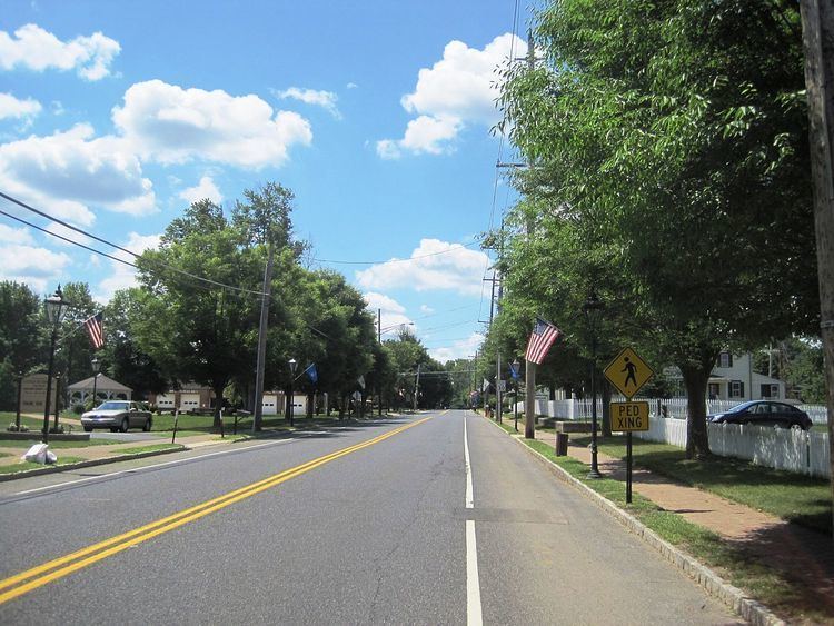
- Map of New Hanover Township NJ USA
- History
- Geography
- Census 2010
- Census 2000
- Local government
- Federal state and county representation
- Politics
- Education
- Roads and highways
- Public transportation
- Notable people
- References
Map of New Hanover Township, NJ, USA
History
New Hanover was originally formed by Royal charter on December 2, 1723, from portions of Chesterfield Township and Springfield Township. New Hanover was incorporated as one of New Jersey's initial 104 townships by an act of the New Jersey Legislature on February 21, 1798. Portions of the township were taken to form Pemberton borough (December 15, 1826), Pemberton Township (March 10, 1846), North Hanover Township (April 12, 1905) and Wrightstown (March 4, 1918).
Geography
According to the United States Census Bureau, the township had a total area of 22.395 square miles (58.004 km2), including 22.175 square miles (57.433 km2) of land and 0.220 square miles (0.570 km2) of water (0.98%).
Fort Dix is an unincorporated community and census-designated place (CDP) with a total 2010 Census population of 7,716 located in portions of New Hanover Township (5,951 of the total), Pemberton Township (1,765 of CDP's residents) and Springfield Township (with no residents in the CDP). McGuire AFB CDP is a CDP with a 2010 population of 3,710 located in portions of New Hanover Township (737 of the total) and North Hanover Township (2,973).
Cookstown is a small unincorporated community located near Fort Dix. Other unincorporated communities, localities and place names located partially or completely within the township include Cranberry Hall, Cranbury Park, Fountain Green, Lewistown, Mahalala, Pointville, Shreve and Taylors Mountain.
The township borders North Hanover Township, Pemberton Township and Wrightstown in Burlington County, and Plumsted Township in Ocean County.
The township is one of 56 South Jersey municipalities that are included within the New Jersey Pinelands National Reserve, a protected natural area of unique ecology covering 1,100,000 acres (450,000 ha), that has been classified as a United States Biosphere Reserve and established by Congress in 1978 as the nation's first National Reserve. Part of the township is included in the state-designated Pinelands Area, which includes portions of Burlington County, along with areas in Atlantic, Camden, Cape May, Cumberland, Gloucester and Ocean counties.
Census 2010
The 2010 United States Census counted 7,385 people, 551 households, and 440.8 families residing in the township. The population density was 333.0 per square mile (128.6/km2). The township contained 613 housing units at an average density of 27.6 per square mile (10.7/km2). The racial makeup of the township was 54.06% (3,992) White, 33.57% (2,479) Black or African American, 0.65% (48) Native American, 2.04% (151) Asian, 0.08% (6) Pacific Islander, 6.24% (461) from other races, and 3.36% (248) from two or more races. Hispanics or Latinos of any race were 20.96% (1,548) of the population.
Out of a total of 551 households, 50.8% had children under the age of 18 living with them, 67.2% were married couples living together, 9.3% had a female householder with no husband present, and 20.0% were non-families. 16.7% of all households were made up of individuals, and 2.4% had someone living alone who was 65 years of age or older. The average household size was 3.09 and the average family size was 3.50.
In the township, 7.9% of the population were under the age of 18, 7.4% from 18 to 24, 46.7% from 25 to 44, 34.2% from 45 to 64, and 3.7% who were 65 years of age or older. The median age was 41.1 years. For every 100 females the census counted 624.0 males, but for 100 females at least 18 years old, it was 830.1 males.
The Census Bureau's 2006-2010 American Community Survey showed that (in 2010 inflation-adjusted dollars) median household income was $63,796 (with a margin of error of +/- $9,062) and the median family income was $61,083 (+/- $9,842). Males had a median income of $33,368 (+/- $5,196) versus $38,977 (+/- $6,300) for females. The per capita income for the borough was $15,387 (+/- $1,620). About 0.7% of families and 0.7% of the population were below the poverty line, including 0.8% of those under age 18 and 8.5% of those age 65 or over.
Census 2000
As of the 2000 United States Census there were 9,744 people, 1,162 households, and 991 families residing in the township. The population density was 437.3 people per square mile (168.9/km²). There were 1,381 housing units at an average density of 62.0 per square mile (23.9/km²). The racial makeup of the township was 64.13% White, 28.90% African American, 0.42% Native American, 1.47% Asian, 0.08% Pacific Islander, 2.66% from other races, and 2.34% from two or more races. Hispanic or Latino of any race were 19.40% of the population.
There were 1,162 households out of which 60.9% had children under the age of 18 living with them, 78.1% were married couples living together, 3.7% had a female householder with no husband present, and 14.7% were non-families. 13.7% of all households were made up of individuals and 0.9% had someone living alone who was 65 years of age or older. The average household size was 3.14 and the average family size was 3.46.
In the township the population was spread out with 14.5% under the age of 18, 15.7% from 18 to 24, 55.4% from 25 to 44, 13.2% from 45 to 64, and 1.3% who were 65 years of age or older. The median age was 32 years. For every 100 females there were 401.8 males. For every 100 females age 18 and over, there were 561.7 males.
The median income for a household in the township was $44,386, and the median income for a family was $45,511. Males had a median income of $26,428 versus $23,050 for females. The per capita income for the township was $12,140. About 3.2% of families and 3.9% of the population were below the poverty line, including 3.3% of those under age 18 and 12.8% of those age 65 or over.
Local government
New Hanover Township is governed under the Township form of government. The five-member Township Committee is elected directly by the voters at-large in partisan elections to serve three-year terms of office on a staggered basis, with either one or two seats coming up for election each year as part of the November general election in a three-year cycle. At an annual reorganization meeting held in January after each election, the Township Committee selects one of its members to serve as Mayor and another as Deputy Mayor.
As of 2016, the members of the New Hanover Township Committee are Mayor Dennis Roohr (R, term on committee and as mayor ends December 31, 2016), George W. Ivins Jr. (R, 2017), Rick Koshak (R, 2018), Patrick Murphy (R, 2018) and Paul D. Peterla (R, 2017).
Federal, state and county representation
New Hanover Township is located in the 3rd Congressional District and is part of New Jersey's 12th state legislative district. Prior to the 2011 reapportionment following the 2010 Census, New Hanover Township had been in the 30th state legislative district.
New Jersey's 3rd Congressional District is represented by Tom MacArthur (R, Toms River). New Jersey is represented in the United States Senate by Cory Booker (D, Newark, term ends 2021) and Bob Menendez (D, Paramus, 2019).
For the 2016–2017 session (Senate, General Assembly), the 12th Legislative District of the New Jersey Legislature is represented in the State Senate by Samuel D. Thompson (R, Old Bridge Township) and in the General Assembly by Robert D. Clifton (R, Matawan) and Ronald S. Dancer (R, Plumsted Township). The Governor of New Jersey is Chris Christie (R, Mendham Township). The Lieutenant Governor of New Jersey is Kim Guadagno (R, Monmouth Beach).
Burlington County is governed by a Board of chosen freeholders, whose five members are elected at-large in partisan elections to three-year terms of office on a staggered basis, with either one or two seats coming up for election each year. The board chooses a director and deputy director from among its members at an annual reorganization meeting held in January. As of 2015, Burlington County's Freeholders are Director Mary Ann O'Brien (R, Medford Township, 2017; Director of Administration and Human Services), Deputy Director Bruce Garganio (R, Florence Township, 2017; Director of Public Works and Health), Aimee Belgard (D, Edgewater Park Township, 2015; Director of Hospital, Medical Services and Education) Joseph Donnelly (R, Cinnaminson Township, 2016; Director of Public Safety, Natural Resources, and Education) and Joanne Schwartz (D, Southampton Township, 2015; Director of Health and Corrections). Constitutional officers are County Clerk Tim Tyler, Sheriff Jean E. Stanfield and Surrogate George T. Kotch.
Politics
As of March 23, 2011, there were a total of 689 registered voters in New Hanover Township, of which 148 (21.5% vs. 33.3% countywide) were registered as Democrats, 278 (40.3% vs. 23.9%) were registered as Republicans and 262 (38.0% vs. 42.8%) were registered as Unaffiliated. There was one voter registered to another party. Among the township's 2010 Census population, 9.3% (vs. 61.7% in Burlington County) were registered to vote, including 10.1% of those ages 18 and over (vs. 80.3% countywide).
In the 2012 presidential election, Republican Mitt Romney received 246 votes (55.2% vs. 40.2% countywide), ahead of Democrat Barack Obama with 194 votes (43.5% vs. 58.1%) and other candidates with 6 votes (1.3% vs. 1.0%), among the 446 ballots cast by the township's 742 registered voters, for a turnout of 60.1% (vs. 74.5% in Burlington County). In the 2008 presidential election, Republican John McCain received 264 votes (56.3% vs. 39.9% countywide), ahead of Democrat Barack Obama with 190 votes (40.5% vs. 58.4%) and other candidates with 3 votes (0.6% vs. 1.0%), among the 469 ballots cast by the township's 674 registered voters, for a turnout of 69.6% (vs. 80.0% in Burlington County). In the 2004 presidential election, Republican George W. Bush received 256 votes (65.3% vs. 46.0% countywide), ahead of Democrat John Kerry with 131 votes (33.4% vs. 52.9%) and other candidates with 4 votes (1.0% vs. 0.8%), among the 392 ballots cast by the township's 572 registered voters, for a turnout of 68.5% (vs. 78.8% in the whole county).
In the 2013 gubernatorial election, Republican Chris Christie received 224 votes (76.7% vs. 61.4% countywide), ahead of Democrat Barbara Buono with 57 votes (19.5% vs. 35.8%) and other candidates with 3 votes (1.0% vs. 1.2%), among the 292 ballots cast by the township's 726 registered voters, yielding a 40.2% turnout (vs. 44.5% in the county). In the 2009 gubernatorial election, Republican Chris Christie received 206 votes (59.2% vs. 47.7% countywide), ahead of Democrat Jon Corzine with 97 votes (27.9% vs. 44.5%), Independent Chris Daggett with 15 votes (4.3% vs. 4.8%) and other candidates with 10 votes (2.9% vs. 1.2%), among the 348 ballots cast by the township's 723 registered voters, yielding a 48.1% turnout (vs. 44.9% in the county).
Education
Public school students in pre-kindergarten through eighth grade attend the New Hanover Township School, which serves students from both New Hanover Township and Wrightstown as part of the New Hanover Township School District. As of the 2013-14 school year, the district's one school had an enrollment of 194 students and 21.3 classroom teachers (on an FTE basis), for a student–teacher ratio of 9.1:1.
For ninth through twelfth grades, public school students from both New Hanover Township and Wrightstown Borough attend Bordentown Regional High School as part of a sending/receiving relationship with the Bordentown Regional School District, a regional K - 12 school district that serves students from Bordentown City, Bordentown Township and Fieldsboro Borough. As of the 2013-14 school year, the high school had an enrollment of 738 students and 52.5 classroom teachers (on an FTE basis), for a student–teacher ratio of 14.1:1.
Students from New Hanover Township, and from all of Burlington County, are eligible to attend the Burlington County Institute of Technology, a countywide public school district that serves the vocational and technical education needs of students at the high school and post-secondary level at its campuses in Medford and Westampton Township.
Roads and highways
As of May 2010, the township had a total of 24.13 miles (38.83 km) of roadways, of which 13.11 miles (21.10 km) were maintained by the municipality, 10.70 miles (17.22 km) by Burlington County and 0.32 miles (0.51 km) by the New Jersey Department of Transportation.
Public transportation
NJ Transit provides bus service in the township on the 317 route between Asbury Park and Philadelphia.
Notable people
People who were born in, residents of, or otherwise closely associated with New Hanover Township include: