
Founded May 17, 1694 Population 450,838 (2013) Unemployment rate 5.7% (Apr 2015) | Area 2,123 km² | |
 | ||
Website www.co.burlington.nj.us Colleges and Universities Rowan College at Burlington County, Empire Beauty School-Bordentown, Lincoln Technical Institute Points of interest Burlington County Prison, Brendan T Byrne State Forest, Lake Atsion, Paulsdale, Burlington Island Destinations | ||
Burlington County is a county located in the U.S. state of New Jersey. The county is the largest in New Jersey by area, and its county seat is Mount Holly Township. Burlington County had a Census-estimated population of 450,226 in 2015, representing a 0.3% increase from the 2010 United States Census, when the population was enumerated at 448,734, in turn an increase of 25,340 (6.0%) from the 423,394 enumerated in the 2000 Census, retaining its position as the 11th-most populous county in the state. The most-populous place was Evesham Township, with 45,538 residents at the time of the 2010 Census, while Washington Township covered 102.71 square miles (266.0 km2), the largest total area of any municipality in Burlington county. The Bureau of Economic Analysis ranked the county as having the 158th-highest per capita income of all 3,113 counties in the United States (and the 11th-highest in New Jersey) as of 2009.
Contents
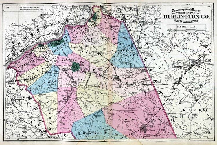
- Map of Burlington County NJ USA
- History
- 19th Century
- Geography
- Climate and weather
- Census 2010
- Census 2000
- Government
- Politics
- Municipalities
- Libraries
- Education
- Roads and highways
- Bridges
- Public transportation
- Wineries
- References
Map of Burlington County, NJ, USA
Burlington County is part of the Delaware Valley area, located east of the Delaware River. However, the county stretches across the state, and its southeast corner reaches tidal estuaries leading to southern New Jersey's Great Bay, which separates the county from the Atlantic Ocean.
History
Anglo-European records of Burlington County date to 1681, when its court was established in the Province of West Jersey. The county was formed on May 17, 1694, "by the union of the first and second Tenths." The county was named for Bridlington, a town in England. Burlington County was also the seat of government for the Province of West Jersey until its amalgamation with East Jersey in 1702, forming the Province of New Jersey. The county was much larger and was partitioned to form additional counties as the population increased. In 1714 one partition to the north became Hunterdon County, which itself was later partitioned to form three additional counties. The county seat had been in Burlington but, as the population increased in the interior, away from the Delaware River, a more central location was needed, and the seat of government was moved to Mount Holly in 1793.
19th Century
Increasing industrialization led to improvements in transportation which increased to profitability of agriculture in the county. Population increases in the coastal towns due to successful international trade and ship repair led to road improvemnts throughout the county.
Geography
According to the 2010 Census, the county had a total area of 819.84 square miles (2,123.4 km2), including 798.58 square miles (2,068.3 km2) of land (97.4%) and 21.26 square miles (55.1 km2) of water (2.6%).
Most of the land in the county is coastal and alluvial plain with little relief. There are a few anomalous hills, such as Apple Pie Hill and Arney's Mount, the highest of not only the entire county but also among the highest in South Jersey at approximately 240 feet (73 m) above sea level. The low point is sea level along the Delaware and Mullica rivers.
The majority of the land is dotted with rivers, streams, and wetlands. Some of the largest and most important rivers in Burlington County include: Rancocas Creek, Assiscunk Creek, Pennsauken Creek, Mullica River, Batsto River, and Wading River.
The county borders Atlantic County, Camden County, Mercer County, Monmouth County and Ocean County in New Jersey; and both Bucks County and Philadelphia County across the Delaware River in Pennsylvania.
Climate and weather
Average temperatures in the county seat of Mount Holly have ranged from a low of 22 °F (−6 °C) in January to a high of 87 °F (31 °C) in July, although a record low of −25 °F (−32 °C) was recorded in February 1934 and a record high of 104 °F (40 °C) was recorded in July 1936. Average monthly precipitation ranged from 2.92 inches (74 mm) in February to 4.87 inches (124 mm) in August. Burlington County has a humid-subtropical / humid continental transition climate, with relatively cold winters and hot summers. Severe weather is common in the warm months. Hurricanes have been known to strike Burlington County on occasion. Tornadoes are uncommon in the county. Severe thunderstorms, however, are quite common during the warm season. Snowfall is typical in the winter, with the snowfall averages in the county ranging from about 18 to 22 inches. The climate and weather of Burlington county is moderated by the nearby Atlantic Ocean, and rain is common year-round. The county seat receives about 41 inches of rain per year. Another interesting weather phenomena that occurs in Burlington County is radiative cooling in the Pine Barrens, a large Pine Forest and reserve that takes up a good portion of Southern and Eastern Burlington County. Due to sandy soil, on clear and dry nights these areas might be 10-15 degrees Fahrenheit colder than the surrounding areas, and there is a shorter frost-free season in these places. The sandy soil of the Pinelands loses heat much faster than the other soils or urban surfaces (concrete, asphalt) in the region, and so achieves a much lower temperature at night than the rest of the county. This effect is far less pronounced on moist, cloudy, or windy nights, as these three factors greatly reduce the radiative cooling of the sandy soil.
Census 2010
The 2010 United States Census counted 448,734 people, 166,318 households, and 117,254 families residing in the county. The population density was 561.9 per square mile (217.0/km2). The county contained 175,615 housing units at an average density of 219.9 per square mile (84.9/km2). The racial makeup of the county was 73.84% (331,342) White, 16.60% (74,505) Black or African American, 0.22% (985) Native American, 4.32% (19,395) Asian, 0.05% (219) Pacific Islander, 2.05% (9,193) from other races, and 2.92% (13,095) from two or more races. Hispanics or Latinos of any race were 6.42% (28,831) of the population.
Out of a total of 166,318 households, 31.3% had children under the age of 18 living with them, 54.3% were married couples living together, 12% had a female householder with no husband present, and 29.5% were non-families. 24.4% of all households were made up of individuals, and 9.5% had someone living alone who was 65 years of age or older. The average household size was 2.62 and the average family size was 3.14.
In the county, 23.2% of the population were under the age of 18, 8.3% from 18 to 24, 25.4% from 25 to 44, 29.2% from 45 to 64, and 13.9% who were 65 years of age or older. The median age was 40.4 years. For every 100 females the census counted 96.6 males, but for 100 females at least 18 years old, it was 94.6 males.
Census 2000
As of the 2000 United States Census there were 423,394 people, 154,371 households, and 111,610 families residing in the county. The population density was 526 people per square mile (203/km²). There were 161,311 housing units at an average density of 200 per square mile (77/km²). The racial makeup of the county was 78.39% White, 15.13% Black or African American, 0.21% Native American, 2.69% Asian, 0.03% Pacific Islander, 1.48% from other races, and 2.07% from two or more races. 4.16% of the population were Hispanic or Latino of any race. Among those residents listing their ancestry, 21.2% of residents were of Irish, 19.1% German, 16.3% Italian, 10.8% English and 7.1% Polish ancestry according to Census 2000.
There were 154,371 households out of which 34.30% had children under the age of 18 living with them, 57.70% were married couples living together, 10.90% had a female householder with no husband present, and 27.70% were non-families. 22.90% of all households were made up of individuals and 8.50% had someone living alone who was 65 years of age or older. The average household size was 2.65 and the average family size was 3.14.
In the county, the population was spread out with 25.20% under the age of 18, 7.50% from 18 to 24, 31.50% from 25 to 44, 23.30% from 45 to 64, and 12.60% who were 65 years of age or older. The median age was 37 years. For every 100 females there were 97.90 males. For every 100 females age 18 and over, there were 95.60 males.
The median income for a household in the county was $58,608, and the median income for a family was $67,481. Males had a median income of $46,381 versus $32,228 for females. The per capita income for the county was $26,339. About 3.2% of families and 4.7% of the population were below the poverty line, including 5.5% of those under age 18 and 4.9% of those age 65 or over.
Government
Burlington County is governed by a Board of chosen freeholders consisting of five members who are elected at large by the voters of Burlington County in partisan elections and serve staggered three-year terms, with either one or two seats up for election each year in a three-year cycle. Burlington County's Freeholders have both administrative and policy making powers. Each Burlington County Freeholder oversees a particular area of service: Administration & Natural Resources; Education & Justice; Public Works & Veteran Services; Public Safety & Health and Human Services; and Hospital and Medical Services & Elections. The Board is currently completely held by Republicans.
As of 2017, Burlington County's Freeholders are:
As of 2016, Burlington County's Constitutional Officers are:
Burlington County constitutes Vicinage 3 of the New Jersey Superior Court. Vicinage 3 is seated at the Burlington County Courts Facility and County Office Building in Mount Holly, with additional space in the Olde Courthouse and Rancocas Building, also in Mount Holly; the Assignment Judge for Vicinage 3 is the Honorable Ronald E. Bookbinder.
Three federal Congressional Districts cover the county, including portions of the 1st, 2nd and 3rd Districts. New Jersey's First Congressional District is represented by Donald Norcross (D, Camden). New Jersey's Second Congressional District is represented by Frank LoBiondo (R, Ventnor City). New Jersey's 3rd Congressional District is represented by Tom MacArthur (R, Toms River).
The county is part of the 6th, 7th, 8th, 9th and 12th Districts in the New Jersey Legislature.
The county is also home to the majority of 42,000-acre (17,000 ha) megabase, Joint Base McGuire-Dix-Lakehurst, the entire Air Force Activity / Headquarters of JB MDL McGuire Air Force Base, and all of the main portions of the Army Support Activity, Fort Dix and most training grounds / shooting ranges lie within the county borders in New Hanover, North Hanover, Pemberton, and Springfield townships.
Politics
A moderate and swing county in New Jersey politics, Burlington County in recent years has become an important area for the Republican Party, especially in more affluent communities that have developed new residential areas, such as Medford, Mount Laurel, Moorestown, and Evesham (as opposed to areas along the Delaware River occupied by minority and working class households). It does however, tend to lean and vote Democratic particularly in federal elections.
As of October 31, 2014, there were a total of 292,538 registered voters in Burlington County, of whom 94,520 (32.3%) were registered as Democrats, 67,733 (23.2%) were registered as Republicans and 130,003 (44.4%) were registered as Unaffiliated. There were 282 voters registered to other parties. Among the county's 2010 Census population, 65.2% were registered to vote, including 76.8% of those ages 18 and over.
In the 2012 presidential election, Democrat Barack Obama received 126,377 votes countywide, ahead of Republican Mitt Romney with 87,401 votes (40.2%) and other candidates with 2,158 votes (1.0%), among the 217,428 ballots cast by the county's 291,760 registered voters, for a turnout of 74.5%. In the 2008 presidential election, Democrat Barack Obama received 131,219 votes in the county, ahead of Republican John McCain with 89,626 votes (39.9%) and other candidates with 2,329 votes (1.0%), among the 224,740 ballots cast by the county's 280,836 registered voters, for a turnout of 80.0%. In the 2004 presidential election, Democrat John Kerry received 110,411 votes in the county (52.9%), ahead of Republican George W. Bush with 95,936 votes (46.0%) and other candidates with 1,609 votes (0.8%), among the 208,540 ballots cast by the county's 264,532 registered voters, for a turnout of 78.8% .
In the 2013 gubernatorial election, Republican Chris Christie received 79,220 votes countywide, ahead of Democrat Barbara Buono with 46,161 votes (35.8%) and other candidates with 1,512 votes (1.2%), among the 129,060 ballots cast by the county's 289,900 registered voters, yielding a 44.5% turnout. In the 2009 gubernatorial election, Republican Chris Christie received 66,723 votes in Burlington County (48.0%), ahead of Democrat Jon Corzine with 63,114 votes (45.4%), Independent Chris Daggett with 6,333 votes (4.6%) and other candidates with 1,661 votes (1.2%), among the 139,030 ballots cast by the county's 282,209 registered voters, yielding a 49.3% turnout rate.
In the 2012 General Election, Democrats Aimee Belgard and Joanne Schwartz won election as Freeholders over Republican incumbents Bruce Garganio and Mary Ann O’Brien, despite being outspent by a six-to-one margin. However, in 2014, both Garganio and O'Brien were successful in winning back seats on the Freeholder board, while Aimee Belgard lost her bid for U.S. Congress, losing the popular vote in both Ocean and Burlington Counties.
In 2015, Republican newcomers Kate Gibbs and Ryan Peters ousted Belgard and Schwartz, again giving the Republican Party full control on the Freeholder Board.
Municipalities
Municipalities in Burlington County (with 2010 Census data for population, housing units and area) are:
Most municipalities have their own municipal courts, which handle traffic and minor criminal and civil matters,. The New Jersey Superior Court handles more serious cases.
Libraries
The Burlington County Library became the first county library in New Jersey when it was established in 1921 in Mount Holly. Library service grew in popularity and several moves ensued as more space became a necessity. By 1971, a new headquarters facility had been constructed, Cinnaminson and Bordentown had joined the system as branches, and a bookmobile visited areas without local facilities. Medford and Evesham had joined the system by 1975. The Pemberton Branch joined the system in 1987. Maple Shade became a branch in April 2001 while Riverton, the newest branch, joined in December 2003. With a larger network of 9 additional member libraries, the system provides a range of services to its residents.
Education
Rowan College at Burlington County is a two-year public community college serving students from Burlington County. The school, located at campuses in Pemberton and Mount Laurel and was founded in 1966 and opened to students in 1969.
Roads and highways
As of May 2010, the county had a total of 2,609.74 miles (4,199.97 km) of roadways, of which 1,913.83 miles (3,080.01 km) were maintained by the local municipality, 504.18 miles (811.40 km) by Burlington County, 154.01 miles (247.86 km) by the New Jersey Department of Transportation and 37.72 miles (60.70 km) by the New Jersey Turnpike Authority.
A variety of major routes were constructed through Burlington County. Major county roads include County Route 528, County Route 530, County Route 532, County Route 534 (only in Shamong), County Route 537, County Route 541, County Route 543, County Route 544, County Route 545 and County Route 563. State Routes that pass through are Route 38, Route 68, Route 70, Route 72, Route 73, Route 90 (only in Cinnaminson), and Route 413 (only in Burlington). U.S. Routes that traverse are U.S. Route 9 (only in Bass River Township), U.S. Route 130 and U.S. Route 206. Limited access roads include the Garden State Parkway (a 7.4 miles (11.9 km) stretch in Bass River Township), Interstate 295 and the New Jersey Turnpike (a portion of Interstate 95).
The Turnpike extends through the county for approximately 30.1 miles (48.4 km) from Cherry Hill Township in Camden County to Hamilton Township in Mercer County (including the 6.5 mile (10.5 km) Turnpike Extension from the turnpike bridge over the Delaware River to the mainline at Exit 6).
Five Turnpike interchanges are located in Burlington: Exit 4 in Mount Laurel Township, Exit 5 in Westampton Township, Exit 6A in Florence Township, Exit 6 in Mansfield Township and Exit 7 in Bordentown Township.
The New Jersey Turnpike Authority plans to widen the Parkway to three lanes in each direction from exit 80 in South Toms River, Ocean County to exit 30 in Somers Point, Atlantic County, including widening of bridges at several river crossings. The Authority extended the 'dual-dual' configuration (inner car lanes and outer car / truck / bus lanes) south to Exit 6 from its former end at Exit 8A in Monroe Township, Middlesex County. This was finished in early November 2014.
Bridges
The Burlington County Bridge Commission is responsible for maintaining the Tacony-Palmyra Bridge and the Burlington-Bristol Bridge, both of which cross the Delaware River. In addition, the agency maintains several bridges along CR 543 including the Riverside-Delanco Bridge over the Rancocas Creek.
Public transportation
The River Line is a diesel light-rail system operated for NJ Transit by the Southern New Jersey Rail Group on a former Pennsylvania Railroad line between the Trenton Transit Center in Trenton and the Walter Rand Transportation Center and other stations in Camden, with 11 stations in the county.
NJ Transit operates bus service into Philadelphia on the following routes; 317, 406, 409, 414, and 417 routes, and into Camden, New Jersey only on the following routes; 407, 413, 418, 419, and 457; and to Atlantic City on the 559 route.
Academy Bus Lines operates buses from Mount Holly, Mount Laurel, Westampton, and Willingboro to New York City's Port Authority Bus Terminal and Midtown Manhattan, as well as the Wall Street area of Lower Manhattan.
The BurLink bus service provides six routes, under service funded by the county and operated by the South Jersey Transportation Authority, providing connections to NJ Transit's bus and rail service.