
Country Language spoken Capital Governor Ishak Mekki | University Sriwijaya University Area 91,592.43 km2 Founded September 12, 1950 | |
 | ||
Population 7.45 million (May 1, 2010) | ||
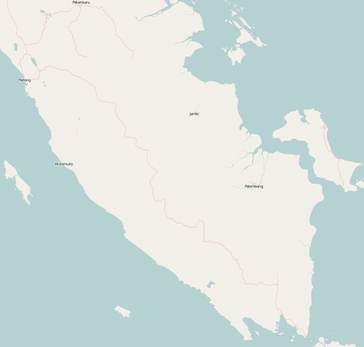
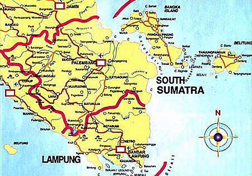
Map of South Sumatra
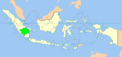
South Sumatra (Indonesian: Sumatera Selatan) is a province of Indonesia. It is located in the southern part of Sumatra Island, east of the Bukit Barisan Mountains. It spans 91,592.43 km2 (35,364 sq mi) and had a population of 7,450,394 at the 2010 Census; the latest official estimate is 10,675,862 (as at May 2015). The capital of the province is Palembang.
Contents
- Map of South Sumatra
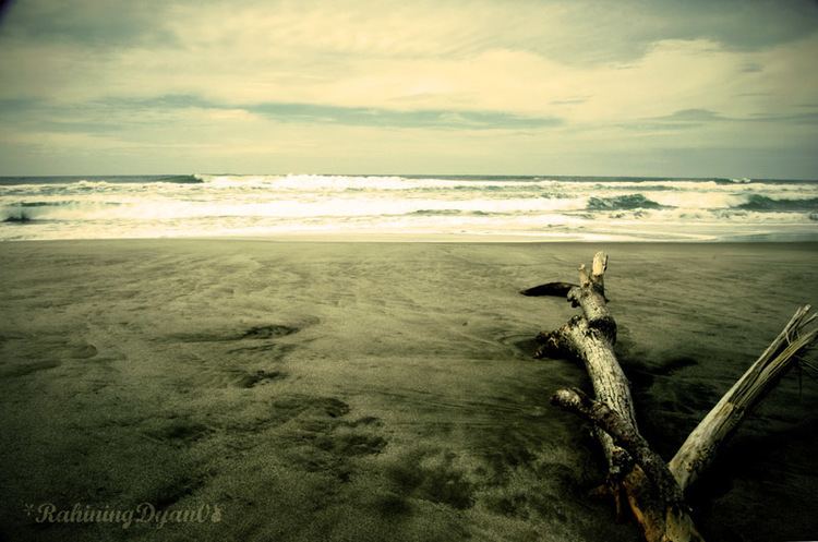
- Luxury sumatra surf camp south sumatra
- Prehistoric era
- Srivijaya era
- Palembang Sultanate Dutch and World War II
- After independence
- Geography
- Demographics
- Religion
- Administrative divisions
- Mining
- References

Luxury sumatra surf camp south sumatra
Prehistoric era
South Sumatra has been settled by humans since the Palaeolithic era. The evidence of those settlements is proven by some discoveries of Palaeolithic tools in the riverbed of Saling and Kikim rivers in Bungamas Village, Lahat Regency. Seventy eight skeletons dating back to 3,000-14,000 years ago, presumably of Austronesian and Austromelanesoid race have been excavated from the site of Harimau Cave in Padang Bindu Village, Ogan Komering Ulu Regency. Relics of seven stone chambers believed to be about 2,500 years old were found near a coffee plantation in Kotaraya Lembak, Lahat Regency. Around 300 BC, the Deutero-Malay people arrived in this region and pushed the native people inland.
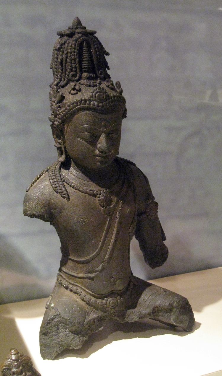
Srivijaya era
Around 7th century AD, an ancient Buddhist kingdom of Srivijaya was established in an area known today as Palembang. It once controlled a large part of what is now Indonesia, Malaysia and Southern Thailand, effectively ruled the Malacca Strait, and controlled the trade in that region. In 1025, it was defeated by the Chola Empire (during the period of Emperor Rajendra Chola I) of southern India. Srivijaya's capital eventually moved northward to Jambi. After its eventual fall in 14th century AD, some small kingdoms were established in South Sumatra. However, there was virtually a power vacuum in the region since there was no prominent power to hold the region except for the waning Majapahit Empire, itself centered in Java island. The vacuum allowed pirates to flourish in the region.
Palembang Sultanate, Dutch, and World War II
In the 16th century AD, the Palembang Sultanate was established by Ki Gede Ing Suro, a politician who fled from Demak Sultanate. Clashes with the Dutch had occurred since the 17th century until the sultanate was abolished in 1825 when the Dutch gave a final blow to the final Sultan of Palembang, Sultan Ahmad Najamuddin. Southern Sumatra was occupied by the Japanese in January 15, 1942 after the Battle of Palembang in World War II.
After independence
After the Proclamation of Indonesian Independence, South Sumatra became a part of Sumatra Province as a residency with Adnan Kapau Gani as the resident. On January 1, 1947, the Dutch tried to gain its sovereignty over South Sumatra by invading Palembang. Since then, fighting ensued across South Sumatra until Indonesia's independence was recognized by the Dutch on December 27, 1949. The area occupied by the Netherlands in South Sumatra was incorporated into South Sumatra State under the United States of Indonesia until the disbandment of the union and the founding of the republic. On September 12, 1950, South Sumatra province was established with a territory much larger than it is today, as it encompassed several provinces that were eventually given autonomy: Lampung was carved from the southern part of the province in 1964, Bengkulu from the coastal western part of the province in 1967, and Bangka Belitung from the titular islands on December 4, 2000.
Geography

The province is located in the southeastern portion of the island of Sumatra. The majority of its area consists of low-lying plains filled with plantations, forest, marshes and mangroves in coastal areas. The natural environment of South Sumatra is hot and humid tropical rain forest. However, most of these forest has been cleared out to make way for oil palm plantation for palm oil production. The Bukit Barisan mountain range is located on the western edge of the province and forms the border with the neighbouring Bengkulu province. The mountains are the source of river systems that drain eastward to the Bangka Strait and South China Sea. The largest among these rivers is Musi River, the longest river in Sumatra.
The administrative area of the province borders the provinces of Lampung to the south, Bengkulu to the west, and Jambi to the north. Off the east coast are the islands of Bangka and Belitung, which were split from South Sumatra province to form the new province of Bangka-Belitung in 2000.
The climate of South Sumatra is quite suitable for palm oil industries, including palm estate and rubber industries.
Demographics
According to a 2015 estimate, South Sumatra has a population of 10,675,862. Its population had tripled from 1971 to 2015, not counting the population lost due to the creation of Bangka Belitung province in 2000.
The province has no clear ethnic dominance, though the indigenous Musi-speaking Malays have a plurality, followed by the Javanese, most of whom recent migrants from Java as part of the government-sanctioned transmigration project created to balance the population, especially from the highly overpopulated Java island; as a result, Javanese is also widely spoken and understood, especially in area with high population of transmigrant, for example Belitang. Forming the next largest group is the other Malayan-speaking populations as well as the Komering, a distinct Malayo-Polynesian people related to the native Lampungese from neighboring Lampung. Minangkabau, Chinese, and Sundanese also form minorities in the province.
Religion
The people of the province, as with other parts of Sumatra with the exception of Bangka Belitung and North Sumatra provinces, overwhelmingly follow the Shafi'i school of law of Sunni Islam. The religion is mainly adopted by the ethnic Malays, Javanese, Minangkabau, and Sundanese, though with a slightly different flavor: the ethnic Malays and Minangkabau follow a modernist principle with little indigenous syncretism equivalent to the "mainstream" branch followed by the other Muslim-majority countries, while the migrants from Java follow a traditionalist interpretation highly accented with pre-Islam beliefs.
Other minority religions are also practiced; the Chinese primarily follow Mahayana Buddhism and Christianity.
Administrative divisions
The capital of South Sumatra province is Palembang. As at 2010 this province was divided into eleven regencies (kabupaten) and four autonomous cities (kota), listed below with their areas and their populations at the 2010 Census and according to the latest (January 2014) estimates.
Mining
The coal deposits of South Sumatra amount to 22.24 billion tons or 48.45 percent of the total national reserves. The province also has 4.18 trillion standard cubic feet of natural gas and 757.4 standard cubic feet of natural oil.