
Pronunciation /ˈsneɪfɛl/ OS grid SC397881 Elevation 620 m | Translation snow fell (Norse) Topo map OS Landranger 95 Prominence 620 m | |
 | ||
Similar North Barrule, South Barrule, Mull Hill, Scafell Pike, Slieau Freoaghane | ||
Isle of man mountain road full speed over snaefell mountain course during the tt 2014 ramsey
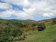
Snaefell (Manx: Sniaull) is the highest mountain and the only summit higher than 2,000 feet (610 m) on the Isle of Man, at 2,037 feet (620.9 m) above sea level. The summit is crowned by a railway station, cafe and several communications masts.
Contents
- Isle of man mountain road full speed over snaefell mountain course during the tt 2014 ramsey
- Map of Snaefell Isle of Man
- ViewsEdit
- Climbing SnaefellEdit
- References
Map of Snaefell, Isle of Man
ViewsEdit
It is a well-known saying in the Isle of Man that on a clear day six kingdoms can be seen from the top: the Isle of Man, England, Ireland, Scotland, Wales and Heaven. Some versions add a seventh kingdom, that of Manannán (or the sea).
The plaque at the summit indicates the directions of five points from Snaefell as well as their distances:
Climbing SnaefellEdit
The Snaefell Mountain Railway has a seasonal electric tram service, typically from April to October, which climbs the 4 miles (6.4 km) from Laxey to the summit.
The A18 Snaefell Mountain Road passes over the slopes of Snaefell, and is the highest section of the Snaefell Mountain Course over which the Isle of Man TT Races are held. Walkers often use the car park on this road near the Bungalow railway station (last railway stop before the summit) from which there is a rough path to the peak. The trail has sections of gravel, slate stones, grass and rock. While the angle of ascent steepens significantly closer to the summit, special climbing equipment is not required. However, caution is required in steep areas as the grass, earth and rocks are often slippery. Average climb time on foot on a dry footpath is about 45 minutes.
A geodetic marker embedded in the small, concrete obelisk indicates the true mountain summit. The rock cairn standing nearby has an information plaque on top.