
Car plates WSI | Area 1,603 km² | |
 | ||
Gminas Total 13Gmina DomaniceGmina KorczewGmina KotuńGmina MokobodyGmina MordyGmina PaprotniaGmina PrzesmykiGmina SiedlceGmina SkórzecGmina SuchożebryGmina WiśniewGmina WodynieGmina Zbuczyn Colleges and Universities Siedlce University of Natural Sciences and Humanities Points of interest Muzeum Regionalne w Siedlca, Park Aleksandria Siedlce, Muzeum Diecezjalne w Siedlca, Kolumna toskańska w Siedlca, Kamienica | ||
Siedlce County (Polish: powiat siedlecki) is a unit of territorial administration and local government (powiat) in Masovian Voivodeship, east-central Poland. It came into being on January 1, 1999, as a result of the Polish local government reforms passed in 1998. Its administrative seat is the city of Siedlce, although the city is not part of the county (it constitutes a separate city county). The only town in Siedlce County is Mordy, which lies 18 km (11 mi) east of Siedlce.
Contents
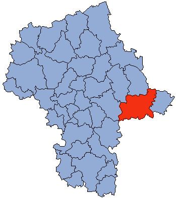
Map of Siedlce County, Poland
The county covers an area of 1,603.22 square kilometres (619.0 sq mi). As of 2006 its total population is 80,560, out of which the population of Mordy is 1,840 and the rural population is 78,720.
Neighbouring counties
Apart from the city of Siedlce, Siedlce County is also bordered by Węgrów County and Sokołów County to the north, Siemiatycze County to the north-east, Łosice County and Biała Podlaska County to the east, Łuków County to the south, Garwolin County to the south-west, and Mińsk County to the west.
Administrative division
The county is subdivided into 13 gminas (one urban-rural and 12 rural). These are listed in the following table, in descending order of population.