
Car plates WM | Area 1,164 km² | |
 | ||
Gminas Total 13 (incl. 2 urban)Mińsk MazowieckiSulejówekGmina CegłówGmina Dębe WielkieGmina DobreGmina HalinówGmina JakubówGmina KałuszynGmina LatowiczGmina Mińsk MazowieckiGmina MrozyGmina SiennicaGmina Stanisławów Points of interest Muzeum Józefa Piłsudski, Rezerwat przyrody Rudka Sa, Pałac Dernałowiczów, Muzeum Ziemi Mińskiej, Muzeum 7 Pułku Ułanów L | ||
Mińsk County (Polish: powiat miński) is a unit of territorial administration and local government (powiat) in Masovian Voivodeship, east-central Poland. It was (re)created on January 1, 1999, as a result of the Polish local government reforms passed in 1998. Its administrative seat and largest town is Mińsk Mazowiecki, which lies 39 kilometres (24 mi) east of Warsaw. The county contains three other towns: Sulejówek, 21 km (13 mi) west of Mińsk Mazowiecki, Halinów, 16 km (10 mi) west of Mińsk Mazowiecki, and Kałuszyn, 17 km (11 mi) east of Mińsk Mazowiecki.
Contents
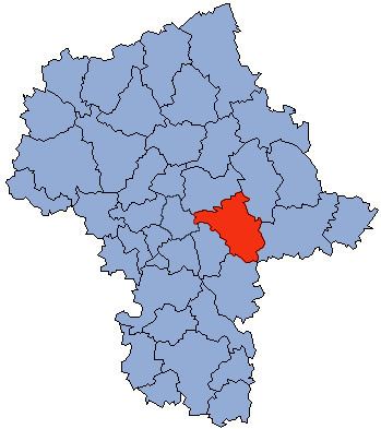
Map of Mi%C5%84sk County, Poland
The county covers an area of 1,164.35 square kilometres (449.6 sq mi). As of 2006 its total population is 141,048, out of which the population of Mińsk Mazowiecki is 37,808, that of Sulejówek is 18,676, that of Halinów is 3,369, that of Kałuszyn is 2,905, and the rural population is 78,290.
Neighbouring counties
Mińsk County is bordered by Węgrów County to the north-east, Siedlce County to the east, Garwolin County to the south, Otwock County and the city of Warsaw to the west, and Wołomin County to the north-west.
Administrative division
The county is subdivided into 13 gminas (two urban, two urban-rural and nine rural). These are listed in the following table, in descending order of population.