
Car plates WWE | Area 1,219 km² | |
 | ||
Gminas Total 9 (incl. 1 urban)WęgrówGmina GrębkówGmina KorytnicaGmina LiwGmina ŁochówGmina MiedznaGmina SadowneGmina StoczekGmina Wierzbno Points of interest Liw Castle, Punkt Widokowy Sowia Gó, Museum of Wooden Architectu, Wioska Indiańska "Fort Hant, Muzeum Ziemi Sadowieńskiej | ||
Węgrów County (Polish: powiat węgrowski) is a unit of territorial administration and local government (powiat) in Masovian Voivodeship, east-central Poland. It came into being on January 1, 1999, as a result of the Polish local government reforms passed in 1998. Its administrative seat and largest town is Węgrów, which lies 73 kilometres (45 mi) east of Warsaw. The only other town in the county is Łochów, lying 26 km (16 mi) north-west of Węgrów.
Contents
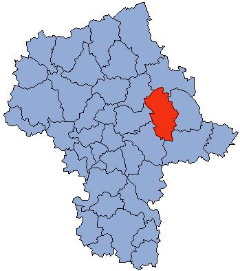
Map of W%C4%99gr%C3%B3w County, Poland
The county covers an area of 1,219.18 square kilometres (470.7 sq mi). As of 2006 its total population is 67,823, out of which the population of Węgrów is 12,606, that of Łochów is 6,452, and the rural population is 48,765.
Neighbouring counties
Węgrów County is bordered by Ostrów Mazowiecka County to the north, Sokołów County to the east, Siedlce County to the south, Mińsk County to the south-west, and Wołomin County and Wyszków County to the west.
Administrative division
The county is subdivided into nine gminas (one urban, one urban-rural and seven rural). These are listed in the following table, in descending order of population.