
Population 834 (2013 est) State electorate(s) Roe Founded 1918 | Established 1918 Area 4,714 km² Mayor Jim M Sullivan | |
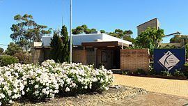 | ||
The Shire of Kulin is a local government area in the Eastern Wheatbelt region of Western Australia, about 300 kilometres (186 mi) ESE of the state capital, Perth. The Shire's land area of 4,714 square kilometres (1,820 sq mi) forms a narrow east-west band, located between the Shire of Kondinin to the north and the Shire of Lake Grace to the south. Its seat of government is the town of Kulin. The local economy is based on agriculture - predominantly cereal grains and sheep.
Contents
Map of Kulin, WA, Australia
History
On 14 June 1918, the Roe Road District was gazetted. It was renamed to the Kulin Road District on 12 March 1926. On 1 July 1961, it became a shire under the Local Government Act 1960.
Wards
The shire is divided into 4 wards.
From 1964 until 3 May 2003, the following system existed: