
Population 4,750 (1992) Area 1,644 km² | Established 1863 Founded 1863 | |
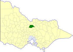 | ||
The Shire of Waranga was a local government area about 165 kilometres (103 mi) north of Melbourne, the state capital of Victoria, Australia. The shire covered an area of 1,644.19 square kilometres (634.8 sq mi), and existed from 1863 until 1994.
Contents
History
Waranga was incorporated as a road district on 1 June 1863, and became a shire on 30 October 1865.
A large area was annexed to the Shire of Echuca on 10 October 1879, which ended up located within the Shire of Deakin. The Shire of Rodney was severed and incorporated on 19 March 1886. On 16 May 1956 another loss of area occurred when Shire of Goulburn annexed some land in Waranga's southeast.
On 18 November 1994, the Shire was abolished, and merged with the City of Echuca, the Town of Kyabram, the Shires of Deakin and Rochester and some neighbouring districts into the Shire of Campaspe. The Murchison district was transferred to the City of Greater Shepparton.
Wards
Waranga was divided into four ridings on 5 May 1971, each of which elected three councillors:
Towns and localities
Population
* Estimate in the 1958 Victorian Year Book.