
Population 16,110 (1992) Area 1,010 km² Council seat Tatura | Established 1886 Founded 1886 | |
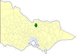 | ||
The Shire of Rodney was a local government area in the Goulburn Valley region, about 170 kilometres (106 mi) north of Melbourne, the state capital of Victoria, Australia, located between Kyabram and Shepparton. The shire covered an area of 1,009.92 square kilometres (389.9 sq mi), and existed from 1886 until 1994.
Contents
History
Rodney was initially part of the Waranga Road District, which was incorporated in 1863, and became a shire two years later. The Shire of Rodney was severed and incorporated on 19 March 1886. Following the secession of the Town of Kyabram on 1 April 1954, the eastern part of the shire, adjoining Shepparton and centred on Mooroopna, which had become home to the Ardmona fruit cannery in 1922, unsuccessfully attempted to secede from Rodney, a move driven by the town's Chamber of Commerce.
On 18 November 1994, the Shire of Rodney was abolished, and, along with the City of Shepparton and the Shire of Shepparton and some neighbouring districts, was merged into the newly created City of Greater Shepparton. The Kyabram hinterland and some land around Lake Waranga were transferred to the newly created Shire of Campaspe.
Wards
The riding boundaries of Rodney were changed and renamed in 1988. This brought about a general spill of the council, and at an election in August of that year, the following nine councilors were elected:
Towns and localities
Population
* Estimate in the 1958 Victorian Year Book.