
Population 2,680 (1992) Founded 1868 | Established 1868 Area 1,016 km² Council seat Nagambie | |
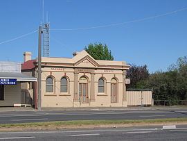 | ||
The Shire of Goulburn was a local government area about 120 kilometres (75 mi) north of Melbourne, the state capital of Victoria, Australia. The shire covered an area of 1,016 square kilometres (392.3 sq mi), and existed from 1868 until 1994.
Contents
History
Goulburn was first incorporated as a road district on 24 November 1868, and became a shire on 24 March 1871. On 16 May 1956, Goulburn annexed land from the Shire of Waranga.
On 18 November 1994, the Shire of Goulburn was abolished, and, along with the Shires of Euroa and Violet Town, and some neighbouring districts, was merged into the newly created Shire of Strathbogie.
Wards
The Shire of Goulburn was divided into three ridings on 16 May 1956, each of which elected three councillors:
Towns and localities
Population
* Estimate in the 1958 Victorian Year Book.