
Population 28,000 (2016 est) Shire President John Erren Founded 1894 Region Peel | Established 1894 Area 905 km² | |
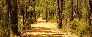 | ||
Points of interest Serpentine National Park, Cohunu Koala Park, Serpentine Falls, Langford Park, Millbrook Winery | ||
The Shire of Serpentine-Jarrahdale is a local government area in the outer southeastern metropolitan area of Perth, the capital of Western Australia, and has an area of 905 square kilometres (349 sq mi) and a population of 28,000 (2016 est). The Shire's seat of government is the town of Mundijong.
Contents
Map of Serpentine-Jarrahdale, WA, Australia
History
The Serpentine Road District was gazetted in December 1894, and in 1913 changed name to Serpentine-Jarrahdale Road District. On 1 July 1961, it became a Shire following the enactment of the Local Government Act 1960. In 1977, it acquired Byford from Shire of Armadale-Kelmscott.
Wards
The Shire was previously split into four wards named: Byford, Central, North West and South. Recently, the boundaries were realigned and on 29 July 2011, the gazetted boundaries became:
Elections to fill all positions in these new wards were called for 15 October 2011.