
Population 763 (2006 census) Postcode(s) 6125 Area 104.8 km² | Established 1893 Postal code 6125 | |
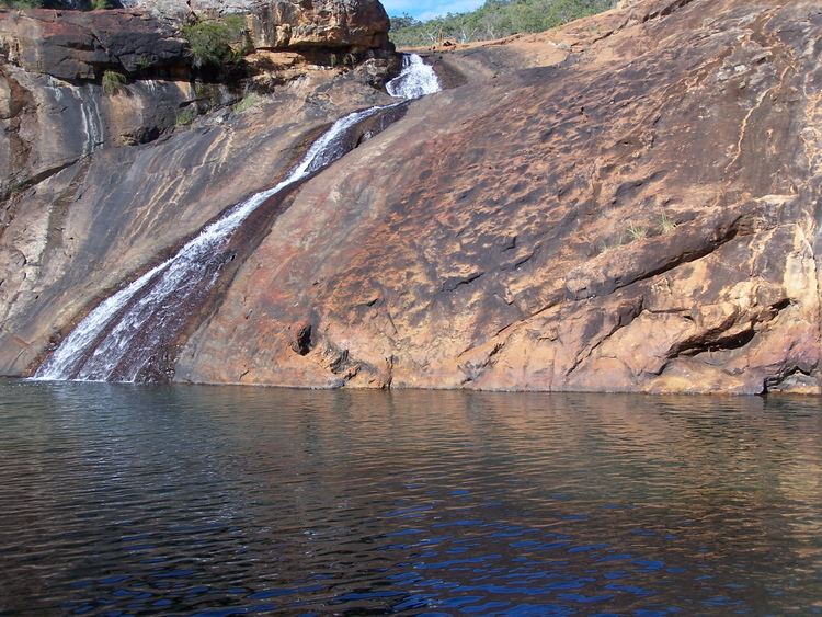 | ||
Weather 27°C, Wind S at 13 km/h, 27% Humidity Points of interest Serpentine National Park, Serpentine Falls, Kingsbury Lookout | ||
Serpentine is a town located 55 kilometres (34 mi) south-southeast of Perth, the capital of Western Australia, and 7 km south of Mundijong.
Map of Serpentine WA 6125, Australia
Serpentine is located on the South Western Railway between Perth and Bunbury, and was one of the original stations when the line was opened in 1893. At the 2006 census, Serpentine had a population of 763.
In 1891 the government had opened up land in the area by declaring the Serpentine Agricultural Area, and in 1893 decided there was sufficient demand for town lots by gazetting the Townsite of Serpentine in December 1893. The townsite derives its name from the nearby Serpentine River. The name is descriptive, derived from the "serpentine" nature of the river in its lower reaches where it was discovered and named in the early 1830s.
The population of the town was 128 (80 males and 48 females) in 1898.
It is the locality to which the BOM weather radar has been shifted following on from the original Perth location in West Perth.
It is also the location of the Bodhinyana Buddhist Monastery.
Serpentine also serves as a stop on the Australind passenger train from Perth to Bunbury.