
Population 11,730 (2013 est) Founded 1871 Federal division Division of Pearce | Established 1871 Area 1,432 km² Mayor Steven Pollard | |
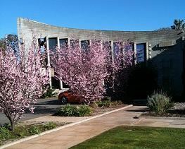 | ||
The Shire of Northam is a local government area in the Wheatbelt region of Western Australia, beyond the northeastern fringe of the Perth metropolitan area centred on the town of Northam itself. The Shire covers an area of 1,431 square kilometres (553 sq mi). In 2007, it merged with the Town of Northam, almost tripling its population in the process from a previous size of 3,794 (ABS 2006).
Contents
Map of Northam, WA, Australia
History
In 1871, the Northam Road District was constituted under the Road Boards Act 1871. On 4 November 1879, the separate Northam Municipality was constituted to manage the town of Northam. The town expanded beyond the municipal boundaries (which were set at about 5 km2 (1.9 sq mi)) and on 6 September 1957, the municipal boundaries were adjusted to bring all of Northam under it. The Road District lost a significant part of its population in this transfer.
On 1 July 1961, the Road District became a shire under the Local Government Act 1960.
Amalgamation
In September 2006, the Shire received a report into the possibility of merging with the Town of Northam, and on 31 October 2006, the Local Government Advisory Board received a proposal to that effect from both councils. Public meetings in December 2006 announced that the new council would be known as the Shire of Northam, and would come into existence on 1 July 2007, initially operated by a board of commissioners (two from each entity plus an independent chair).
In January 2007, the Local Government Advisory Board officially recommended to the Minister for Local Government that the amalgamation proceed. The Shire electors successfully petitioned for a referendum within their area, which was held on 28 April 2007. Prior to the election, the Shire of Northam itself took the unusual step of asking its electors not to vote, in order to deny the referendum the 50% of voters needed to constitute a valid poll under Clause 10 of Schedule 2.1 of the Local Government Act 1995. With a participation rate of 23.59%, a majority of 93% voted against the proposal. This 23.59% voter participation equates to 596 voters; less than the number that petitioned for the referendum in the first place.
The amalgamation proceeded as planned and the first elections for seats in the new council were held in October 2007.
Wards
The Shire has been divided into four wards.
Towns and localities
Population
The historic populations of the area which now forms the Shire of Northam are as follows. "Old Shire" relates to the pre-2007 boundaries.