
Population 6,580 (2011 census) Postcode(s) 6401 Founded 1833 Local time Sunday 9:32 PM | Established 1833 Elevation 170 m Postal code 6401 Federal division Division of Pearce | |
 | ||
Weather 15°C, Wind SE at 13 km/h, 47% Humidity | ||
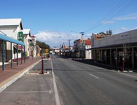
Northam /ˈnɔːrðəm/ is a town in Western Australia, situated at the confluence of the Avon and Mortlock Rivers, about 97 kilometres (60 mi) east-northeast of Perth in the Avon Valley. At the 2011 census, Northam had a population of 6,580. Northam is the largest town in the Avon region. It is also the largest inland town in the state not founded on mining.
Contents
- Map of Northam WA 6401 Australia
- History
- Northam Migrant Accommodation Centre
- Yongah Hill Immigration Detention Centre
- Climate
- Government
- River
- Transport
- Tourism
- Railways
- Current railway station
- Original railway station
- Avon Yard
- Sport
- Events in Northam
- Military History
- Notable people
- References
Map of Northam WA 6401, Australia
History
The area around Northam was first explored in 1830 by a party of colonists led by Ensign Robert Dale, and subsequently founded in 1833. It was named by Governor Stirling, probably after a village of the same name in Devon, England. Almost immediately it became a point of departure for explorers and settlers who were interested in the lands which lay to the east.
This initial importance declined with the growing importance of the nearby towns of York and Beverley, but the arrival of the railway made Northam the major departure point for prospectors and miners heading east towards the goldfields.
A number of older buildings have local heritage significance and still serve the community.
A severe thunderstorm lashed the town and surrounding areas on 27 January 2011 resulting in roofs being ripped off, trees being uprooted and power lines being brought down. About 50 houses were damaged in the town as a result of the storm but no injuries were reported.
Northam Migrant Accommodation Centre
During the 1940s and 1950s in Northam there were extensive camps for displaced persons and immigrants from continental Europe.
The Northam Migrant Accommodation Centre closed in September 1951. It had been the first place of residence in Western Australia for approximately 15,000 immigrants from the Baltic states, Hungary, Poland, Czechoslovakia, Italy, Yugoslavia, Ukraine, Belarus and Bulgaria. During the peak immigration period, Northam had the largest immigrant receiving facilities within the State and the third largest in Australia. By 1950, the camp housed 4,000 people and two new blocks of huts were built to accommodate them all. By May 1954, 23,000 migrants had passed through the Northam Camp once the Accommodation Centre had closed. A significant number of these post-war arrivals eventually settled in the Northam area.
Yongah Hill Immigration Detention Centre
On 18 October 2010 the Yongah Hill (YHIDC) centre was announced as being established at the former Northam Training Camp. It was not opened until early 2012, however, and, after it was downsized from the original 1500 expected occupancy, talk of expansion has been happening.
It is run by Serco for the Department of Immigration and Border Protection.
Climate
Northam has a Mediterranean climate with hot dry summers and cool wet winters.
Government
For many years Northam consisted of the Town of Northam and Shire of Northam. After 53 years of debates and attempts, these two councils merged on 1 July 2007 to form one new council called the Shire of Northam.
River
The town and hinterland of Northam are located in the Avon Valley - so named after the river the Avon River. It has been periodically flooded, and man-made banks protect the town from inundation. The Avon is a name commonly used by organisations, newspapers and sporting groups.
Burlong Pool a pool just south of the town was known as the Burlong swimming pool, and in the 1890s the location of the source of water for the Goldfields Water Trains
Transport
Northam is connected to Perth via coach services N3 and N5 and rail services Prospector and Avon link provided by Transwa
Tourism
Northam has a number of tourist attractions, including hot air ballooning, wineries, cafes & restaurants, museums, hotels and motels.
Railways
Northam is a major railway junction, and serves as the commercial centre for much of the western Wheatbelt. The dual gauge Eastern Railway terminates here and becomes the standard gauge Eastern Goldfields Railway. Narrow gauge radiates both south of the town to York and beyond (Great Southern Railway), and north to Goomalling, another rural railway junction.
Current railway station
Northam railway station is served by Transwa's Prospector and Avonlink rural train services, and Great Southern Rail's Indian Pacific to Sydney.
Original railway station
The original station on Fitzgerald Street was opened in 1900 and closed in 1966 when the new Eastern Railway route became operational.
The layout of the pre-1966 narrow gauge railway also had a busy junction at East Northam; this was removed on the completion of the new standard gauge railway.
Avon Yard
The Western Australian Government Railways originally created it as the Avon Marshalling Yard, and more recent operators in the yards such as Australian Railroad Group have named it the Avon Yard
Northam has a senior high school that conducts classes from Year 7 to Year 12. It also has 3 public primary schools – Northam Primary School, West Northam Primary School and Avonvale Primary School – that conduct classes from kindergarten to Year 6.
Northam has a private Catholic school, St Josephs, which provides an alternative to public schools. St Josephs conducts classes from kindergarten to Year 11.
Sport
Northam has some very committed sporting teams. Australian rules football is an obsession with many of the people of Western Australia. Northam has two teams that play in the Avon Football Association competition, Federals and Railways.
Field and indoor hockey, cricket, and netball also attract significant numbers of players and spectators. Individual sports such as tennis and cycling including BMX are also popular.
The BMX State Championships were held in Northam in 2003 with 3,000 competitors and spectators attending the event for over a week with Northam competitors showing their dominance in the sport in the state. Three local riders who participated in this event (Dale Reynolds - then ranked 3WA for 18 Men's, Chris Marris - then ranked 1WA for 18 Men's, and Kyle Martin - then ranked 4WA for 18 Men's) have subsequently completed cross country rides from Adelaide to Perth demonstrating the interest in cycling in Northam.
Steve Fossett became the first person to fly around the world alone, non-stop, in a hot air balloon when he launched from Northam on 19 June 2002, and returned to Australia on 3 July, landing in Queensland.
Between 1952 and 1956 several motor racing events were held using streets within the town. The first circuit used was on the south side of the Avon River, but this was considered too dangerous, so a new circuit was built in 1956 on the north side of the river.
Events in Northam
The annual Avon Descent river race starts in Northam.
The Northam Flying 50's, a historical car racing event, is held each year in early April, attracting around 5,000 spectators.
The Northam Agricultural Show is held annually on a Friday and Saturday in mid-September.
The Kep Ultra running race is held each year on the Foundation Day long weekend in early June. The race starts in Northam and includes 100 km and 75 km events finishing at Mundaring Weir.
Military History
During World War I, Wilberforce, an area on the Spencers Brook to York Road was the area set up for the selection of horses to be transported to overseas theatres of war involving Australian horseman in particular the iconic 10th Light Horse Regiment.
Also in November 1920, an area at Noggojerrring was purchased by the Federal Government for £7,000. It was an area of 875 acres(350 hectares) of farming land and was located four miles (6.5 kilometres) north of Northam on the Northam - Pithara Road. Of that area, 860 acres (344 hectares) were cleared and divided into 11 paddocks. The property was well watered, and carried a wind mill, two dwellings, three sheds, and a stable. The Goomalling railway bisected it. The Federal Government's purpose was the settlement of tubercular soldiers. The place was christened Anzac Farm.
During World War II, Northam was the location of a number of important strategic military camps, depots and installations. Due to its strategic geographical location and being close to water, the Goldfields Water Supply Scheme, close to strategic railway junction, as it was close to the coast but inland, Northam became an important military hub.
The installations, camps, and depots were some of those developed in the Wheatbelt during 1939-1945, located within the Shire of Northam, some of which still exist today.
Notable people
Northam is the birthplace of the following people: