
Population 491 (2013 est) Mayor Gary Shadbolt | Postcode(s) 6479 Area 3,437 km² Postal code 6479 | |
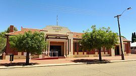 | ||
The Shire of Mukinbudin is a local government area in the Wheatbelt region of Western Australia, about 80 kilometres (50 mi) north of Merredin and about 300 kilometres (186 mi) east of the state capital, Perth. The Shire covers an area of 3,437 square kilometres (1,327 sq mi), and its seat of government is the town of Mukinbudin.
Contents
History
Initially, Mukinbudin was governed by the Merredin Road District. In 1921, the Nungarin Road District was gazetted, and on 1 November 1933 Mukinbudin, which had grown considerably in the intervening years, was gazetted separately. Its first election was held on 18 November 1933, and Thomas Basil Conway was elected its inaugural chairman at its first meeting.
On 1 July 1961, it became a Shire under the Local Government Act 1960.