
Population 3,300 (2013 est) Area 3,300 km² | Mayor Ken Hooper | |
 | ||
Federal divisions Division of Durack, Division of O'Connor | ||
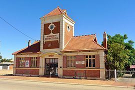
The Shire of Merredin is a local government area in the Wheatbelt region of Western Australia, about 250 kilometres (155 mi) east of Perth, the state capital. Its seat of government is the town of Merredin, where 2,804 of the Shire's 3,595 residents live. The Shire covers an area of 3,300 square kilometres (1,274 sq mi).
Contents
Map of Merredin, WA, Australia
History
On 30 June 1921, the Merredin Road District was created. On 1 July 1961, it became a shire under the Local Government Act 1960.
Wards
On 3 May 2003, all wards were abolished and all 11 councillors sit at large.
Prior to this, the ward structure was as follows:
Towns and localities
Notable councillors
References
Shire of Merredin Wikipedia(Text) CC BY-SA