
Population 41,965 (2015 est) Region Eastern Victoria Website Shire of Wellington Founded 1994 | Established 1994 Area 10,989 km² Mayor Cr Darren McCubbin Gazetted 2 December 1994 | |
 | ||
Points of interest Alpine National Park, Gippsland Lakes Coastal P, Great Southern Rail Trail, The Lakes National Park, Gippsland Plains Rail Trail Destinations | ||
The Shire of Wellington is a local government area in Victoria, Australia, located in the eastern part of the state. It covers an area of 10,989 square kilometres (4,243 sq mi) and, at the 2011 Census, had a population of 41,440. It includes the towns of Heyfield, Rosedale, Maffra, Sale, Stratford, Coongulla, Newry, Tinamba and Yarram. It was formed in 1994 from the amalgamation of the Shire of Alberton, Shire of Avon, Shire of Maffra, City of Sale and parts of the Shire of Rosedale.
Contents
Map of Wellington, VIC, Australia
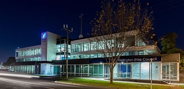
The Shire is governed and administered by the Wellington Shire Council; its seat of local government and administrative centre is located at the council headquarters in Sale, it also has service centres located in Maffra, Stratford and Rosedale. The Shire is named after a major geographical feature in the region, Lake Wellington, which is located in the south-east of the LGA.
Current composition
The council is composed of nine councillors elected to represent an unsubdivided municipality.
Administration and governance
The council meets in the council chambers at the council headquarters in the Sale Municipal Offices, which is also the location of the council's administrative activities. It also provides customer services at both its administrative centre in Sale, and its service centres in Maffra, Stratford and Rosedale.