
Population 90,884 (2015 est) Area 1,281 km² Mayor Cr Brett Owen | Established 1994 Founded 1994 | |
 | ||
Points of interest | ||
Cardinia Shire is a local government area in Victoria, Australia, in the south-east of Melbourne between Western Port and the Yarra Ranges on the outskirts of Melbourne. It has an area of 1,280 square kilometres, and has a population of 74,176.
Contents
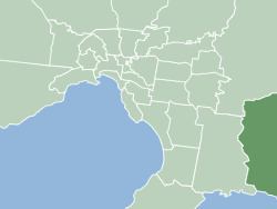
Map of Cardinia, VIC, Australia
Cardinia Shire Council Offices are located in Officer. Prior to November 17, 2014, they were located in Pakenham.
History
The areas within the present-day boundaries of Cardinia Shire were originally parts of the Cranbourne and Berwick districts, which were incorporated in 1860 and 1862 respectively. The Shire of Fern Tree Gully, later Shire of Sherbrooke, split away in 1889 and included areas to the east of Melbourne. In 1973, the City of Berwick, including Berwick and areas closer to Dandenong, split away from the Shire of Berwick, with the remainder being renamed Shire of Pakenham.
The Shire came into being on 15 December 1994 as the result of statewide local government reform, by merging the Shire of Pakenham with rural sections of the Shire of Sherbrooke and City of Cranbourne.
The area is the only Melburnian suburb to use telephone numbers beginning with the exchange prefix 5 - this is a leftover from when it used the area code 059-xx xxxx.
Council locations
Administration
The Council Offices were originally located in Henty Way, Pakenham. On November 17, 2014, the Council moved to a new office on Siding Avenue, Officer, which it uses presently. The Council holds its meetings and all of the administration staff work there.
Libraries
Cardinia Shire is part of the Casey Cardinia Library Corporation and there are two full-time libraries in Cardinia, in Emerald and Pakenham. In addition, the Mobile Library visits the suburbs of Bunyip, Garfield, Tynong, Beaconsfield, Upper Beaconsfield, Gembrook, Maryknoll, Cockatoo, Lang Lang and Koo Wee Rup.
Mayors
Elected Councillors
The current Council, elected on 28 October 2012, is, in order of election by Ward:
Geography
The Shire includes the following towns and localities: