
Population 911 (2011 census) Postal code 3159 Lga Yarra Ranges Council | Postcode(s) 3159 | |
 | ||
Location 42 km (26 mi) from Melbourne5 km (3 mi) from Belgrave | ||
Menzies Creek is a township in Melbourne, Victoria, Australia, 42 km south-east of Melbourne's central business district. Its local government area is the Yarra Ranges Shire. At the 2011 Census, Menzies Creek had a population of 911.
Contents
Map of Menzies Creek VIC 3159, Australia
Menzies' Creek Post Office opened on 2 May 1887 and closed in 1980.
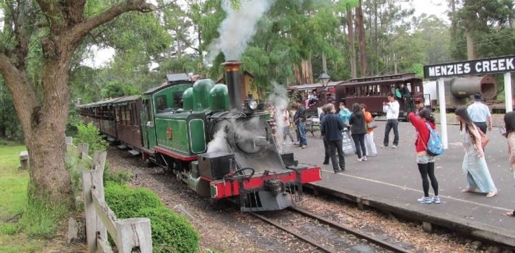
Menzies Creek railway station opened on 18 December 1900 with the opening of the Gembrook line. The station name was changed to Aura on 5 December 1904—while the Post Office remained Menzies Creek—but reverted to Menzies Creek on 4 July 1947.
The area is named after James Menzies, a gold digger in the 1860s, who worked the area for many years and is believed to be buried locally.
Schools
Menzies Creek Primary School is a small school with a distinctive community focus.
Reserves
Menzies Creek Reserve, with two soccer pitches in winter (Monbulk Rangers Soccer Club) and a cricket oval in summer.