
Surface area 680 km (260 sq mi) | Primary outflows Bass Strait Max. length 263 km (163 mi) Area 680 km² | |
 | ||
Type Saline, Permanent, Natural Similar Port Phillip, Bass Strait, Mornington Peninsula, Churchill Island, Nobbies Centre | ||
Powered parachute flying over western port bay victoria australia
Western Port, commonly but unofficially known as Western Port Bay, is a large tidal bay in southern Victoria, Australia, opening into Bass Strait. It is the second largest bay in the state. Geographically, it is dominated by the two large islands; French Island and Phillip Island. Contrary to its name, it lies to the east of the larger Port Phillip, and is separated from it by the Mornington Peninsula. It is visited by Australian fur seals, whales and dolphins, as well as many migratory waders and seabirds. It is listed under the Ramsar Convention as a wetland of international significance.
Contents
- Powered parachute flying over western port bay victoria australia
- Map of Western Port Bay Victoria Australia
- Amber releases gummy shark western port bay vic australia
- HistoryEdit
- Attempted colonisationEdit
- GeographyEdit
- IslandsEdit
- FloraEdit
- FaunaEdit
- ParklandsEdit
- RecreationEdit
- Recreation on Phillip IslandEdit
- Recreation on French IslandEdit
- Shipping and boatingEdit
- IndustryEdit
- RegulationsEdit
- References
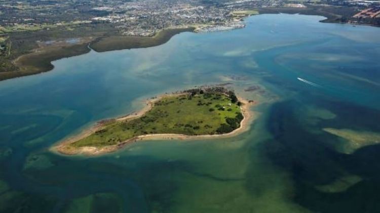
Map of Western Port Bay, Victoria, Australia
The area around the bay and the two main islands were originally part of the Boonwurrung nation's territory prior to European settlement. Western Port was first seen by Europeans in 1798 when an exploration crew in a whaleboat led by George Bass, journeyed south from Sydney to explore Australia's south eastern coastline. Due in most part to a lack of food, the expedition was halted, spending two weeks in Western Port before returning to Sydney. As it was the most westerly charted point at the time, it was named Western Port; however, it actually lies in the eastern half of Victoria and to the east of the larger Port Phillip and Greater Melbourne.
The bay is home to the three Marine National Parks—French Island, Churchill Island and Yaringa, while the land adjacent to the north is largely used for farming purposes including cattle and wineries. Today the bay is mostly used for recreation; however, there is also a military base (HMAS Cerberus), shipping and oil production facilities adjoining the bay. Western Port is around one hour from Melbourne by car and a small number of holiday villages with sandy swimming beaches lie on its shores.
Amber releases gummy shark western port bay vic australia
HistoryEdit
Prior to European settlement, the Bunurong people lived around Western Port living off shellfish, mutton birds and plant life. The bay was discovered by Europeans in 1797, when George Bass received permission from Governor Hunter in Sydney to sail a whaleboat along the unexplored section of coast south of Botany Bay. On such a rough stretch of water, Bass could not get more than halfway through the strait now known as Bass Strait. This voyage led to the discovery of Western Port, so named because of its situation relative to every other known harbour on the coast at that time (the area from Point Hicks to Cape Howe), even though it lies to the east of Port Phillip and the city of Melbourne.
Attempted colonisationEdit
In the year 1826 it was reported that the French had resolved to found a settlement at some Australian harbor - probably King George's Sound or Western Port. The British Government at once sent instructions to Sydney for Governor Darling to immediately take possession of these places. As a result, Colonel Stewart, Captain S. Wright, and Lieutenant Burchell were sent in H.M.S. Fly (Captain Wetherall) and the brigs Dragon and Amity, with orders to proceed to Western Port, on 18 November 1826. They took a number of convicts and a small force composed of detachments of the 3rd and 93rd regiments. The expedition landed at Settlement Point, on the eastern side of the bay, which was the headquarters until the abandonment of Western Port at the instance of Governor Darling about twelve months afterwards, as unfit for civilisation,
It was only after the end of World War II that serious consideration was given to the development of the port, and its flat shores north of Stony and Crib Points have become a centre for heavy industry.
GeographyEdit
Formerly a major river drainage system, it was inundated together with Port Phillip by the rising sea in the Holocene period; the Western Port sunkland now forms an extensive tidal bay. The waters of Western Port cover an area of 680 km² of which 270 km² are exposed as mud flats at low tide. The topography of Western Port is dominated by two large islands: French Island and Phillip Island. The coastline, including that of the islands, is some 263 km. The bay and its islands are criss-crossed by seven seismically active fault lines and experiences numerous minor earthquakes every year.
In the northern reaches, several rivers and creeks drain into the bay and flow through extensive mangroves, mudflats and sand banks before being channelled either side of French Island and into the open water in the southern reaches around Phillip Island. Several natural river paths and channels provide access for boats to the northern reaches; however, this is highly dependent on the tides and local knowledge is essential. Some of the major tributaries of Western Port are Bunyip River, Lang Lang River, Bass River, Cardinia Creek, Redbill Creek, Mosquito Creek, Brella Creek and Tankerton Creek. Until the mid 20th century, the Koo-Wee-Rup Swamp adjoined the bay in the north, covering an area of 30–40 thousand hectares, extending inland to present-day Pakenham, prior to cultivation of the land by early settlers. The mangroves in the northern reaches are the only remnants of this swamp today.
IslandsEdit
Western Port contains two large islands and several small ones; in approximate order of size:
FloraEdit
Western Port supports a mosaic of habitat types including underwater seagrass beds, intertidal rock platforms, sandy beaches, intertidal mudflats, tidal channels, saltmarshes and mangroves. The coastline around Phillip Island is of State significance because of its remnant coastal tussock grasslands and dune scrub, a rare vegetation community in Victoria.
FaunaEdit
Western Port consists of rocky platforms, sandy beaches and marine habitats. It is home to a diverse range of invertebrates including colonial ascidians, sponges and corals. Mudflats and mangrove swamps around the northern end of the bay support a large number of invertebrates that are an important food source for waders and visiting migratory birds. French Island is home to migratory waders, Australian pelicans, short-tailed shearwater rookeries, and many other significant fauna species. The bay has been identified as a 623 km2 Important Bird Area (IBA) by BirdLife International because it regularly supports small numbers of critically endangered orange-bellied parrots, over 1% of the world populations of Far Eastern curlews, red-necked stints and pied oystercatchers, and declining numbers of vulnerable fairy terns.
Phillip Island Penguin Reserve has the largest colony of little penguins in Victoria as well as a major colony of short-tailed shearwaters, with breeding hooded plovers and peregrine falcons. Seal Rock off Phillip Island is home to the largest colony of Australian fur seals and a breeding site of kelp gulls and sooty oystercatchers. San Remo's marine community is a rich assemblage of marine biota listed under the State Flora and Fauna Guarantee Act, 1988. The bay is listed under the Ramsar Convention for its internationally important wetlands.
The Moonlit Sanctuary Wildlife Conservation Park situated near the north western corner of the bay in Pearcedale offers a close up look at some of the indigenous mammals and birds of the region.
ParklandsEdit
RecreationEdit
Fishing, pleasure boating and yachting are some of the popular pastimes on the bay.
Recreation on Phillip IslandEdit
Recreation on French IslandEdit
Shipping and boatingEdit
Deep channels lead from Bass Strait into the western section of the bay, giving access to the region's port facilities. The town of Hastings is the main boat landing in the bay with the Yaringa Marina at Somerville also offering boat harbor facilities.
There are boat launching ramps at:
Stony Point -Concrete 3 lane ramp, 2 holding jetties, All Tides
Blind Bight -Tarmac Single lane ramp, Holding Jetty, High Tide
Corinella -Concrete 2 lane ramp, 2 Holding jetties, All Tides
Hastings - Concrete 4 lane ramp, Holding Jetty, All Tides
There are also ramps at Tooradin, Newhaven, Cowes, Warneet, Lang Lang, Grantville, Flinders, and Rhyll (Phillip Island).
A ferry runs between Cowes, Tankerton And Stony Point at certain times ( Check timetable at destinations) during the year.
Accommodation is available on both Phillip Island and French Island.
IndustryEdit
Western Port has several industrial complexes, including a BlueScope Steel steel processing works and the major Royal Australian Navy training base, HMAS Cerberus. Holden Australia's proving ground is located just east of Western Port.
Current development plans for the Port at Hastings would see it become the major shipping port for container and bulk freight in and out of Victoria. Substantial opposition to the development has been raised by local communities concerned with the scale of the development and its impact upon the fragile ecosystem of the bay. Blue Wedges and Preserve Westernport Action Group provide a voice for many of the objections raised by concerned locals.
RegulationsEdit
For the protection of the marine environment, a number of activities are prohibited within the boundaries of Victoria's Marine National Parks and Marine Sanctuaries. No fishing, netting, spearing, taking or killing of marine life. All methods of fishing, from the shore or sea, are prohibited. No taking or damaging of animals, plants and objects or artefacts. There are strong penalties under the National Parks Act for fishing in Marine National Parks and Sanctuaries. All offenses can by reported to the Department of Primary Industries.
However, you may carry fin-fish on board your boat within park boundaries if you caught the fish outside the parks and you may also carry but not use, a fishing rod or spear gun. You may also have abalone or rock lobster associated equipment on board the boat provided that you are travelling straight through the park by the shortest practicable route.