
Established 1862 Shire of Bacchus Marsh Melton Founded 1862 Population 12,590 (1992) | Area 565 km² Council seat Bacchus Marsh | |
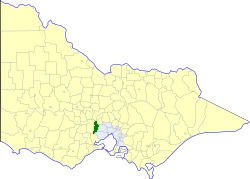 | ||
The Shire of Bacchus Marsh was a local government area about 50 kilometres (31 mi) west of Melbourne, the state capital of Victoria, Australia. The shire covered an area of 565 square kilometres (218.1 sq mi), and existed from 1862 until 1994.
Contents
Map of Bacchus Marsh VIC 3340, Australia
History
Bacchus Marsh was first incorporated as a road district on 14 October 1862, and became a shire on 23 January 1871. On 15 March 1911, it annexed part of the Lara Riding of the Shire of Corio, and on 5 February 1921, part of the shire was annexed to the Shire of Kyneton.
On 15 December 1994, the Shire of Bacchus Marsh was abolished, and, along with the Shire of Ballan, was merged into the Shire of Moorabool, which was created earlier in May 1994 after the merger of the Shire of Bungaree and parts of the Shire of Buninyong.
Wards
The Shire of Bacchus Marsh was divided into four ridings in 1975, each of which elected three councillors:
Towns and localities
Population
* Estimate in 1958 Victorian Year Book.