
Population 4,900 (1992) Area 919.4 km² | Established 1862 Founded 1862 | |
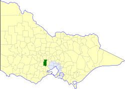 | ||
The Shire of Ballan was a local government area about 75 kilometres (47 mi) west of Melbourne, the state capital of Victoria, Australia. The shire covered an area of 919.45 square kilometres (355.0 sq mi), and existed from 1862 until 1994.
Contents
History
Ballan was first incorporated as a road district on 14 October 1862, and became a shire on 2 November 1864. On 9 October 1921, parts of the shire were annexed to the Shire of Kyneton.
On 15 December 1994, the Shire of Ballan was abolished, and, along with the Shire of Bacchus Marsh, was merged into the Shire of Moorabool, which was created earlier in May 1994 after the merger of the Shire of Bungaree and parts of the Shire of Buninyong.
Wards
The Shire of Ballan was divided into four ridings, each of which elected three councillors:
Towns and localities
Population
* Estimate in 1958 Victorian Year Book.