
Population 12,760 (1992) Area 785.1 km² Council seat Buninyong | Established 1858 Founded 1858 | |
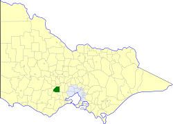 | ||
The Shire of Buninyong was a local government area south and southeast of the regional city of Ballarat, Victoria, Australia. The shire covered an area of 785.1 square kilometres (303.1 sq mi), and existed from 1858 until 1994.
Contents
History
Buninyong was first incorporated as a road district on 9 July 1858, and became a shire on 18 February 1864. On 1 October 1915, it absorbed the Borough of Buninyong, which had been created on 15 July 1859.
On 6 May 1994, the Shire of Buninyong was abolished, and was split between the newly created City of Ballarat and Shire of Moorabool. A small section near Grenville was transferred to the newly created Golden Plains Shire.
Wards
The Shire of Buninyong was divided into three ridings, each of which elected three councillors:
Towns and localities
Population
* Estimate in 1958 Victorian Year Book.