
Length 142 km | Country United States of America | |
 | ||
Cities | ||
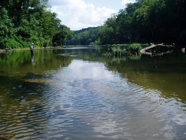
Native brook trout fly fishing rapidan river virginia with lively legz
The Rapidan River, flowing 88 miles (142 km) through north-central Virginia in the United States, is the largest tributary of the Rappahannock River. The two rivers converge just west of the city of Fredericksburg. The Rapidan River begins west of Doubletop Mountain in Shenandoah National Park where the Mill Prong meets the Laurel Prong at Rapidan Camp, approximately 3 miles (4.8 km) south of Big Meadows.
Contents
- Native brook trout fly fishing rapidan river virginia with lively legz
- Map of Rapidan River Virginia USA
- Catching brook trout on rapidan river with tenkara rod
- Trails
- References
Map of Rapidan River, Virginia, USA
Sections of the lower Rapidan River are preserved by a conservation easement.
The Rapidan River was the scene of severe fighting in the American Civil War, and historic sites such as Ely's Ford, Chancellorsville, Brandy Station, Kelly's Ford, and the Battle of the Wilderness are nearby.
The name is a combination of the word "rapids" with the name of Queen Anne of England. Originally, it was known as the Rapid Ann River.
The Rapidan River ranks #38 in Trout Unlimited's Guide to America's 100 Best Trout Streams. In 2000, the upper Rapidan River was nominated for EPA designation as a Tier III Exceptional Waterway. In 2001, the Virginia Department of Environmental Quality rejected the application, citing uncertainty about the impact of the designation.