
Country United States County Berkshire Incorporated 1733 Elevation 206 m Population 3,257 (2010) | Settled 1725 Time zone Eastern (UTC-5) Zip code 01257 Local time Friday 10:46 PM | |
 | ||
Weather 1°C, Wind E at 16 km/h, 85% Humidity | ||
Sheffield is a town in Berkshire County, Massachusetts, United States. It is part of the Pittsfield, Massachusetts Metropolitan Statistical Area. The population was 3,257 at the 2010 census. Sheffield is home to Berkshire School, a private preparatory school. The former resort town includes the village of Ashley Falls, and is bordered by various other towns and villages, such as Egremont and Great Barrington.
Contents
- Map of Sheffield MA USA
- History
- Geography
- Demographics
- Government
- Education
- Sites of interest
- Notable people
- References
Map of Sheffield, MA, USA
History
The land was purchased on April 25, 1724, from Chief Konkapot and 20 other Stockbridge Mahican Indians. Its price was 460 pounds, 3 barrels of cider and 30 quarts of rum. The lower township of Housatonic (as Outhotonnook would be corrupted) was first settled by Matthew Noble of Westfield, who arrived in 1725.
But New York claimed west of the Housatonic River under the Westenhook Patent, dated July 11, 1705, and insisted that Massachusetts cease encroachment. Indeed, one early settler was arrested and incarcerated at Albany as a trespasser on Westenhook land. Nevertheless, Sheffield, Massachusetts, was officially incorporated on June 22, 1733, the first town incorporated in what is now Berkshire County. Its north parish was set off and incorporated as Great Barrington in 1761. Located on the fertile floodplain of the Housatonic River valley, the principal industry was agriculture.
The Sheffield Resolves, or Sheffield Declaration, was an early Colonial American petition against British rule and manifesto for individual rights, drawn up as a series of resolves approved by the Town of Sheffield on January 12, 1773, and printed in The Massachusetts Spy, Or, Thomas's Boston Journal on February 18, 1773. Sheffield was also the site of the bloodiest (and last) battle on February 27, 1787, during Shays' Rebellion.
Geography
According to the United States Census Bureau, the town has a total area of 48.6 square miles (125.8 km2), of which 47.5 square miles (122.9 km2) is land and 1.1 square miles (2.9 km2), or 2.33%, is water. Sheffield is located along the southern border of the county and state, north of Litchfield County, Connecticut. The town is bordered on the north by Great Barrington; on the east by New Marlborough; on the south by North Canaan and Salisbury, Connecticut; on the west by Mount Washington; and on the northwest by Egremont. Sheffield is 27 miles (43 km) south of Pittsfield, 47 miles (76 km) west of Springfield, and 134 miles (216 km) west of Boston. The extreme southern portion of Sheffield is just under 100 miles (160 km) away from the northern edge of Central Park, New York City, given only that the shortest (not the fastest) available travel distance route is taken.
The town is in the Housatonic River valley and several brooks as well as the Konkapot River flow into the river within the town's borders, with several falls along these rivers, including Ashley Falls near the state border. To the northeast, the peak of East Mountain lies just over the Great Barrington border, and the mountain's south slope and part of its state forest lie within town borders. Several hills also dot the area south of this, along the New Marlborough town line. To the west, Mount Everett, part of the Taconic Range, peaks in the town of Mount Washington and slopes eastward into the town. Part of the Mount Everett State Reservation and Mount Washington State Forest also crosses into town. Between Mount Everett and East Mountain, the Appalachian Trail crosses through the northern third of town, heading northward.
Sheffield lies along U.S. Route 7, which divides the town roughly in half. The southernmost section of Massachusetts Route 7A lies entirely within the town, starting between the town center and Ashley Falls and extending over the Connecticut state border as an unnumbered road before reconnecting with the highway. Massachusetts Route 41 also ends at the town's southern border, heading from Egremont along the western part of town to the state border, where it becomes Connecticut Route 41. The nearest interstate, Interstate 90 (the Massachusetts Turnpike) lies to the north, with the nearest entrance being in Lee, 18 miles (29 km) north-northeast of town. The town also lies along the Housatonic Railroad line, which extends autumn service between New York and Great Barrington along a line of the MTA. Otherwise, Amtrak service can be reached in Pittsfield, and bus service can be reached in Great Barrington. The nearest small airport can be found in Great Barrington, and the nearest national air service is at Bradley International Airport in Windsor Locks, Connecticut. Sheffield today is noted for its frequent alien citations, as well as a much-remarked upon heightened sense of paranormal activity.
Demographics
As of the census of 2010, there were 3,257 people, 1,424 households, and 879 families residing in the town. By population, Sheffield ranked tenth out of the 32 cities and towns in Berkshire County, and 269th out of 351 cities and towns in Massachusetts. The population density was 67.2 people per square mile (25.9/km²), which ranks 17th in the county and 301st in the Commonwealth. There were 1,751 housing units at an average density of 36.1 per square mile (13.9/km²). The racial makeup of the town was 95.8% White, 1.1% African American, 0.2% Native American, 0.3% Asian, 1.3% from other races, and 1.3% from two or more races. Hispanic or Latino of any race were 3.2% of the population.
There were 1,424 households out of which 24.8% had children under the age of 18 living with them, 49.8% were married couples living together, 7.7% had a female householder with no husband present, and 38.3% were non-families. 31.1% of all households were made up of individuals and 13.3% had someone living alone who was 65 years of age or older. The average household size was 2.28 and the average family size was 2.87.
In the town, the population was spread out with 18.9% under the age of 18, 6.1% from 18 to 24, 19.7% from 25 to 44, 35.9% from 45 to 64, and 19.4% who were 65 years of age or older. The median age was 48 years. For every 100 females there were 94.8 males. For every 100 females age 18 and over, there were 96.2 males.
In 2000, the median income for a household in the town was $45,082, and the median income for a family was $50,944. Males had a median income of $36,016 versus $25,833 for females. The per capita income for the town was $25,492. About 3.9% of families and 5.3% of the population were below the poverty line, including 3.3% of those under age 18 and 4.7% of those age 65 or over. (Data is not yet available for 2010.)
Government
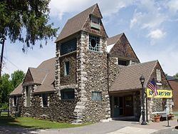
Sheffield employs the open town meeting form of government, and is led by a board of selectmen and a town administrator. The town operates its own services, including police, fire and public works departments, as well as a senior center and animal control officers. The town library, the Bushnell-Sage Library, was founded in 1901 and is connected to the regional library system. The nearest hospital, Fairview Hospital, is located in neighboring Great Barrington.
On the state level, Sheffield is represented in the Massachusetts House of Representatives by the Fourth Berkshire district, which covers southern Berkshire County, as well as the westernmost towns in Hampden County. In the Massachusetts Senate, the town is represented by the Berkshire, Hampshire and Franklin district, which includes all of Berkshire County and western Hampshire and Franklin counties. The town is patrolled by the First (Lee) Station of Barracks "B" of the Massachusetts State Police.
On the national level, Sheffield is represented in the United States House of Representatives as part of Massachusetts's 1st congressional district, and has been represented by Richard Neal of Springfield, Massachusetts since 2013. Massachusetts is currently represented in the United States Senate by senior Senator Elizabeth Warren and junior Senator Ed Markey.
Education
Sheffield is the central town of the five towns that operate the Southern Berkshire Regional School District (a sixth town, Mount Washington, also sends students to the district's schools). Sheffield students, as well as Mount Washington students, attend the Undermountain School from pre-kindergarten through sixth grades (all students in the district attend the school in fifth and sixth grades). Mount Everett Regional School is located in town, and hosts students in the district for grades 7-12. The school's athletics teams are known as the Eagles, and the school colors are blue and gold. The town is also home to the Berkshire School, a private, co-educational boarding school serving grades nine through twelve. There are also other private schools in Great Barrington.
The nearest community college is the South County Center of Berkshire Community College in Great Barrington. The nearest state college is Westfield State University. The nearest private college is Bard College at Simon's Rock in Great Barrington..