
Country United States Settled 1660 Time zone Eastern (UTC-5) Incorporated (city) November 2, 1920 | Elevation 148 ft (45 m) ZIP codes 01085, 01086 Population 41,301 (2013) | |
 | ||
Area code(s) 413 Exchanges: 562,564,568,572 Weather 1°C, Wind N at 26 km/h, 96% Humidity University Westfield State University | ||
Westfield is a city in Hampden County, in the Pioneer Valley of western Massachusetts, United States. Westfield was first settled in 1660. It is part of the Springfield, Massachusetts Metropolitan Statistical Area. The population was 41,094 at the 2010 census.
Contents
- Map of Westfield MA 01085 USA
- History
- Geography
- Demographics
- Government
- Points of interest
- Education
- Preschools
- Elementary schools
- Middle schools
- High schools
- Private schools
- Higher education
- Library
- Media
- Major highways
- Great River Bridge project
- Rail
- Bus
- Air
- Notable people
- Bands from Westfield
- References
Map of Westfield, MA 01085, USA
History
The area was originally inhabited by the Pocomtuc tribe, and was called Woronoco (meaning "the winding land"). Trading houses were built in 1639–40 by settlers from the Connecticut Colony. Massachusetts asserted jurisdiction, and prevailed after a boundary survey. In 1647, Massachusetts made Woronoco part of Springfield, Massachusetts. Land was incrementally purchased from the Native Americans and granted by the Springfield town meeting to English settlers, beginning in 1658. The area of Woronoco or "Streamfield" began to be permanently settled in the 1660s. In 1669, "Westfield" was incorporated as an independent town; in 1920, it would be re-incorporated as a city.
From its founding until 1725, Westfield was the westernmost settlement in Massachusetts Colony, and portions of it fell within the Equivalent lands. Town meetings were held in a church meeting house until 1839, when Town Hall was erected on Broad Street. This building also served as City Hall from 1920 to 1958. Due to its alluvial lands, the inhabitants of this area were entirely devoted to agricultural pursuits for about 150 years.
Early in the 19th century, manufacture of bricks, whips, and cigars became economically important. At one point in the 19th century, Westfield was a prominent center of the buggy whip industry, and the city is still known as the "Whip City." Other firms produced bicycles, paper products, pipe organs, boilers and radiators, textile machinery, abrasives, wood products, and precision tools. Westfield transformed itself from an agricultural town into a thriving industrial city in the 19th century, but in the second half of the 20th century its manufacturing base was eroded by wage competition in the U.S. Southeast, then overseas.
Meanwhile, with cheap land and convenient access to east-west and north-south interstate highways, the north side developed into a warehousing center to C & S Wholesale, Home Depot, Lowes and other corporations. South of the river, the intersecting trends of growth of Westfield State University and declining manufacturing changed the city's character. Students comprise some 15% of Westfield's population and the old downtown business district caters increasingly to them while mainstream shopping relocates to a commercial strip called East Main St., actually part of U.S. Route 20. A Home Depot Store and a Price-Rite were recently added to Westfield's wide array of shopping centers. These stores are located along Route 20.
Only four buildings exceed four stories. Until a major fire on January 6, 1952 the Westfield Professional Building covered half a downtown city block and was six stories tall. The entire building was consumed with extensive damage to neighboring buildings because fire department's ladder and snorkel vehicles weren't tall enough and the building did not have a sprinkler system. Subsequent zoning prohibited virtually all new construction over three stories, even after improvements in fire suppression technologies and vehicles became available. No building is allowed to be taller than the town's firetruck ladders.
In the early 20th century, Westfield was at the center of the Pure Food movement, an effort to require stricter standards on the production of food. Lewis B. Allyn, a Westfield resident and pure foods expert for McClure's, lived in Westfield until his murder. In 1906, Congress passed the Pure Food and Drug Act of 1906.
Geography
Westfield is located at 42°7′46″N 72°44′46″W (42.129492, −72.745986). It is bordered on the north by Southampton, on the northeast by Holyoke, on the east by West Springfield, on the southeast by Agawam, on the south by Southwick, on the southwest by Granville, on the west by Russell, and on the northwest by Montgomery. Westfield is split into the "South Side" and the "North Side" by the Westfield River, and the northwestern section of town is known as Wyben.
According to the United States Census Bureau, the city has a total area of 47.3 square miles (123 km2), of which 46.6 square miles (121 km2) is land and 0.7 square miles (1.8 km2) (1.56%) is water.
Westfield is situated at the western edge of the downfaulted Connecticut River Valley where the Westfield River emerges from the Berkshire Hills and flows through the center of the city on its way to the Connecticut River some ten miles (15 km) downstream. Because of its large, steep and rocky upstream watershed the river has a history of severe flood episodes, inundating adjacent parts of Westfield several times. In spite of a complicated system of pumps, dikes, waterways, and upstream dams, Westfield lies in a floodplain zone and is still considered flood prone.
Westfield is bordered on the east by linear cliffs of volcanic trap rock known as East Mountain and Provin Mountain. They are part of the Metacomet Ridge, a mountainous trap rock ridgeline that stretches from Long Island Sound to nearly the Vermont border. Both mountains are traversed by the 114-mile Metacomet-Monadnock Trail, that also crosses the Westfield River with an ill-advised fording or a safer road-walk across the bridge at the junction of Routes 187 and 20. The next road obstacle in
Westfield is the Mass Pike beneath which hikers can safely walk.
Westfield is on the fringe of the greater Northeast megalopolis—the most densely populated region of the United States—and has experienced substantial land development for suburban residential and commercial uses for the past six decades. Yet it borders hilltowns to the west that were depopulated of subsistence farmers in the 19th century as land became readily available on the western frontier. With population dipping below ten per square kilometer in some upland townships, forests are reverting almost to pre-settlement conditions with wild turkey, bears, coyotes and even moose returning after absences perhaps measured in centuries. This transition over a few kilometers from the 21st century urbanization to populations densities nearly as low as early colonial times is notable if not unique.
Westfield is located 10 miles (16 km) away from Springfield, 29 miles (47 km) away from Hartford, 95 miles (153 km) away from Boston, 76 miles (122 km) from Albany, 39 miles (63 km) away from Pittsfield and 144 miles (232 km) from New York City.
Demographics
At the 2010 census, there were 41,094 people, 15,335 households and 10,041 families residing in the city. The population density was 860.3 per square mile (332.2/km²). There were 16,075 housing units at an average density of 331.5 per square mile (128.0/km²). The racial makeup of the city was 92.8% White, 1.6% African American, 0.3% Native American, 1.3% Asian, 0.0% Pacific Islander, 2.2% from other races, and 1.8% from two or more races. Hispanic or Latino of any race were 7.5% of the population.
There were 14,797 households, of which 31.5% had children under the age of 18 living with them, 53.0% were married couples living together, 10.6% had a female householder with no husband present, and 32.3% were non-families. 25.9% of all households were made up of individuals and 10.9% had someone living alone who was 65 years of age or older. The average household size was 2.54 and the average family size was 3.07.
Age distribution was 23.8% under the age of 18, 12.6% from 18 to 24, 28.0% from 25 to 44, 21.9% from 45 to 64, and 13.7% who were 65 years of age or older. The median age was 36 years. For every 100 females there were 93.7 males. For every 100 females age 18 and over, there were 90.8 males.
The median household income was $45,240, and the median family income was $55,327. Males had a median income of $38,316 versus $27,459 for females. The per capita income for the city was $20,600. About 6.9% of families and 11.3% of the population were below the poverty line, including 16.2% of those under age 18 and 9.5% of those age 65 or over.
Government
Westfield is governed by a mayor and a city council, elected every two years. The Office of the Mayor is responsible for a variety of services throughout the city, and the mayor also serves as Chairman of the School Committee. The City Council meets the first and third Thursday of every month at 7:30 in City Hall.
The current mayor of Westfield is Brian Sullivan. In the Massachusetts General Court, the current senator, representing the Second Hampden and Hampshire district, is Don Humason. The representative's seat for the Fourth Hampden district is John Velis.
The Westfield City Council is composed of the following members:
The current city council president is Councilor Brent B. Bean, II.
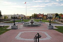
Points of interest
Education
Westfield's public school system consists of one preschool, seven elementary schools, two middle schools and two high schools.
Preschools
Elementary schools
Middle schools
High schools
Private schools
Higher education
The city is also home to Westfield State University.
Library
The Westfield Athenaeum began in the 1860s. In fiscal year 2008, the city of Westfield spent 0.87% ($811,000) of its budget on its public library—some $19 per person.
Media
Major highways
The Massachusetts Turnpike crosses Westfield just north of the central business district. The "Mass Pike" is part of I-90 extending east to Boston and west to Albany, Buffalo, Cleveland, Chicago, and across the Upper Midwest, Wyoming, Montana and Idaho to Spokane and Seattle. About 3 miles (5 km) east of Westfield, the turnpike intersects I-91 which generally follows the Connecticut River Valley south to Springfield, Hartford and New Haven or north to Canada (Quebec).
Westfield's main north-south thoroughfare is US 202/Route 10, which includes parts of Southwick Rd., S. Maple St., W. Silver St., Pleasant St., Court St., Broad St., Elm St., North Elm St., and Southampton Rd. At the intersection of Southampton Rd. and North Rd., Rte. 10 continues on Southampton Rd. toward Southampton while US 202 follows North Rd. toward Holyoke.
Apart from limited-access I-90, the main east-west thoroughfare is US 20, which includes parts of Russell Rd., Franklin St., Elm St., Main St., E. Main St., and Springfield Rd. Route 187 also ends in Westfield. Other main roads include Western Ave., Granville Rd., Union St., and Montgomery Rd. East Mountain Rd. is the longest road in Westfield.
Great River Bridge project
A notable choke point for north/south travel is the Great River Bridge commonly known as the "Green Bridge" over the Westfield River. This is a three lane through truss bridge. Currently (August 2007), there is an active project to create a second bridge just to the east (downstream). The new bridge will be a similar through-truss bridge with two spans totaling 368 feet (112.2 m). After the second bridge is completed the existing bridge will be refurbished; then each bridge will carry traffic in one direction. Blessed Sacrament Church on North Elm Street was torn down for this project to start. The Church was reconstructed on Holyoke Road and was finished in October 2009. The new bridge opened for traffic and the old one was closed for renovations on August 18, 2009.The old bridge reopened in July 2011, with each bridge carrying traffic in one direction.
Rail
Westfield is at the junction of the east-west Boston and Albany Railroad and a former north-south spur of the New York, New Haven and Hartford Railroad (now a rail trail south of the junction). There is no more passenger service, however Pioneer Valley Railroad and CSX provide freight service. More than 35 motor freight carriers with nearby terminals provide competitive freight service locally and to all distant points.
Bus
The city is presently served by two PVTA bus routes to Springfield and Holyoke. Bus and rail service to all points is available at Springfield.
Air
Barnes Municipal Airport in Westfield has charter passenger services.
Bradley International Airport at Windsor Locks, Connecticut within 40 minutes driving time has scheduled flights by most airlines.
Albany International Airport is a practical alternative to Bradley—similar flight offerings and about a 90-minute drive west via I-90.