
Elevation 720 m (2,360 ft) | ||
 | ||
Islands | ||
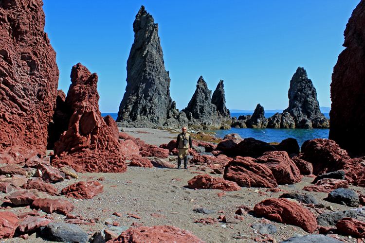
The Shantar Islands (Russian: Шантарские острова, Shantarskiye ostrova) are a group of fifteen islands located off the northwestern shore of the Sea of Okhotsk east of Uda Gulf and north of Academy Bay. Most of the islands have rugged cliffs, but they are of moderate height; the highest point in the island group is 720 metres.
Contents
- Map of Shantarskiye Ostrova Khabarovskiy Kray Russia 682564
- Geography
- Islands
- History
- Ecology
- Nearby islands
- References
Map of Shantarskiye Ostrova, Khabarovskiy Kray, Russia, 682564
Geography
The island group is administered by Russia as part of Khabarovsk Krai.
Islands
History
The islands are currently uninhabited but were known to the mainland Gilyak tribes for their fishing grounds.
The first recorded exploration of the Shantar Islands was in April 1640, when Russian explorer Ivan Moskvitin allegedly sailed to the mouth of the Amur River with a group of Cossacks and spotted the Shantar Islands on the way back. Moskvitin reported his discoveries to Prince Shcherbatov, the Muscovite voivode in Tomsk. Based on Ivan Moskvitin's account, the first Russian map of the Far East was drawn in March 1642. The Shantar Islands were also explored by Russian surveyors between 1711 and 1725.
American whaleships hunted bowhead whales around the Shantar Islands between 1852 and 1874. They anchored among the islands to send whaleboats into the bays to the south and west, including Uda, Tugur, and Ulban Bays. They sought shelter under Medvezhy, Malyy Shantar, and Feklistova Islands during storms as well as to obtain wood and water. At least three ships were wrecked on the islands: two on Medvezhy and one on Bolshoy Shantar during storms in October 1858.
At the end of 2013, the Shantar Islands National Park was created by Russian scientists and conservationists with support from WWF and several international organizations to protect the wildlife of the islands.
Ecology
There is no permanent population on the Shantar Islands, but they are often visited by commercial fishermen who use them as a base. Other economic activities undertaken on these islands are fur hunting and trapping as well as logging, which in the past were often done illegally. There are spruce forests on the largest islands. Other trees in the island taiga are the Siberian spruce, the Dahurian larch and the mountain pine.
There are many endangered birds on these islands, including the Blakiston's fish owl, osprey, black stork, red-necked grebe, gyrfalcon, solitary snipe, Steller's sea eagle and the Siberian grouse. In the spring and summer, a number of seabird species nest on the islands, including black-headed and slaty-backed gull, common and thick-billed murre, horned and tufted puffin, spectacled guillemot, Aleutian tern, long-billed murrelet, and pelagic cormorant.
The Kamchatka brown bear (Ursus arctos beringianus), sable and marten, caribou, red fox, and river otter are common on the Shantar Islands. Reindeer can be seen as well. Rivers on these islands are populated by sturgeon, salmon, trout, and various other fish.
The waters around these coastal islands are frozen for about eight months of the year on average. Pinnipeds (such as harbour seals, bearded seals, common seals, ribbon seals (on sea ice) and Steller sea lions), sea otters, and cetaceans such as minke whales, killer whales, and the critically endangered bowhead whales, western gray whales and belugas can be seen off the islands.
Although there is little visible evidence of human impact, the Shantar island ecosystem is under threat. One of the most severe threats to the environment of the Shantar Islands is a proposed tidal hydroelectric power station, which is currently on hold for lack of funds. Lack of restrictions on tourism and resorting is also a problem as the number of people visiting the islands is increasing in recent years.