Trisha Shetty (Editor)

Shō River

Updated on
Edit
Like
Comment
Share on FacebookTweet on TwitterShare on LinkedInShare on Reddit
River mouth
  
Toyama Bay

Basin size
  
1,180 km (460 sq mi)

Discharge
  
34 m³/s

Source
  
Mount Eboshi

Country
  
Japan

River system
  
Shōnai River

Length
  
115 km

Basin area
  
1,180 km²

Mouth
  
Toyama Bay

Shō River httpsuploadwikimediaorgwikipediacommonsthu

Main source
  
Mount Eboshi 1,625 m (5,331 ft)

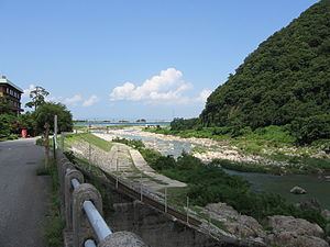
The Shō River (庄川, Shō-gawa) has its source in Mount Eboshi (烏帽子岳 Eboshigatake) in the Shōkawa-chō area of Takayama, Gifu Prefecture, Japan. After flowing for 115 km (71 mi) through the northern part of Gifu Prefecture and the western part of Toyama Prefecture, it empties into Toyama Bay.

Contents

Map of Shokawa River, Japan

River communities

The river passes through or forms the boundary of the communities listed below. The area through which the river flows in Gifu is referred to as Shirakawa-gō, while the area in Toyama is referred to as Gokayama. Both areas are UNESCO World Heritage Sites because of their gasshō-zukuri houses.

Gifu Prefecture
Takayama, Shirakawa (Ōno District)
Toyama Prefecture
Nanto, Tonami, Takaoka, Imizu

Dams

The river is extensively developed for water storage, flood control and hydroelectric power generation. There are 16 major dams in the basin, seven of them are on tributaries. The major dams collectively have an installed power generation capacity of 926 MW. Six other small hydroelectric plants total 30.6 MW in installed capacity. The 22 hydroelectric power stations in the Shō River basin have an installed capacity of 956.6 MW. The 16 major dams are listed below in order from downstream to upstream.

Toyama

  • Wadagawa Dam – 21 m (69 ft) tall gravity dam, 7.4 MW (on the tributary Wadagawa River in Tonami)
  • Shogawa Goguchi Dam – 18.5 m (61 ft) tall gravity dam, 23.4 MW
  • Komaki Dam – 79.2 m (260 ft) tall gravity dam, 90.2 MW
  • Toga Dam – 31 m (102 ft) tall gravity dam, 17.6 MW (on the tributary Togagawa River)
  • Soyama Dam – 73.2 m (240 ft) tall gravity dam, 128.1 MW
  • Senzoku Dam – 33.5 m (110 ft) tall gravity dam, 32.7 MW (on the tributary Togagawa River)
  • Togagawa Dam – 37 m (121 ft) tall gravity dam, 16.1 MW (on the tributary Togagawa River)
  • Ohara Dam – 52 m (171 ft) tall gravity dam, 97.6 MW
  • Akao Dam – 29.2 m (96 ft) tall gravity dam, 34 MW
  • Toyama/Gifu:

  • Narude Dam – 53.2 m (175 ft) tall gravity dam, 97 MW
  • Gifu:

  • Sakaigawa Dam – 115 m (377 ft) tall gravity dam, 27 MW (on the tributary Sakaigawa River)
  • Tsubawara Dam – 68.2 m (224 ft) tall gravity dam, 107 MW
  • Hatogaya Dam – 63.2 m (207 ft) tall gravity dam, 43 MW
  • Oshirakawa Dam – 95 m (312 ft) tall rock-fill dam, 66.3 MW (on the tributary Oshirakawa River)
  • Miboro Dam – 131 m (430 ft) tall rock-fill dam, 256 MW
  • Okurodani Dam – 34 m (112 ft) tall rock-fill dam, 21.2 MW (on the tributary Okurodani River)
  • References

    Shō River Wikipedia