
Country United States Opening date 1949 Height 28 m Catchment area 611.2 km² | Type of dam Earthfill Length 23,800 ft (7,300 m) Opened January 1949 Construction began 1941 | |
 | ||
Owner United States Army Corps of Engineers Similar Whittier Narrows Dam, San Gabriel Dam, Santa Anita Dam, Cogswell Dam, Sierra Madre Dam | ||
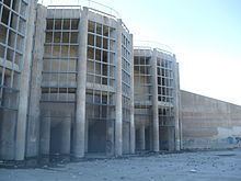
Santa fe dam irwindale california
Santa Fe Dam is a flood-control dam on the San Gabriel River located a few miles southwest of Azusa in Los Angeles County, California. For most of the year, the 92-foot (28 m)-high dam and its reservoir lie empty, but can hold more than 45,000 acre feet (56,000,000 m3) of water during major storms. During the dry season, the basin behind the dam is used for groundwater recharge, as well as various recreational activities.
Contents
- Santa fe dam irwindale california
- Map of Santa Fe Dam Irwindale CA 91706 USA
- HistoryEdit
- StatisticsEdit
- OperationsEdit
- RecreationEdit
- References
Map of Santa Fe Dam, Irwindale, CA 91706, USA
HistoryEdit
Construction of the dam began in 1941 under the U.S. Army Corps of Engineers (USACE), mainly in response to major floods on the river in 1938; however, work stopped in 1943 and did not resume again until 1946 due to the unlucky intervention of a major flood and World War II. The dam embankment and spillway were completed in early 1947, and the entire project was finished in January 1949 with the installation of the spillway gates, four months ahead of schedule.
StatisticsEdit
Santa Fe Dam is a horseshoe-shaped curved gravity structure located on the alluvial flood plain of the San Gabriel River roughly 3 mi (4.8 km) downstream from the San Gabriel Mountains. The dam is of zoned earthen construction and has a structural height of 92 feet (28 m), standing 87 feet (27 m) above the riverbed. It is one of the largest dams by volume in the United States, containing more than 12,000,000 cubic yards (9,200,000 m3) of material in an embankment more than four miles long.
The reservoir formed behind Santa Fe has a maximum capacity of 45,409 acre·ft (56,011,000 m3) at spillway crest, 21 feet (6.4 m) below the top of the dam itself. Water releases from the dam are controlled by two sets of gates. The outlet works, located at the base of the dam, are fed by sixteen 7 ft (2.1 m) diameter conduits capable of discharging 17,000 cu ft/s (480 m3/s). The emergency spillway is located to the northwest of the dam and comprises a concrete overflow weir with a capacity of 200,000 cu ft/s (5,700 m3/s).
OperationsEdit
The dam functions as a dry dam, with its reservoir empty most of the year. During large floods, water is stored behind the dam and then released as quickly as possible without exceeding the capacity of downstream levees. Releases from Santa Fe are coordinated with Whittier Narrows Dam 10 miles (16 km) downstream, as well as the upstream Cogswell, San Gabriel and Morris Dams, to provide flood protection to cities along the San Gabriel River. By capacity, it is the second largest dam along the San Gabriel, after Whittier Narrows.
During the summer and autumn months, most of the water flowing into the Santa Fe reservoir is diverted into the Santa Fe Spreading Grounds, located near the upper end of the flood control basin, helping to recharge groundwater levels in the San Gabriel Valley. Excess inflow can be sent to the Peck Road Water Conservation Area and additional spreading grounds along the Rio Hondo. As a result, the San Gabriel River channel below the dam is often bone dry. Most of the spreading grounds are owned and maintained by the Los Angeles County Department of Public Works, reclaiming an average of 110,000 acre·ft (140,000,000 m3) of water each year.
RecreationEdit
During most of the year, the empty reservoir behind the Santa Fe Dam is used for recreational purposes. The Santa Fe Dam Recreation Area, located in Irwindale, is an 836-acre (338 ha) multi-use facility located behind the dam.
The park's mainstay is a 70-acre (28 ha) lake with boat rentals, fishing, a swimming beach, hiking trails, and California native plants and chaparral habitat conservation areas.