
Country United States Opening date 1928 Height 21 m Length 61 m | Purpose flood control Opened 1928 Spillway 1 | |
 | ||
Similar Santa Anita Dam, San Dimas Dam, Santa Fe Dam, Pyramid Dam, Whittier Narrows Dam | ||
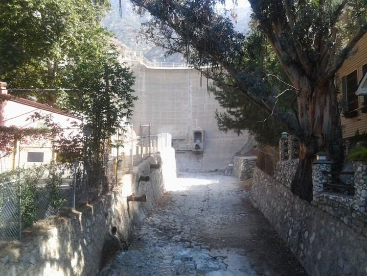
The Sierra Madre Dam is a dam on Little Santa Anita Creek, at the mouth of Little Santa Anita Canyon, in Los Angeles County, California. It is in the San Gabriel Mountains, south of the Angeles National Forest, on the northern border of Sierra Madre.
Contents
Map of Sierra Madre Dam, Sierra Madre, CA 91024, USA
Dam
The concrete arch dam has a height of 69 feet (21 m), and a width of 200 feet (61 m). Construction was completed in 1928. It is owned by Los Angeles County Department of Public Works. At the lower face of the dam, water can be released out a of steel grille covered 4 feet (1.2 m) diameter outlet onto a spillway, and then into channelized Little Santa Anita Creek.
In the 1940s CCC—Civilian Conservation Corps workers built the concrete channel containing the creek, from the dam through adjacent Sierra Madre. They also constructed public street bridges and footbridges across the channel in the Sierra Madre Canyon neighborhood.
Reservoir—debris basin
The dam's debris basin, when unfilled with sediment and a small reservoir, can have a storage capacity of 51 acre feet (63,000 m3), and a normal surface area of 1 acre. Its surrounding perimeter watershed area is 0.77 square miles (2.0 km2), with some slopes coated in gunnite. The upstream drainage basin for Little Santa Anita Creek is much larger.
Little Santa Anita Creek is a tributary of Santa Anita Creek, which is a tributary of the Rio Hondo at their confluence in Whittier Narrows. The Rio Hondo is a major tributary of the Los Angeles River.
The dam and debris basin—reservoir are used for flood and sediment control, and for downstream fish habitat protection.
Access
Access to the dam is restricted by locked gates and chain link fencing across the public Sierra Madre Canyon neighborhood side.
To the west, on Mount Wilson Trail Road in the neighborhood, there is a trailhead for the historic Mount Wilson Trail, a hiking trail that climbs up through Little Santa Anita Canyon to reach Mount Wilson. Other trails, now within the Angeles National Forest, branch off it to the creek for canyoneering, and to other views and destinations. Waterfalls, including a 40-foot (12 m) tall one, are in the deep canyon above the dam.