
Prominence 365 m | Elevation 1,215 m | |
 | ||
Listing #68 New England 100 Highest Easiest route maintained hiking trail Similar Mount Tripyramid, Mount Whiteface, Mount Tecumseh, Mount Passaconaway, Mount Osceola | ||
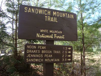
Sandwich Mountain (or Sandwich Dome) is a mountain located on the border between Carroll (Town of Sandwich) and Grafton (Town of Waterville Valley) counties, New Hampshire. The mountain is part of the Sandwich Range of the White Mountains. Sandwich Mountain is flanked to the northeast by Mount Tripyramid, and to the southwest by Mount Weetamoo across Sandwich Notch. Several maintained hiking trails pass over the summit.
Map of Sandwich Mountain, Sandwich, NH 03227, USA
The north side of Sandwich Mtn. drains into Drakes Brook, thence into the Mad River, Pemigewasset River, Merrimack River, and thence into the Gulf of Maine at Newburyport, Massachusetts. The west side of Sandwich Mtn. drains into Smarts Brook, thence into the Mad River. The southwest flank of Sandwich Mtn. drains into the Beebe River, thence into the Pemigewasset River. The south side of Sandwich Mtn. drains into the Cold River, Bearcamp River, Ossipee River, and the Saco River, which reaches the Gulf of Maine at Saco, Maine. The east side of Sandwich Mtn. drains into Pond Brook, thence into the Cold River.