
Length 30 km | ||
 | ||
Bridges Porter-Parsonsfield Bridge | ||
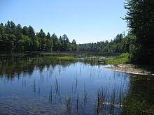
The Ossipee River is an 18.3-mile-long (29.5 km) river in eastern New Hampshire and western Maine in the United States. It is a tributary of the Saco River, which flows southeast to the Atlantic Ocean at Saco, Maine.
Map of Ossipee River, United States
The Ossipee River begins at the village of Effingham Falls, New Hampshire, at the outlet of Berry Bay, the farthest downstream of a chain of lakes connected to Ossipee Lake. The river, flowing east, forms the border between the towns of Effingham and Freedom. Entering Maine, the river continues to serve as a municipal boundary, first between Porter and Parsonsfield, and then between Hiram and Cornish. Kezar Falls, a village in the town of Porter, forms a significant community along the river, with two dam impoundments.
Route 25 follows the river for its entire length.