
Prominence 180 m | Elevation 1,225 m Listing Four-thousand footers | |
 | ||
Similar Mount Passaconaway, Mount Tripyramid, East Peak Mount Osceola, Mount Carrigain, Carter Dome | ||
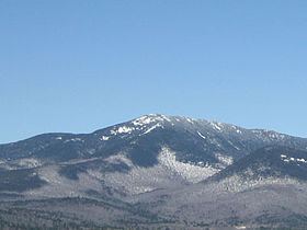
Mount Whiteface is a mountain located in Grafton County, New Hampshire. The mountain is part of the Sandwich Range of the White Mountains. Whiteface is flanked to the northwest by Mount Tripyramid, and to the northeast by Mount Passaconaway. Whiteface is on the eastern border of the Sandwich Range Wilderness. To the east, between Whiteface, Passaconaway, and Mt. Wonalancet, lies The Bowl natural area, an unlogged cirque.
Map of Mt Whiteface, Waterville Valley, NH 03259, USA
Mt. Whiteface lies within the watershed of the Saco River, which reaches the Gulf of Maine at Saco, Maine. The south side of Whiteface is drained by the Whiteface River, thence into the Cold River, Bearcamp River, Ossipee River, and the Saco River. The east side is drained by the Wonalancet River, thence into Swift River, and Bearcamp River. The north side is drained by Downes Brook, thence into another Swift River, and the Saco River.
The summit of Mt. Whiteface is in a wooded area along the Rollins Trail, approximately .3 miles (0.5 km) north of the top of the massive granite cliff for which the mountain is named. Many hikers reach the open area at the top of the cliff and do not realize the true summit is farther to the north.