
Founded approx. 1450 Time zone CLST (UTC-3) Area 23,439 km² Province El Loa | Elevation 2,407 m (7,900 ft) Area code(s) (+56) 5 Local time Tuesday 12:50 AM Number of airports 1 | |
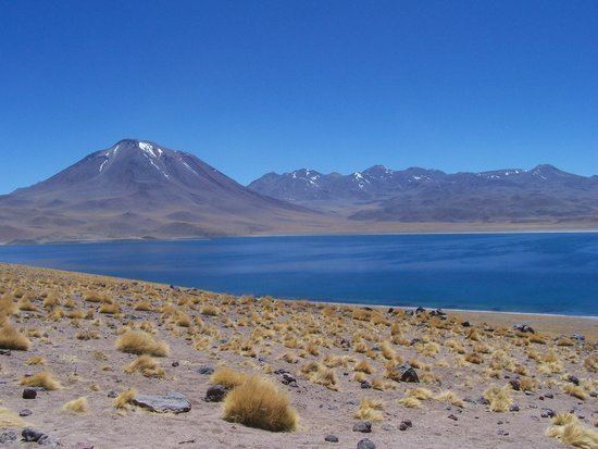 | ||
Weather 16°C, Wind S at 8 km/h, 34% Humidity Points of interest Pukará de Quitor, Valle de la Luna, Church of San Pedro de Ataca, Tulor, Miscanti Lake | ||
San pedro de atacama el loa province antofagasta region chile south america
San Pedro de Atacama is a Chilean town and commune in El Loa Province, Antofagasta Region. It is located east of Antofagasta, some 106 km (60 mi) southeast of Calama and the Chuquicamata copper mine, overlooking the Licancabur volcano. It features a significant archeological museum, the R. P. Gustavo Le Paige Archaeological Museum, with a large collection of relics and artifacts from the region. Native ruins nearby now attract increasing numbers of tourists interested in learning about pre-Columbian cultures.
Contents
- San pedro de atacama el loa province antofagasta region chile south america
- Map of San Pedro de Atacama Antofagasta Region Chile
- History
- Demographics
- Administration
- Climate
- Transportation
- Tourism
- Sights in town
- Outlying sights
- Holidays and festivals in San Pedro de Atacama
- References
Map of San Pedro de Atacama, Antofagasta Region, Chile
History
San Pedro de Atacama grew, over centuries, around an oasis in the Puna de Atacama, an arid high plateau. Its first inhabitants were the Atacameños, who developed basketworks and ceramic pottery crafts that can be now be appreciated by tourists in the several souvenir shops as typical products of San Pedro de Atacama.
It was part of Bolivia since independence until Chile claimed ownership during the War of the Pacific.
Demographics
According to the 2002 census of the National Statistics Institute, San Pedro de Atacama had 4,969 inhabitants (2,928 males and 2,041 females). Of these, 1,938 (39%) lived in urban areas and 3,031 (61%) in rural areas. The population grew by 75.6% (2,140 persons) between the 1992 and 2002 censuses.
Administration
As a commune, San Pedro de Atacama is a third-level administrative division of Chile administered by a municipal council, headed by an alcalde who is directly elected every four years. The 2008-2012 alcalde is Sandra Berna Martínez.
Within the electoral divisions of Chile, San Pedro de Atacama is represented in the Chamber of Deputies by Marcos Espinosa (PRSD) and Felipe Ward (UDI) as part of the 3rd electoral district, (together with Tocopilla, María Elena, Calama and Ollagüe). The commune is represented in the Senate by Alejandro Guillier Álvarez (PRSD) and Pedro Araya Guerrero (Ind.) as part of the 2nd senatorial constituency (Antofagasta Region).
Climate
The town lies at an average of 7,900 feet (2,400 m), and visitors often experience mild altitude sickness such as dizziness, lethargy and headaches. The local climate is extremely dry and mild, with daytime temperatures between 25–30 degrees Celsius (77–86 degrees Fahrenheit) in the summer (December to February) and 18–25 °C (64–77 °F) in the winter (June to August). Nighttime temperatures routinely drop below 0 °C (32 °F) and can reach as low as −10 °C (14 °F) in the winter.
Köppen-Geiger climate classification system classifies its climate as cold desert (BWk) for an isotherm of the mean yearly temperature of lower than 18 °C (64 °F), or as a hot desert (BWh) for an isotherm of the coldest month's mean temperature of 0 °C (32 °F) or lower.
Transportation
San Pedro lies on the main paved road from Argentina over the Paso de Jama, 160 km from the town. The road is paved throughout. There are frequent bus services to Calama, several buses daily to Santiago and buses on 6 days a week to Salta across the Andes in Argentina. Nearby airports are San Pedro de Atacama Airport and Salar de Atacama Airport for private aircraft, and the larger El Loa Airport/Calama 100 km away for scheduled aircraft.
Tourism
There are various activities for tourist and adventurers in the San Pedro de Atacama area: trekking, climbing, archaeological sightings, amateur astronomy, exploration tours in natural landscapes and even sand boarding in the desert. Because of its altitude, a brief period of acclimatization may be required.
Sights in town
In the town are some cultural sites:
Outlying sights
Holidays and festivals in San Pedro de Atacama
The festivals includes typical dances, masses in the street and a little parade through the main street of San Pedro de Atacama.