
Country United States State Mayor Joe Gunter | Population 155,662 (2013) Area 23.217 sq mi Region | |
 | ||
Colleges and Universities Hartnell College, Heald College-Salinas, Central Coast College, CET-Salinas | ||
Unemployment rate 12.2% (Feb 2015) | ||
Map of Salinas, California
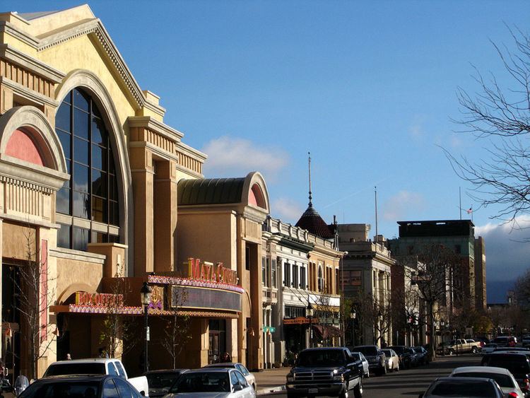
Salinas is the county seat and largest municipality of Monterey County, California. Salinas is located just outside the southern portion of the greater Bay Area and 10 miles (16 km) east-southeast of the mouth of the Salinas River, at an elevation of about 52 feet (16 m) above sea level. The population was 155,662 as of 2013. The city is located at the mouth of the Salinas Valley roughly eight miles from the Pacific Ocean and has a climate more influenced by the ocean than the hot-summer interior. The city consists mostly of late 20th century single family homes and low-level apartments, ranging from modest bungalows to spacious luxury homes, and serves as the main business, governmental and industrial center of the region. The marine climate is ideal for the floral industry, grape vineyards, and vegetable growers. Salinas is known for its vibrant and large agriculture industry and as the hometown of writer and Nobel Prize in Literature laureate John Steinbeck, who based several of his novels there.
Contents
- Map of Salinas California
- Michelle imperato wedding ksbw salinas ca wesh orlando florida wedding photographer monterey ca
- 02 19 2017 salinas california major storm damage and cleanup
- History
- Ethnology
- Geography
- Climate
- Income poverty and education 20122014
- Data by Area
- 2010
- 2000
- Crime
- Economy
- Arts and culture
- Boronda Adobe History Center
- California Rodeo Salinas
- River Road Wine Trail
- School districts
- Higher education
- Media
- Highways and roads
- Rail
- Bus
- Airport
- Hospitals
- Utilities
- Notable people
- Salinas in popular culture
- Sister cities
- References
Michelle imperato wedding ksbw salinas ca wesh orlando florida wedding photographer monterey ca
02 19 2017 salinas california major storm damage and cleanup
History
The land currently occupied by the city of Salinas is thought to have been settled by Native Americans known as the Esselen prior to 200 AD. Between 200 and 500 AD, they were displaced by the Rumsen group of Ohlone speaking people. The Rumsen-Ohlone remained as the inhabitants of the area for approximately another 1200 years, and in the 1700s, were the group of native inhabitants contacted and recorded by the first Spanish explorers of the Salinas area.
Upon the arrival of the Spanish, large Spanish land grants were initially issued for the Catholic Missions and also as bonuses to soldiers. Later on after Mexican independence, smaller land grants continued to be issued for ranchos where mostly cattle were grazed. One of the many land grants was the Rancho Las Salinas land grant, part of which included the area of modern day Salinas. As a result of the many new cattle ranches, a thriving trade eventually developed in cattle hide shipments, shipping primarily out of the Port of Monterey.
In 1848 California officially became a part of the United States of America. This transition followed several years of battles in the Salinas area with John Fremont flying the American flag on the highest peak of the Gabilan Mountains and claiming California for the United States. Before the transition to American administration, Monterey had been the capital of California. For a short while after the transition, California was ruled by martial law.
In the 1850s a junction of two main stage coach routes was located 18 miles east of Monterey and along the big bend of what is locally referred to as the Alisal Slough. In 1854, six years after becoming a part of the United States, a group of American settlers living in the vicinity of this route-junction opened a post office at the junction, naming their town "Salinas," apparently a reference to the original "Rancho Las Salinas" name for the area. Soon thereafter, in 1856, a traveler's inn called the Halfway House was opened at that junction in Salinas. (The nearby Salinas River, was apparently only later named by an American cartographer, after the nearest town of Salinas in 1858. Previously that river had gone by the name: "Rio de Monterey."). The streets of Salinas were laid out in 1867, and the town was incorporated in 1874.
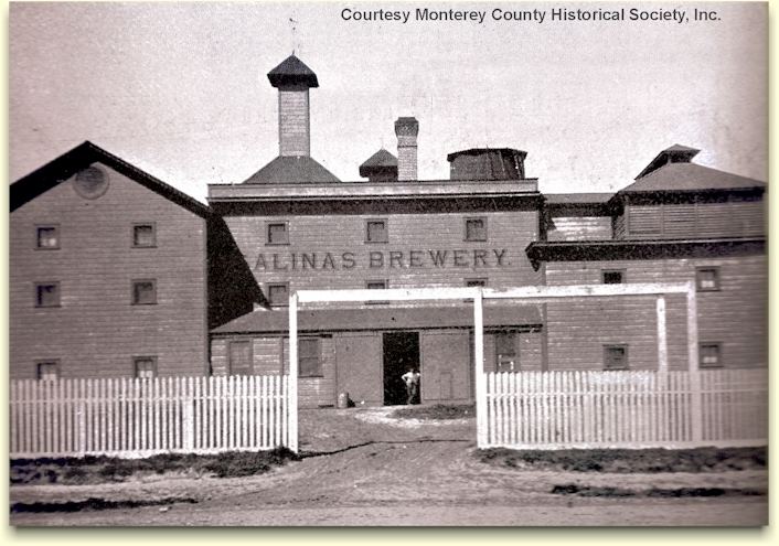
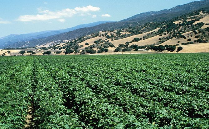
The conversion of grazing land to crops and the coming of the rail road in 1868 to transport goods and people was a major turning point in the history and economic advancement of Salinas. Dry farming of wheat, barley, and other grains as well as potatoes and mustard seed was common in the 1800s. Chinese labor drained thousands of acres of swampland to become productive farmland, and as much early farm labor was done by Chinese immigrants, Salinas boasted the second largest Chinatown in the state, slightly smaller than San Francisco. Irrigation changed farming in Salinas to mainly row crops of root vegetables, grapes and sugar beets. Many major vegetable producers placed their headquarters in Salinas. The historic prevalence of row crops is documented by aerial photographic interpretation of Earth Metrics, Driven by the profitable agricultural industry, Salinas had the highest per capita income of any city in the United States in 1924.
During World War II, the Salinas Rodeo Grounds was one of the locations used as a temporary detention camp for citizens and immigrant residents of Japanese ancestry, before they were relocated to more permanent and remote facilities. One of seventeen such sites overseen by the Wartime Civilian Control Administration, the Salinas Assembly Center was built after President Roosevelt issued Executive Order 9066, authorizing the removal and confinement of Japanese Americans living on the West Coast. The camp opened on April 27, 1942 and held a total of 3,608 people before closing two months later on July 4.
Following World War II major urban and suburban development converted much farmland to city. The city experienced two particularly strong growth spurts in the 1950s and 1960s, and again in the 1990s and early 2000s. Aerial photographic interpretation indicate such major conversion of cropland to urban uses over the time period 1956 to 1968, while the city annexed the adjacent communities of Alisal and Santa Rita during this time. The Harden Ranch, Creekbridge and Williams Ranch neighborhoods constituting much of the city's North-East were built almost exclusively between 1990 and 2004.
Salinas was also the birthplace of writer and Nobel Prize laureate John Steinbeck. The historic downtown, known as Oldtown Salinas, features much fine Victorian architecture, and is home to the National Steinbeck Center, the Steinbeck House and the John Steinbeck Library.
Major development took place in the 1990s, with the construction of Creekbridge, Williams Ranch, and Harden Ranch.
Ethnology
Traditionally an Anglophonic European American settlement, Salinas became home to a significant Asian minority who joined European-American immigrants in the agriculture and fishing industries at the turn of the 20th century. Meanwhile, the neighboring and, at the time, unincorporated community of Alisal became a mecca for Hispanic immigrants primarily from Mexico, drawn to opportunities in the area's agricultural industry. When annexed in 1963, Alisal was described as a large Mexican-American enclave, added to a city that was still otherwise majority European-American.
Hispanic immigration peaked from the 1980s through the early 2000s. Mostly European-American neighborhoods in North Salinas, an expansion of the original city built mostly in the 1950s and 60s, became majority Latino by 2010. As Latino immigrants and their descendants became more affluent and established, the proportion of Hispanics increased in the city's more affluent South and North-East. From the time it was first built in the late 1980s, to the 2000 Census, Creekbridge – the city's highest income area, least affected by poverty - remained mostly European-American and minority Latino. By 2010, however, US-born Latinos had become the largest ancestry group in the area. In South Salinas, the city's original area and most European-American section, Hispanics typically constitute over 40% of residents.
Despite its key role in the city's early development and significant Filipino immigration over recent decades, the Asian-American community of Salinas remains small compared to California average. The highest concentration of Asian-Americans is found in Creekbridge, where they constitute roughly 1 in 5 residents.
Along with the great influx of legal immigrants was an influx of undocumented immigrants. By 2011, Salinas had one of the highest concentrations of unauthorized immigrants in the state and nationwide. Of the city's three main zip codes, two had 10%-15% of residents being unauthorized immigrants, and a third over 15%.
The fear many undocumented immigrants have of government authorities has been a great obstacle faced by local law enforcement in crime investigations, community relations, and gathering information needed for effective policing. As a result, Salinas police department policy is to not verify immigration status of individuals coming into contact with city police officers.
Geography
According to the United States Census Bureau, the city has a total area of 23.2 square miles (60 km2), 99.84% of it land and 0.16% of it water.
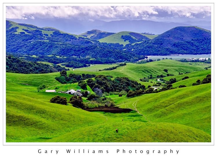
Prior to mass agricultural and urban development, much of the city consisted of rolling hills bisected by wooded creeks and interspersed with marsh land. Today, the city is located mostly on leveled ground, with some rolling hills and wooded gulches with creeks remaining in the north-eastern Creekbridge and Williams Ranch neighborhoods, as well as the Laurel Heights section of East Salinas. The natural ecosystems accompanying the area's topography and environment have been recreated in Natividad Creek Park and adjacent Upper Carr Lake.
The city rests about 18 meters (59 feet) above sea level, and it is located roughly eight miles from the Pacific Ocean. The Gabilan and Santa Lucia mountain ranges border the Salinas Valley to the east and to the west, respectively. Both mountain ranges and the Salinas Valley run approximately 90 miles (145 km) south-east from Salinas towards King City.
The Salinas River runs the length of the Salinas Valley and empties into the Pacific Ocean at the center of the Monterey Bay. During the summer months the river flows partially underground and it is this extensive underground aquifer that allows for irrigation of cropland in an area without much annual rainfall.
Climate
Salinas has cool and moderate temperatures, due to the “natural air conditioner” that conveys ocean air and fog from the Monterey Bay to Salinas, while towns to the north and south of Salinas experience hotter summers, as mountains block the ocean air. Thus, Salinas weather is closer to that of the Central Coast of California, rather than that of inland valleys, and thus has a mild Mediterranean climate with typical daily highs ranging from around 63 °F (17 °C) in the winter to around 75 °F (24 °C) in the summer. According to the Weather Channel, monthly average temperature highs range from 61 to 75 °F or 16.1 to 23.9 °C. The record highest temperature was 106 °F (41 °C) on September 14, 1971. The record lowest temperature was 18 °F (−8 °C) on December 21, 1937. Annually, there are an average of 5.5 days with 90 °F (32 °C)+ highs, and an average of 11.7 days with lows reaching the freezing mark or lower.
Salinas is in the top ten American cities for cleanest air quality, because the offshore marine layer generates winds that blow smog further inland.
The difference between ocean and air temperature also tends to create heavy morning fog during the summer months, known as the marine layer, driven by an onshore wind created by the local high pressure sunny portions of the Salinas Valley, which extend north and south from Salinas and the Bay.
The average annual rainfall for the city is approximately 13.26 inches or 336.8 millimetres. The wettest “rain year” since records at the present station began in 1959 was from July 1997 to June 1998 with 34.63 inches (879.6 mm) of precipitation, and the driest from July 1971 to June 1972 with 7.29 inches (185.2 mm). The most precipitation in one month was 11.10 inches (282 mm) in February 1998. The record maximum 24-hour precipitation was 2.96 inches (75 mm) on January 23, 2000. Occasionally, there is snowfall on the peaks of the Gabilan and Santa Lucia mountain ranges, but snow in the city itself is extremely rare, occurring about once every 5 to 15 years on average. An inch of snow fell in Salinas on February 26, 2011.
Income, poverty and education: 2012–2014
As of the 2008–2012 American Community Survey by the U.S. Census Bureau, Salinas tended to be poorer and less educated than California and the nation as a whole, with the notable exception of sizable neighborhoods in the southern and north-eastern portions of the city (see thematic maps and table below).
The most affluent and educated neighborhoods in Salinas are Creekbrige (North-East), Laurelwood (Central-West) and South Salinas (South-West). Hebbron Heights/central East Salinas was the poorest and least educated - as it has been since the Alisal area containing it was annexed by the city in 1963.
While most neighborhoods saw 1 in every 4-to-6 residents live in poverty, only 1 in 25 residents lived in poverty in Creekbridge - by far the lowest rate in the city and less than a third of state and national average. Regarding educational attainment, the pattern was different. There remained a significant disparity across the city, but the city's most affluent neighborhoods failed to exceed national or statewide averages despite having significantly higher incomes and lower poverty than California or the nation as a whole.
Data by Area
Income, poverty and education for all neighborhoods within Salinas city limits (2008 – 2012 5-year average)
Note: Census tract 9800 omitted from the table above. Although located within city limits, census tract 9800 consists solely of an airport, golf course and commercial area with a population of 0.
2010
The 2010 United States Census reported that Salinas had a population of 150,441. The population density was 6,479.8 people per square mile (2,501.9/km²). The racial makeup of Salinas was 68,973 (45.8%) White, down from 90.3% in 1970, 2,993 (2.0%) African American, 1,888 (1.3%) Native American, 9,438 (6.3%) Asian, 478 (0.3%) Pacific Islander, 59,041 (39.2%) from other races, and 7,630 (5.1%) from two or more races. Hispanic or Latino of any race were 112,799 persons (75.0%).
The Census reported that 147,976 people (98.4% of the population) lived in households, 658 (0.4%) lived in non-institutionalized group quarters, and 1,807 (1.2%) were institutionalized.
There were 40,387 households, out of which 21,435 (53.1%) had children under the age of 18 living in them, 21,380 (52.9%) were opposite-sex married couples living together, 6,835 (16.9%) had a female householder with no husband present, 3,300 (8.2%) had a male householder with no wife present. There were 3,271 (8.1%) unmarried opposite-sex partnerships, and 271 (0.7%) same-sex married couples or partnerships. 6,895 households (17.1%) were made up of individuals and 2,587 (6.4%) had someone living alone who was 65 years of age or older. The average household size was 3.66. There were 31,515 families (78.0% of all households); the average family size was 4.05.
The population was spread out with 47,180 people (31.4%) under the age of 18, 18,049 people (12.0%) aged 18 to 24, 44,978 people (29.9%) aged 25 to 44, 28,976 people (19.3%) aged 45 to 64, and 11,258 people (7.5%) who were 65 years of age or older. The median age was 28.8 years. For every 100 females there were 102.1 males. For every 100 females age 18 and over, there were 100.8 males.
There were 42,651 housing units at an average density of 1,837.1 per square mile (709.3/km²), of which 18,198 (45.1%) were owner-occupied, and 22,189 (54.9%) were occupied by renters. The homeowner vacancy rate was 2.5%; the rental vacancy rate was 4.6%. 65,108 people (43.3% of the population) lived in owner-occupied housing units and 82,868 people (55.1%) lived in rental housing units.
2000
The 2000 United States Census reported that Salinas had a population of 151,060. The population density was 7,948.4 per square mile (3,068.1/km²). There were 39,659 housing units at an average density of 2,086.8 per square mile (805.5/km²). The racial makeup of the city was 65.2% Hispanic or Latino of any race, 49.1% White, 6.2% Asian American, 3.3% African American, 1.3% Native American, 38.7% from other races, and 5.1% from two or more races. 49.2% have children under the age of 18 living with them, 57.6% were married couples living together, 14.8% had a female householder with no husband present, and 21.6% were non-families. 17.1% of all households were made up of individuals and 6.5% had someone living alone who was 65 years of age or older. The average household size was 3.69 and the average family size was 4.08
Age distribution was 33.0% under the age of 19 or younger, 11.8% from 18 to 24, 33.7% from 25 to 44, 15.5% from 45 to 64, and 7.1% who were 65 years of age or older. The median age was 28 years. For every 100 females there were 117.7 males. For every 102 females age 18 and over, there were 117.4 males.
The median household income was $43,728, and the median family income was $44,669. Males had a median income of $35,641 versus $27,013 for females. The per capita income for the city was $14,495. About 12.8% of families and 16.7% of the population were below the poverty line, including 20.1% of those under age 18 and 9.4% of those age 65 or over.
Median household income in the city tended to be significantly higher alongside the city limits, especially in the northern Harden Ranch and Creekbridge neighborhoods. East Salinas and the downtown area suffered from a very low median household income as well as high crime rates. South and North Salinas featured roughly the same level of median households income with the latter being home to city's wealthiest newly constructed neighborhoods.
Crime
Salinas has long had a well-recognized, significant problem with organized street gangs Such as Nortenos and Surenos, and associated violent crime. According to the U.S. Bureau of Justice Statistics, the city's overall violent crime and homicide rates are significantly above those for California and the nation overall, although the overall violent crime has declined since 2000. Gang activity and violent crime are focused in the poorer parts of Central and East Salinas and exacerbated by the city's comparatively low tax base and consequently limited policing resources. A hypothesis to explain the city's particularly intense problem with gang related violent crime cites the city's proximity to Salinas Valley State Prison. The prison was an early launch pad for street operations of the notorious prison gang, Nuestra Familia. This in turn, is seen as having spawned a legacy of multi-generational gang membership among the poorer and less educated residents of East Salinas.
Violent Crimes and Homicides per 100,000 residents (US Bureau of Justics Statistics, 2014)
Economy
Major employers in Salinas include Taylor Farms, Salinas Valley Memorial Hospital, Natividad Medical Center, Mann Packing, Hilltown Packing, Newstar Fresh Foods, and Monterey County.
Arts and culture
Salinas boasts an emerging arts scene led by the First Fridays Art Walk and the innovative use of non-traditional or business venues to exhibit art and host live local music. The oldest gallery in Salinas, the Valley Art Gallery, has been active for over 30 years. The Hartnell College Gallery hosts world-class exhibitions of art during the school year. The National Steinbeck Center has two galleries with changing exhibits, and the city's newest @Risk Gallery features cutting-edge and visionary exhibitions. The Art Walk, held in the downtown area, features 50 venues.
Live theater companies in Salinas include ARIEL Theatrical located in the Karen Wilson's Children's Theater in Oldtown Salinas, and The Western Stage, based at Hartnell College.
Live local music is available at many restaurants in the downtown area, and during the First Fridays Art Walk. Concerts are held at the historic Fox California Theater, Steinbeck Institute for Arts and Culture and the Salinas Sports Complex, as well as at Hartnell Community College.
Salinas is home to many public murals, including work by John Cerney which can be viewed in the agricultural fields surrounding the city. Claes Oldenburg placed his sculpture, Hat in Three Stages of Landing, in Sherwood Park at the center of the city.
Boronda Adobe History Center
Just outside the official city limits, the restored adobe dwelling constructed in 1844 by José Eusebio Boronda, rests on one of the original Mexican land grants. The Boronda Adobe is a California Historical Landmark and listed in the National Register of Historic Places and holds a museum of early Salinas and California history. Other historic buildings are located here, including the Lagunita School house John Steinbeck wrote about in the Red Pony. The site also holds the official archive of Monterey County, open to researchers by appointment.
California Rodeo Salinas
As host of a PRCA-sanctioned rodeo, Salinas is a major stop on the professional rodeo circuit. The California Rodeo Salinas began in 1911 as a Wild West Show on the site of the old race track ground, now the Salinas Sports Complex. Every third week of July is Big Week, when cowboys and fans come for the traditional rodeo competitions, including bull riding. Rodeo-related events held in Salinas and Monterey include cowboy poetry, wine tasting, a carnival, barbecues and a gala cowboy ball.
River Road Wine Trail
The largest wine-grape producing region in California, the Salinas Valley, is home to over 20 wineries and 14 estate tasting rooms along the River Road, just south of the city limits.
School districts
Salinas has seven school districts serving the city core and adjacent unincorporated areas. The largest school district in Salinas is the Salinas Union High School District (grades 7-12) with 13,578 students enrolled in 10 campuses. The Salinas City Elementary School District is the largest elementary school district in Salinas, with 13 schools and 7,954 students. Other districts include Santa Rita Union Elementary School District, Graves Elementary School District, Washington Union School District, Lagunita School District, and Alisal Union School District.
Higher education
Opportunities for higher education in Salinas include Hartnell College.
Media
Local newspapers include The Salinas Californian, Monterey County Weekly and Monterey County Herald. Television service for the community comes from the Monterey-Salinas-Santa Cruz designated market area (DMA).
Local radio stations include:
KSMS-TV Channel 67, KION-TV Channel 46 and KSBW Channel 8 also provides news for the area as UNIVISION, CBS, NBC and ABC affiliates.
Highways and roads
U.S. Route 101 is the major north-south highway in Salinas, linking the city to the rest of the Central Coast region, San Francisco to the north, and Los Angeles to the south. California State Route 68 heads west to Monterey, while California State Route 183 runs northwest to Castroville.
Rail
Amtrak, the national passenger rail system, serves Salinas, operating its Coast Starlight daily in each direction between Seattle, Washington, and Los Angeles.
Bus
Public transportation via bus is provided by Monterey-Salinas Transit. Public buses take passengers throughout the county, as well as San Jose and Gilroy. Buses to San Jose and Gilroy connect to Caltrain and Amtrak in those cities.
Greyhound operates from the Salinas Amtrak station with service to other California cities and throughout the United States.
Airport
Salinas Municipal Airport is located on the southeastern boundary of the City of Salinas, three miles (5 km) from the city center. It is a general aviation facility occupying 763 acres (3.1 km2), with three runways serving single and twin engine aircraft and helicopters, as well as an increasing number of turbopropeller and turbine-powered business jets.
The airport has an air traffic control tower in operation twelve hours a day, seven days a week. The airport terminal is located on Mortensen Avenue and houses airport office staff as well as professional offices. The city is currently accepting proposals for leasing and operation of the restaurant located within the Terminal. Salinas Airport Commissioners agreed to a proposed project that would bring a 100-room hotel, offices and hangars to a vacant lot in front of the Salinas Municipal Airport terminal. The Salinas Jet Center would include a national chain hotel, 80,000 square feet (7,000 m2) of office space, four large complexes combining more offices with airplane hangars and a 24-hour, full-service aircraft fueling station. The project would also include a taxiway to allow planes to access the new hangars.
The airport has full Instrument Landing System (ILS) and VHF omnidirectional range (VOR) located on the airport. The ILS has a Medium Intensity Approach Lighting System, with Runway Alignment Indicator Lights. The VOR approach has Runway End Identifier Lights. All but the ILS runway, RWY 31, have Visual Approach Slope Indicators (VASIs).
The airport is the site of the California International Airshow, set annually in the late summer or early autumn. The event draws thousands of visitors to Salinas over its three-day run.
Hospitals
Salinas and its surrounding towns are served by Salinas Valley Memorial Hospital and Natividad Medical Center, both located in Salinas. Natividad is one of the University of California, San Francisco's teaching hospitals and is owned and operated by Monterey County.
Natividad Medical Center, through its affiliated Natividad Medical Foundation, offers trained medical interpreters for speakers of several Oaxacan languages (including Triqui, Mixteco, and Zapotec) as well as Spanish.
Utilities
Salinas is served by the following utilities:
Notable people
Salinas in popular culture
Sister cities
Salinas has established sister city relationships with four cities: