
Length 17.65 km | ||
 | ||
County | ||
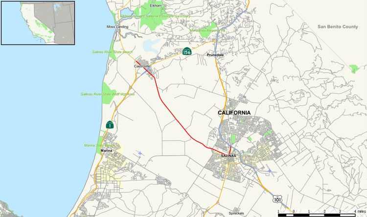
State Route 183 is a short state highway in California, USA, running from Salinas to State Route 1 in Castroville.
Contents
Map of CA-183, California, USA
This route is part of the California Freeway and Expressway System.
Route description
SR 183 begins in the center of the city of Salinas at an at-grade interchange with U.S. Route 101. The road then heads toward the center of Salinas along North Main Street before abruptly turning northwest along Castroville Road. Following an interchange with Davis Road, the route exits town and enters and area covered with farmland. It continues through this central Monterey County while gradually turning north until it reaches southern Castroville, where it again turns northeast. The road then interchanges with State Route 156 and traverses northeast as the western boundary of Castroville before meeting its northern terminus, State Route 1, the Cabrillo Highway.
History
This route was defined in 1933. It appears to have been unsigned before 1964.
Major intersections
Except where prefixed with a letter, postmiles were measured on the road as it was in 1964, based on the alignment that existed at the time, and do not necessarily reflect current mileage. R reflects a realignment in the route since then, M indicates a second realignment, L refers an overlap due to a correction or change, and T indicates postmiles classified as temporary (for a full list of prefixes, see the list of postmile definitions). Segments that remain unconstructed or have been relinquished to local control may be omitted. The entire route is in Monterey County.