
- elevation 120 m (394 ft) | - elevation 90 m (295 ft) | |
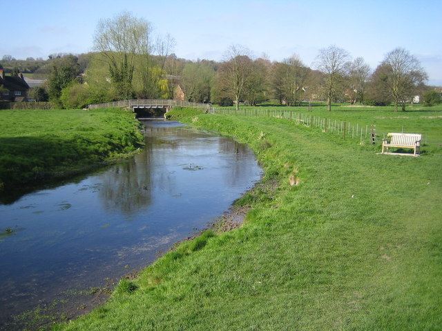 | ||
- location Two Waters Apsley, Hemel Hempstead | ||
The River Bulbourne is a small river in Dacorum, Hertfordshire, England. The word bourne derives from the Anglo-Saxon word for a stream. It is an unnavigable tributary of the River Gade, which flows into the River Colne, which in turn is a tributary of the River Thames.
Contents
- Map of River Bulbourne United Kingdom
- Geography
- Course
- Human Activity
- Tributaries
- Recent History
- References
Map of River Bulbourne, United Kingdom
Geography
The Bulbourne is one of only 210 chalk streams in the world. It flows in the Chiltern Hills, part of a system of chalk downlands throughout eastern and southern England, which formed between 84 and 100 million years ago in the Cretaceous Period when the area was a chalk-depositing marine environment. The valley is at the southernmost limit of the Pleistocene glaciation ice erosion of the Chiltern scarp, giving it a smooth rounded appearance. The underlying geology is chalk, which outcrops in places along the east side of the valley. The subsoil is predominantly a stiff reddish clay-with-flints; in the valley itself the chalk is overlain with alluvium. Around Berkhamsted the valley sides rise 300 ft. Situated on its northern rim, the valley is a small part of a larger syncline or down folding of rocks called the London Basin.
Course
The river runs in a south-easterly direction from between the Cow Roast and Dudswell in Northchurch, through Berkhamsted, Bourne End and Boxmoor to where it joins the River Gade at Two Waters in Apsley near Hemel Hempstead. The current total length of the river is 7 miles (11 km), from its source to its mouth it falls 30 meters (98 ft).
Human Activity
The River Bulbourne was historically rich in eels and other fish, fast-moving, and prone to frequent localised flooding. Over the years, human activity has had a significant effect on the river. Originally the source of the Bulbourne was near the hamlet of Bulbourne near Tring (which would make the river 2.9 miles (4.7 km) longer), in 1700 the source was said to be Parkhill Farm, near Pendley Manor (making the river .5 miles (0.80 km) shorter).
Settlement in the valley began prior the Late Iron Age period. The upper Bulbourne Valley was rich in timber and iron ore. In the late Iron Age, a four-square-mile (ten-square-kilometre) area around Northchurch was a major iron production centre (considered to be one of the most important late Iron Age and Roman industrial areas in England). Water was drawn from 14 well shafts close to the river at Cow Roast, where a Roman town grew up between the river and the Roman engineered, Akeman Street (which had been a pre-existing route from St Albans (Verulamium) to Cirencester (Corinium)) Iron production ceased at the end of the Roman period. The where Roman villas in Northchurch, Berkhamsted and Boxmoor.
Early Anglo-Saxon settlements rose in Northchurch and Berkhamsted. In the Medieval period, the Bulbourne powered two watermills in Berkhamsted (Upper and Lower - recorded in 1086) and another in Bourne End. It also fed the three moats of the large Norman (Motte and Bailey) Berkhamsted Castle, that stands close to the center of the town. The river created a marsh environment (at times referred to as an 'unhealthy swamp') in the center of the valley, which added to the defenses of the castle.
In the Industrial Age, in 1797 the Grand Union Canal was dug alongside the entire length of the river, the Bulbourne became the main source of water for the Canal that was the main link between London and the coalfields of the Midlands. This man made waterway was the only one to be built across the Chilterns hills. Ensuring a constant supply of water in a region of permeable chalk was an engineering challenge which required the building of reservoirs, pumps and boreholes. After the Pre-Roman Road and the canal, the third major transport route to carve its way along the Bulbourne valley was the London to Birmingham railway in 1834. In 1883, the Berkhamsted Times congratulated a Mr Bedford on having converted the remaining "dirty ditches and offensive marshes" into watercress beds. Thus the River Bulbourne was reduced by centuries of increased drinking needs, dredging, milling and agriculture as well as the London to Birmingham canal.
Tributaries
The Bourne Gutter is a short 400 yards (370 m) tributary of the Bulbourne rising between Berkhamsted and Bourne End. According to local legend it is a "Woe Water", said to only flow at time of national emergency. Its recent flows in 1990 and 2001 coincided with wars between Britain and Iraq then the Twin Towers disaster. In February 2014, it flowed due to the exceptionally wet winter.
Another small tributary was 60 feet (20 yd) at St Johns Well Lane (in Berkhamsted), it dried up in the 1930s due to increased local water pumping needs. From at least the Middle Ages the 'holy well' there had been Berkhamsted's principal source of drinking water.
Recent History
In October 2011 concerns were raised about local water levels when the River Bulbourne dried up. Local commentators blamed increased water consumption brought about by the number of new property developments in Berkhamsted, although the Environment Agency and the Veolia water company claimed it was due to a low water table caused by lack of rainfall.