
Sovereign state United Kingdom Founded 1974 Area 212.4 km² | Constituent country England Local time Wednesday 5:13 PM | |
 | ||
Weather 11°C, Wind W at 11 km/h, 76% Humidity Points of interest Ashridge, Natural History Museum, Berkhamsted Castle, Tring Local History Museum, National Trust ‑ Ashridge | ||
Dacorum look no further life in
The Borough of Dacorum is a local government district in Hertfordshire, England that includes the towns of Hemel Hempstead, Berkhamsted, Tring and the western part of Kings Langley. The district, which was formed in 1974, had a population of 137,799 in 2001. Its name was taken from the old hundred of Dacorum which covered approximately the same area.
Contents
- Dacorum look no further life in
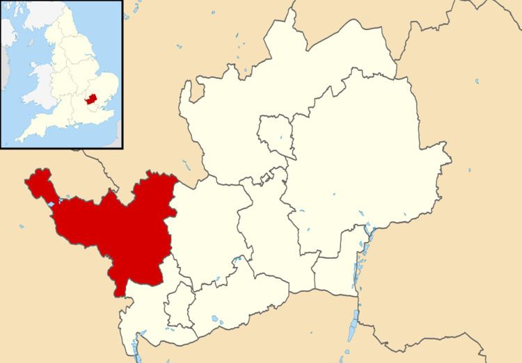
- Map of Dacorum District UK
- History
- Main settlements
- Political representation
- Wards
- Town twinning
- References
Map of Dacorum District, UK
History
The name Dacorum comes from Latin and it means "hundred of the Dacians". The latter word was used mistakenly in the Middle Ages for 'Danes'. This happened because of a legend asserting that certain tribes from Dacia had migrated to Denmark. The hundred of Dacorum was first recorded in 1196, although it has existed since the 9th and 10th centuries, when it lay near the southern boundary of the Danelaw, on the River Lea. In 1086, the Domesday Book records the hundreds of Tring and Danais in places that became parts of the hundred of Dacorum.
In 1974, the modern district of Dacorum was formed under the Local Government Act 1972. Major components were the municipal borough of Hemel Hempstead, the urban districts of Berkhamsted and Tring, the rural districts of Berkhamsted and Hemel Hempstead and those parts of the rural districts of St Albans and Watford which were within the designated area of Hemel Hempstead new town.
The district was granted borough status in 1984. Hemel Hempstead had maintained Charter Trustees from 1974 to 1984. The amalgamation of the former local authorities was symbolised in the seven oak leaves which surround a tudor rose on the Dacorum coat of arms.
Main settlements
The main towns and villages of the borough are:
Aldbury, Bovingdon, Berkhamsted, Bourne End, Bulbourne, Chipperfield, Cow Roast, Flamstead, Flaunden, Frithsden, Gaddesden Row, Great Gaddesden, Hemel Hempstead, Kings Langley, Little Gaddesden, Little Tring, Long Marston, Markyate, Nettleden, New Mill, Northchurch, Potten End, Ringshall, Tring, Tringford, Water End and Wigginton.
The borough is entirely parished, apart from Hemel Hempstead.
Political representation
Dacorum Borough Council consists of 51 elected members, representing twenty-five electoral wards. 14 of the wards elect two councillors each. Six, indicated below, elect three councillors each. Five, also shown below, elect one each.
The council is currently controlled by the Conservatives, who hold 46 of the 51 seats. The Liberal Democrats hold 3, and Labour hold 2.
Wards
Dacorum consists of twenty-five wards. Wards electing three members are denoted with an asterisk (*). Those electing one member are denoted with an obelus (†).
Town twinning
Two of the civil parishes in the borough also maintain their own separate twinning arrangements: