
Local time Friday 2:27 AM | Population 2,665 (30 Sep 2016) | |
 | ||
Time zone Japan Standard Time (UTC+9) Weather -2°C, Wind NE at 14 km/h, 78% Humidity Points of interest Himenuma, Rishirifuji Hot Spring, Rishiritokyodo Museum, Ponyama, Ashiyu | ||
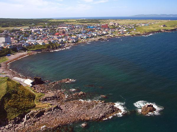
Rishirifuji (利尻富士町, Rishirifuji-chō) is a town located on Rishiri Island in Rishiri District, Sōya Subprefecture, Hokkaido, Japan.
Contents
- Map of Rishirifuji Rishiri District Hokkaido Prefecture Japan
- Geography
- Neighbouring municipalities
- History
- Transportation
- References
Map of Rishirifuji, Rishiri District, Hokkaido Prefecture, Japan
As of 2016, the town has an estimated population of 2,665 and a density of 25 persons per km2. The total area is 105.69 km2.
Geography
Situated on Rishiri Island, it is surrounded by the Sea of Japan. Mount Rishiri, also known as Rishirifuji, is located on the border between the town of the Rishiri to the south, with an elevation of 1721m.
Temperatures can drop to -10oC the winter and summers are quite cool. There is adequate precipitation throughout the year.
Neighbouring municipalities
History
Transportation
Rishiri Airport is located in Rishirifuji, which has flights to New Chitose Airport in Sapporo. The company Heartland regulates ships to Wakkanai on mainland Hokkaido and Rebun on Rebun Island nearby.