
Width 8 km (5 mi) Highest elevation 490.0 m (1,607.6 ft) Elevation 490 m | Length 29 km (18 mi) Coastline 72 km (44.7 mi) Area 81.33 km² | |
 | ||
Points of interest Cape Sukoton, Cape Sukai, Kitano Canary Park, Momoiwa, Rebuncho Kyodo Museum | ||
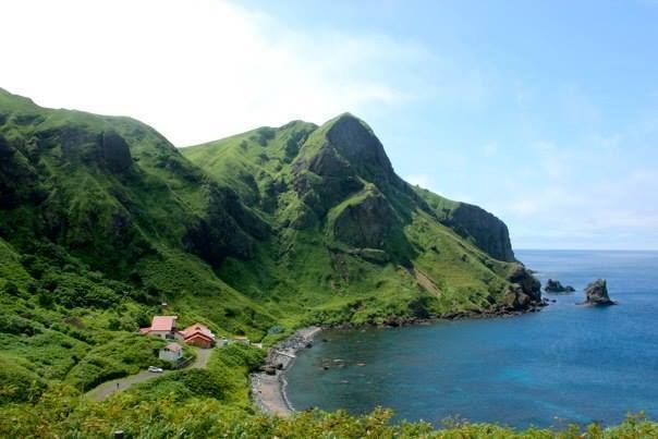
Rebun Island (礼文島, Rebun-tō; Ainu: Repun) is an island in the Sea of Japan off the northwestern tip of Hokkaidō, Japan. The island sits 50 kilometres (31 mi) off the coast of Hokkaidō. Rebun stretches 29 kilometres (18 mi) from north to south and 8 kilometres (5.0 mi) from east to west. The island covers approximately 80 square kilometres (31 sq mi). Rebun Island is located 10 kilometres (6.2 mi) northwest of Rishiri Island, and the two islands are separated by the Rebun Channel.
Contents
- Map of Rebun Island Rebun Rebun District Hokkaido Prefecture Japan
- Etymology
- Areas of interest
- Communities
- Transportation
- References
Map of Rebun Island, Rebun, Rebun District, Hokkaido Prefecture, Japan
Rebun Island is known for its alpine flowers and the 8-Hour Hiking Course which runs from one end of the island to the other, north to south. The hiking course can be broken into two sections, known as the 4-Hour Hiking Courses. Rebun Island is home to a chashi, or hilltop fortifications of the Ainu people. The highest point on the island is Mount Rebun (490 metres (1,610 ft)). The island is part of the Rishiri-Rebun-Sarobetsu National Park.
Etymology
The name of the island in the Ainu language, "Repun", means "island in the open sea."
Areas of interest
Communities
All communities on Rebun Island are part of the town of Rebun in Rebun District. From roughly from north to south, they are: