
Topo map OS Landranger 148 Prominence 373 m | OS grid SO182639 Elevation 660 m Parent range Cambrian Mountains | |
 | ||
Similar | ||
Coed mawr and rhos fawr humps part 10
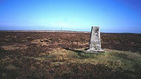
Rhos Fawr or Great Rhos is a mountain summit in Mid Wales, and is the highest point on the Radnor Forest rock dome.
Contents
Map of Great Rhos, Llandrindod Wells, UK
The summit is located on a broad heathery plateau, which is separated from Black Mixen: the eastern plateau summit, by the cwm of Harvey Dingle. To the west is Drygarn Fawr and Gorllwyn, to the north Plynlimon, to the east Black Mixen and to the south the Black Mountains.
References
Rhos Fawr Wikipedia(Text) CC BY-SA