
Topo map OS Landranger 147 Prominence 258 m | OS grid SN862584 Elevation 645 m | |
 | ||
Listing Marilyn, Hewitt, Nuttall Similar Gorllwyn, Pen y Garn, Rhos Fawr, Black Mixen, Bache Hill | ||
Walk on drygarn fawr in the cwmdeuddwr hills mid wales february 2013
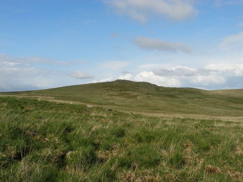
Drygarn Fawr is a mountain in the county of Powys, Wales. It is one of the highest summits in Mid Wales standing at 645 metres above sea level. Rising above the remote moorland plateau of the Cambrian Mountains, the summit is topped by two distinctive, large cairns. The mountain has a gentle, grassy, conical shape with a few rocks near the summit. Nearby are the summits of Gorllwyn and Y Gamriw, both over 600m.
Contents
- Walk on drygarn fawr in the cwmdeuddwr hills mid wales february 2013
- Map of Drygarn Fawr Rhayader UK
- Drygarn fawr
- References
Map of Drygarn Fawr, Rhayader, UK
There are two paths to the summit which can offer impressive views. From Llannerch Yrfa, a bridleway winds up through forests in the Nant y Fedw valley before skirting the southern edge of the mountain.
An alternative route may be taken starting from Rhiwnant on the edge of the Caban Coch reservoir, one of the Elan Valley Reservoirs, and following the Nant Paradwys before turning off west towards the summit cairn. Both routes pass across wild moorland and peat bogs and the path may become difficult to follow and impassable, particularly after heavy rain.
The views to the north include Pen y Garn and Plynlimon, to the east Rhos Fawr and Gorllwyn and the Brecon Beacons to the south.