
Existed: mid-1930s – present North end: Route 2 in Warwick | Length 48.4 km | |
 | ||
Counties | ||
Route 3 is a state highway in the U.S. state of Rhode Island. Route 3 serves as a local alternative to Interstate 95 as it parallels I-95 for almost its entire length. Route 3 in West Warwick was the site of The Station nightclub fire.
Contents
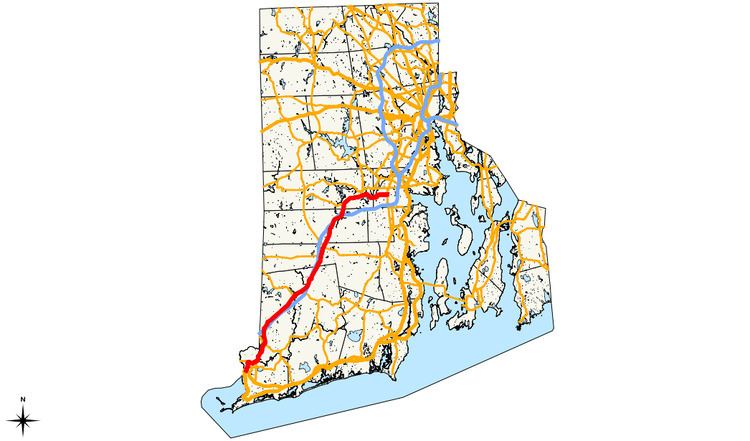
Map of RI-3, Rhode Island, USA
Route description
Route 3 starts at US 1 in Westerly. It begins heading north, and it has a partial interchange with the Westerly Bypass. Route 3 continues north, intersects I-95 at exit 1, and turns to the northeast to parallel I-95. After two more interchanges with I-95, Route 3 passes through downtown Coventry. Continuing east into West Warwick, Route 3 terminates at Route 2 on the West Warwick/Warwick town line.
History
About 1835 the New London Turnpike was established as the primary road between Providence, Rhode Island and New London, Connecticut. As such, it was one of the earliest interstate highways in the country. The New London Turnpike proved a viable alternative to the Old Post Road, which followed the coastal route, as it was more direct and faster.
The New London Turnpike (also called New London Avenue in parts of Rhode Island and the Gold Star Highway in Connecticut) was a primary route until the advent of automobiles in the early 20th Century. The increased need for roadways led to the development of a more improved interstate highway system. The Connecticut portion of the New London Turnpike is now Route 184 and in Rhode Island parts of the New London Turnpike are on Routes 2 and 3.
In 1922, the Westerly–Providence road was assigned New England Interstate Highway 1A, as an alternate to New England Interstate Highway 1. The road was only paved north of Nooseneck Hill. When NE 1 became US 1 in 1927, NE 1A became Route 1A (now assigned to a different route).
The original NE 1A alignment differed from the current Route 3 alignment in the following places:
From there, the main road used Route 33 to where the Meshanticut Interchange is now, and then roughly Route 2 (though the exact route is unclear; it may have originally used Cranston Street into Westminster Street) to end concurrent with US 1 and Route 2 in Providence, possibly at Broad Street (former Route 117).
By 1934, the number had been changed to Route 3, and it was on its current alignment (though still extending north to Providence, via Route 2 and US 1), and was fully paved with concrete except for a bit in downtown Westerly (and along Route 2 and US 1 north of Route 12). Route 3 was part of a major through route, serving as a cutoff for US 1, along with Rhode Island–Connecticut Route 84. In fact, in 1947, Connecticut proposed moving US 1 to this route, but RIDOT declined, wanting US 1 to continue through the shore towns. RIDOT offered US 1A as a compromise, but this was never signed. The old alignment through Washington to the Meshanticut Interchange site became Route 3A and later Route 33; by 1939 this was on its current alignment, bypassing Washington.
1952 and 1953 saw the building of a new high-speed relocation of Route 3 from Route 84 to north of Wyoming, where Route 3 left the New London Turnpike. This was built as a four-lane surface road, with interchanges at the Route 3/Route 84 split and Route 138.
When the Huntington Expressway was built in 1959, Route 2 was moved onto it, leaving Route 3 as the only road on Reservoir Avenue north of the Expressway. Later the Expressway was designated Route 10, and Route 2 was moved back. At or after that time, Route 3 was truncated to Route 2.
In 1957 and 1958, the Kent County Freeway was built, splitting from Route 3 near Nooseneck Hill and heading east to Route 2. The original designation of this is unknown. However, the westernmost section carried Route 3, at least southbound, due to southbound access along the old road being cut off at the merge. This access was brought back in 1969 when the freeway extension was built to the south.
1959 also saw the assignment of the Interstate Highways, including I-95 along the Route 3 corridor. Route 84 and Route 3 were temporarily designated Route 95 from Connecticut to the beginning of the Kent County Freeway, which was I-95. Route 3 was moved back to the old alignment at the 1952–1953 relocation.
The southernmost several blocks in Westerly may have at one time used Canal Street and one of the diagonal streets to cut over to current Route 3.