
Founded June 11, 1750 Area 486.9 km² | Population 165,035 (2013) Unemployment rate 5.2% (Apr 2015) | |
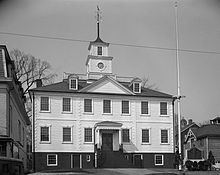 | ||
Colleges and Universities Community College of Rhode Isl, New England Institute o, Empire Beauty Schools‑Warwick, Toni & Guy Hairdressing Academy‑Cranston Points of interest General Nathanael Greene H, New England Wireless, Paine House, Goddard Memorial State Park, Big River Management Area | ||
National register of historic places listings in kent county rhode island top 5 facts
Kent County is a county located in the U.S. state of Rhode Island. As of the 2010 census, the population was 166,158 making it the second-most populous county in Rhode Island. The county was formed in 1750 from the southern third of Providence County. It was named after the county of Kent, in England. Kent County, like other counties in Rhode Island, no longer has governmental functions (other than as court administrative and sheriff corrections boundaries).
Contents
- National register of historic places listings in kent county rhode island top 5 facts
- Map of Kent County RI USA
- Geography
- Adjacent counties
- 2000 census
- 2010 census
- City
- Towns
- Census designated place
- Politics
- References
Map of Kent County, RI, USA
Kent County is included in the Providence-Warwick, RI-MA Metropolitan Statistical Area, which is also included in the Boston-Worcester-Providence, MA-RI-NH-CT Combined Statistical Area.
Geography
According to the U.S. Census Bureau, the county has a total area of 188 square miles (490 km2), of which 169 square miles (440 km2) is land and 20 square miles (52 km2) (10%) is water.
Adjacent counties
2000 census
As of the census of 2000, there were 167,090 people, 67,320 households, and 44,969 families residing in the county. The population density was 982 people per square mile (379/km²). There were 70,365 housing units at an average density of 414 per square mile (160/km²). The racial makeup of the county was 95.54% White, 0.93% Black or African American, 0.23% Native American, 1.34% Asian, 0.02% Pacific Islander, 0.65% from other races, and 1.28% from two or more races. 1.69% of the population were Hispanic or Latino of any race. 20.1% were of Italian, 18.9% Irish, 11.1% English, 10.1% French, 6.1% French Canadian and 6.1% Portuguese ancestry according to Census 2000. 92.0% spoke English, 1.9% Spanish, 1.5% French, 1.4% Portuguese and 1.1% Italian as their first language.
There were 67,320 households out of which 29.90% had children under the age of 18 living with them, 52.70% were married couples living together, 10.50% had a female householder with no husband present, and 33.20% were non-families. 27.60% of all households were made up of individuals and 11.40% had someone living alone who was 65 years of age or older. The average household size was 2.45 and the average family size was 3.02.
In the county, the population was spread out with 23.20% under the age of 18, 7.00% from 18 to 24, 30.50% from 25 to 44, 24.20% from 45 to 64, and 15.10% who were 65 years of age or older. The median age was 39 years. For every 100 females there were 92.30 males. For every 100 females age 18 and over, there were 88.70 males.
The median income for a household in the county was $47,617, and the median income for a family was $57,491. Males had a median income of $40,052 versus $29,130 for females. The per capita income for the county was $23,833. About 4.80% of families and 6.60% of the population were below the poverty line, including 7.90% of those under age 18 and 8.10% of those age 65 or over.
2010 census
As of the 2010 United States Census, there were 166,158 people, 68,645 households, and 43,747 families residing in the county. The population density was 985.9 inhabitants per square mile (380.7/km2). There were 73,701 housing units at an average density of 437.3 per square mile (168.8/km2). The racial makeup of the county was 93.4% white, 2.0% Asian, 1.4% black or African American, 0.3% American Indian, 1.0% from other races, and 1.8% from two or more races. Those of Hispanic or Latino origin made up 3.2% of the population. In terms of ancestry, 26.7% were Irish, 23.2% were Italian, 17.3% were English, 8.9% were Portuguese, 7.6% were German, and 3.3% were American.
Of the 68,645 households, 28.7% had children under the age of 18 living with them, 48.1% were married couples living together, 11.1% had a female householder with no husband present, 36.3% were non-families, and 29.2% of all households were made up of individuals. The average household size was 2.40 and the average family size was 2.98. The median age was 42.7 years.
The median income for a household in the county was $61,088 and the median income for a family was $77,100. Males had a median income of $53,458 versus $41,380 for females. The per capita income for the county was $31,221. About 4.9% of families and 7.9% of the population were below the poverty line, including 9.5% of those under age 18 and 8.6% of those age 65 or over.
City
Towns
Census-designated place
Politics
Kent County, like most of Rhode Island, has been strongly Democratic for the last half century. In 2016, Donald Trump was the first Republican to win the county since Ronald Reagan in 1984.